2020s Maps of Gallia County, Ohio
Explore 17 historic maps of Gallia County from the 2020s. These maps offer a rare glimpse into what life looked like during the 2020s — showing old roads, neighborhoods, homes, and landmarks that have changed or disappeared over time.
Whether you're researching your family's past, planning a metal detecting trip, or studying how Gallia County's landscape evolved across the 2020s, these high-resolution maps are a powerful tool for exploring the history of this region.
- Focus on a specific era: All maps on this page are from the 2020s, giving you a focused view of this time period.
- See what’s changed: Compare century-old streets, trails, and buildings to today's modern landscape using overlays and satellite layers.
- Research with precision: Use these maps for genealogy, historical research, land use analysis, or educational projects.
- View, download, or print: Maps are fully viewable online in high resolution, and can be downloaded or printed for your own records.
Start exploring Gallia County's history through authentic maps from the 2020s. This is your window into the past.
Gallia County, OH maps
(17)- 2023 Map of Athalia, 2023 Print
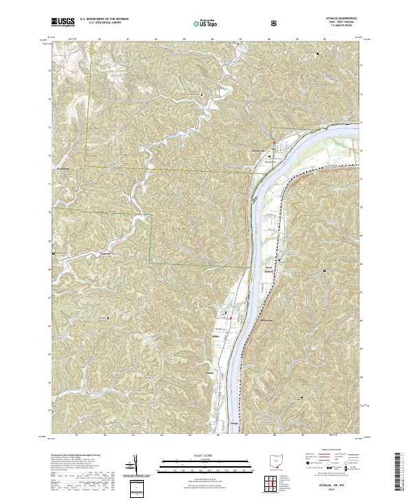 2023 Athalia2023 Print · USGSThe riverfront communities of southern Ohio and West Virginia are captured here along the banks of the Ohio River. Researchers can trace old family burial grounds like Good Hope Cem and Calloway Cem or locate small settlements such as Platform and Miller.
 - 2023 Map of Mercerville, 2023 Print
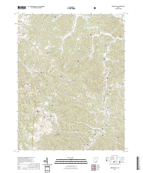 2023 Mercerville2023 Print · USGSGallia County at the southern edge of the Ohio hill country is documented here in the early twenty-first century. Genealogists can trace family names through dozens of upland burial sites like Old Walnut Ridge Cem, Mercerville Cem, and Siloam Cem.
 - 2023 Map of Gallia, 2023 Print
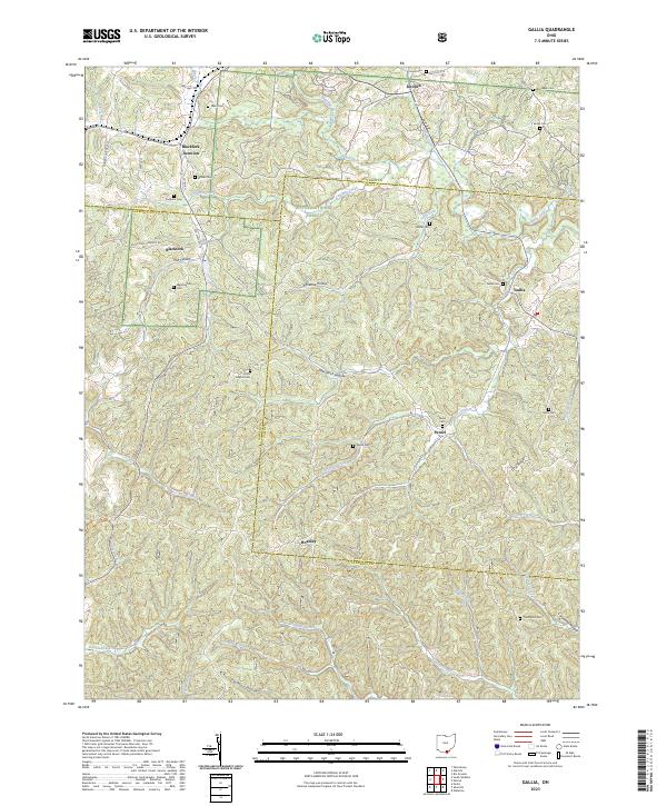 2023 Gallia2023 Print · USGSThe hills where Jackson, Lawrence, and Gallia counties meet remain a landscape of deep hollows and quiet cemeteries. Genealogists can trace family roots at Union Baptist Cem, Sardis Cem, and Thompson Cem, or locate old settlements like Peniel and Hoadley.
 - 2023 Map of Patriot, 2023 Print
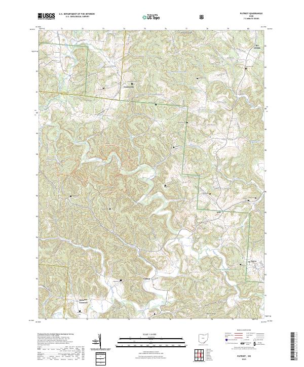 2023 Patriot2023 Print · USGSGallia County's wooded ridges and creek valleys are documented in the early twenty-first century, showing the enduring settlement patterns of southern Ohio. Researchers can locate numerous family burial grounds like Old Pine Cem and trace the paths of Symmes Creek and Trace Creek.
 - 2023 Map of Rodney, 2023 Print
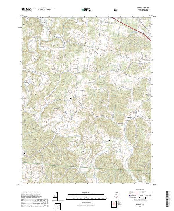 2023 Rodney2023 Print · USGSGallia County's rolling hills and creek valleys are documented here in recent years, showing a landscape defined by small hamlets and forest land. Genealogists can trace family roots at Fairfield Church Cem, Asbury Cem, and the settlement of Rodney.
 - 2023 Map of Waterloo, 2023 Print
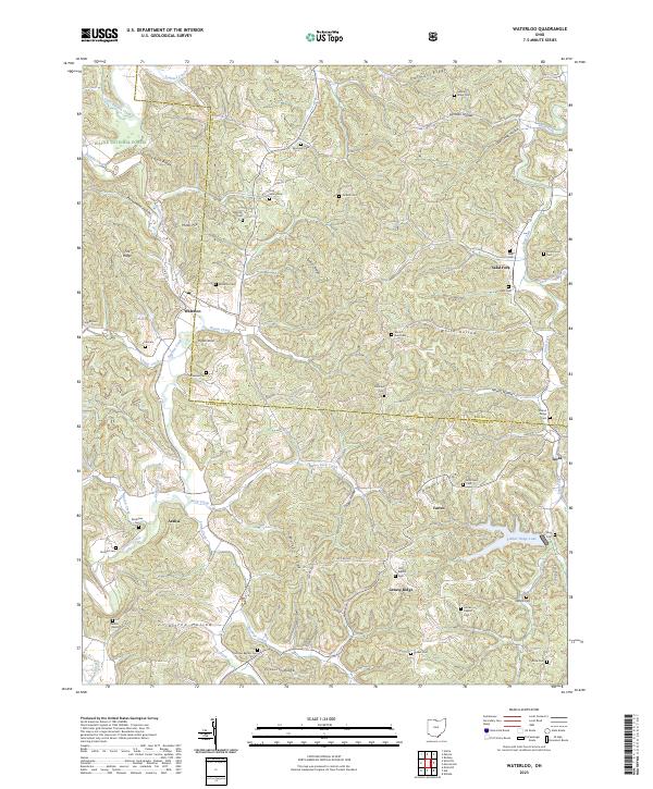 2023 Waterloo2023 Print · USGSModern Lawrence County retains its traditional character in this survey of the southern Ohio hill country. Genealogists can locate dozens of family burial sites such as Flag Spring Cem and Okey Cem near the communities of Waterloo and Arabia.
 - 2023 Map of Wilkesville, 2023 Print
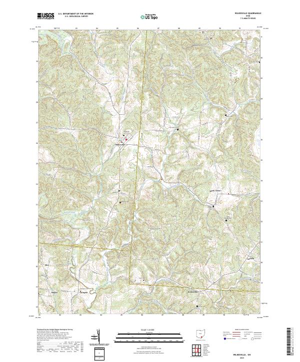 2023 Wilkesville2023 Print · USGSSoutheast Ohio's hills at the junction of Vinton, Meigs, and Gallia counties reveal a deep rural heritage of crossroads settlements and family burial grounds. Local researchers can trace family roots at Old Salem Cem, locate the village of Salem Center, or follow the winding path of Raccoon Creek.
 - 2023 Map of Rutland, 2023 Print
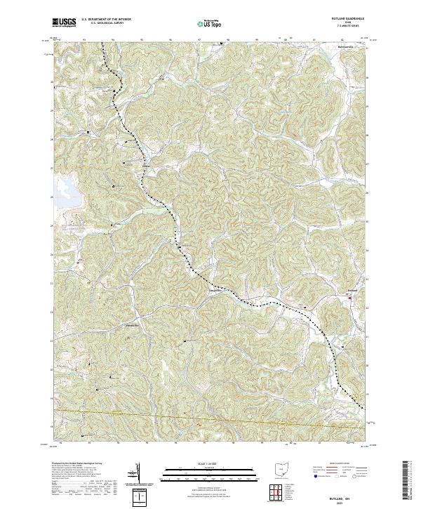 2023 Rutland2023 Print · USGSMeigs County's rural townships and family-named landmarks are documented here in the early twenty-first century. Researchers can trace ancestral sites like Longstretch Cem and Miles Cem or explore settlements at Harrisonville and Langsville.
 - 2023 Map of Addison, 2023 Print
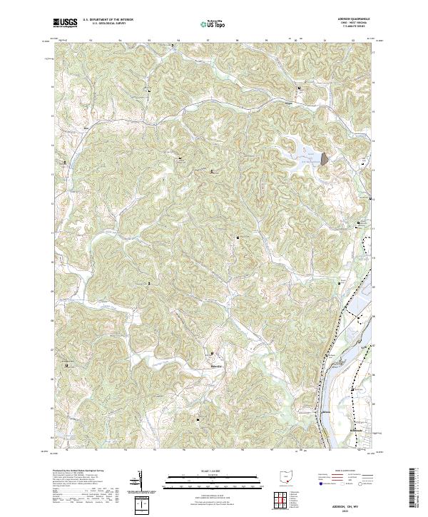 2023 Addison2023 Print · USGSGallia County, Ohio, along the West Virginia border, reveals a landscape of riverfront industry and rural ridge-top life. Researchers can trace family ties at the Roush Cem and Rife Cem or explore the geography around Bulaville and Addison.
 - 2023 Map of Rio Grande, 2023 Print
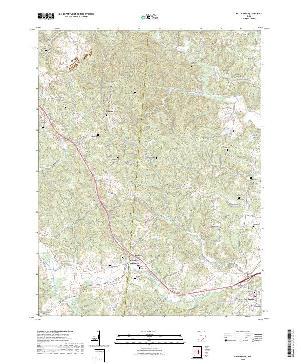 2023 Rio Grande2023 Print · USGSGallia and Jackson counties at the start of the 2020s show a landscape of deep-rooted rural communities. Genealogists can trace family landmarks like Lackey Ridge and numerous burial sites including Hill and McNeal.
 - 2023 Map of Cheshire, 2023 Print
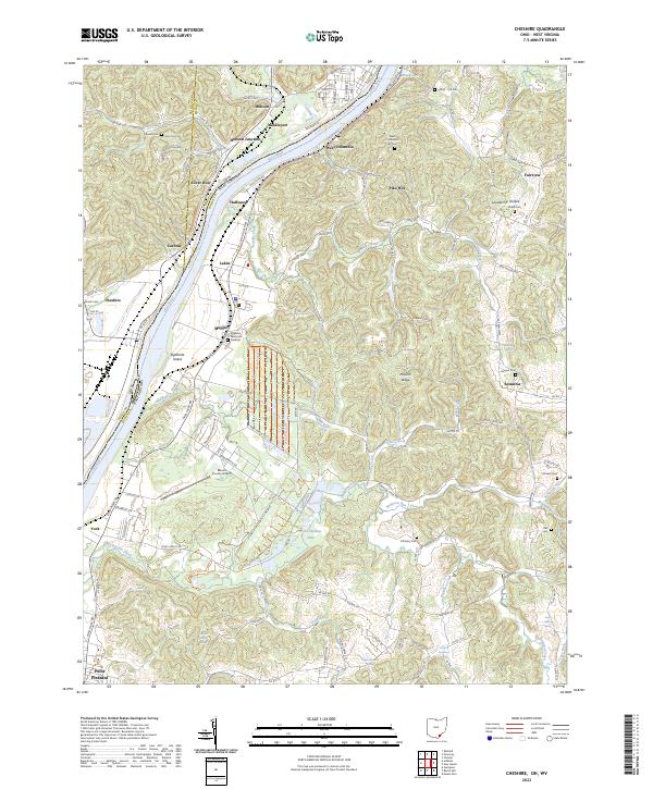 2023 Cheshire2023 Print · USGSThe Ohio River valley at the border of Ohio and West Virginia is shown here in detail during the early 2020s. Researchers can locate family sites and rural landmarks like Clifton - Hill Cem, the Mason County Airport, and the rail junction at Hobson Junction.
 - 2023 Map of Vinton, 2023 Print
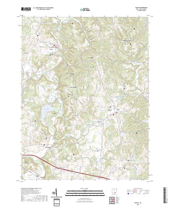 2023 Vinton2023 Print · USGSGallia County's rural communities and valley settlements are shown here as they appear in the early 2020s. Genealogists and local historians can locate numerous family burial grounds including Lower McCarley Cem and Vance Cem near the banks of Raccoon Creek.
 - 2023 Map of Gallipolis, 2023 Print
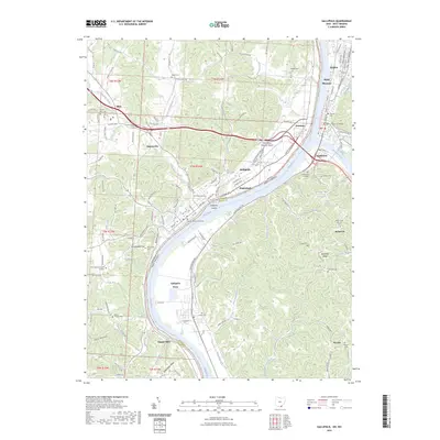 2023 Gallipolis2023 Print · USGSThe Ohio River valley at the border of Ohio and West Virginia comes alive in this survey of the river-and-rail corridor. Genealogists can trace family roots at Mound Hill and Pioneer Cem, or locate historic sites like the Gallia County Courthouse and the old Gallipolis Ferry crossing.
 - 2023 Map of Apple Grove, 2023 Print
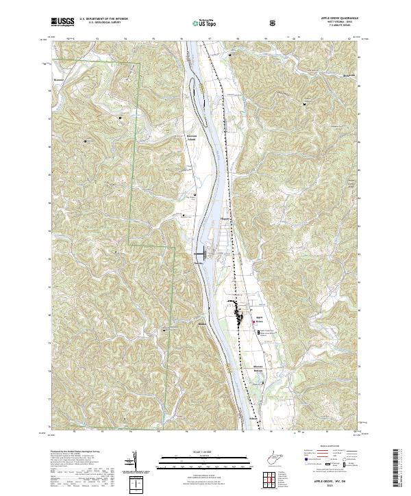 2023 Apple Grove2023 Print · USGSThe Ohio River borderlands between Ohio and West Virginia are detailed in this recent survey of the valley and its flanking ridges. Researchers can trace numerous burial sites like Bethel Methodist Episcopal Cem and riverside hamlets such as Mercers Bottom and Apple Grove.
 - 2023 Map of Glenwood, 2023 Print
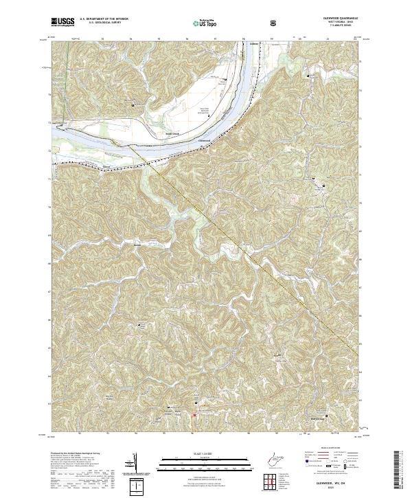 2023 Glenwood2023 Print · USGSModern West Virginia river life and hill country traditions meet along the banks of the Ohio River in the early 2020s. Genealogists and local historians can trace family ties through numerous upland sites like Moores Chapel Cemetery and the historic Swan Creek settlement.
 - 2023 Map of Mulga, 2023 Print
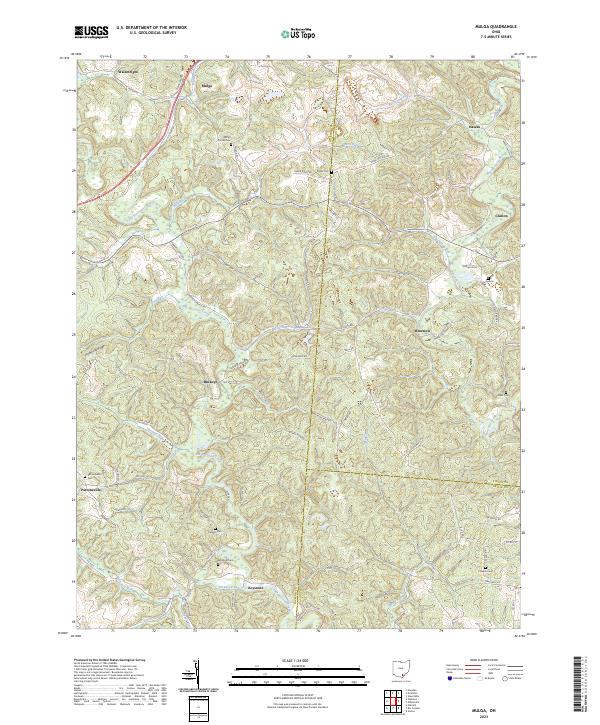 2023 Mulga2023 Print · USGSSouthern Ohio's creek valleys and family settlements are mapped in detail as they appear today across Jackson and Vinton Counties. Genealogists can trace rural roots through numerous burial sites like Pattonsville Cem and Curry Cem near the CSX Transportation line.
 - 2023 Map of Pomeroy, 2023 Print
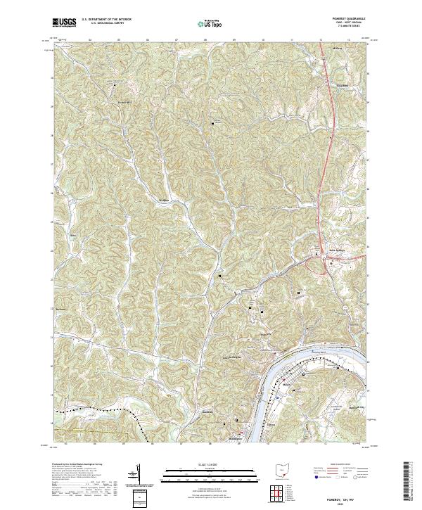 2023 Pomeroy2023 Print · USGSPomeroy and Middleport sit along the Ohio River in this recent survey of Meigs County. Genealogists can trace family burial sites at Saint Josephs Cem and Riverview Cem or locate the Meigs County Courthouse.
End of results
Showing maps 1-17 of 17
Top cities of Gallia County
- Gallipolis historical maps
- Rio Grande historical maps
- Crown City historical maps
- Vinton historical maps
- Cheshire historical maps
Frequently asked questions
- What are the different types of historical maps available for Gallia County?
- What is the oldest map of Gallia County?
- Where can I purchase historical maps of Gallia County for my home or office?
- Where can I download high-res historical maps of Gallia County?
- Are there historical topographic maps available for Gallia County?
- Is there historical aerial imagery available for Gallia County?
- Where are historical maps of Gallia County sourced from?