Old Maps of Harrison County, Ohio for Metal Detecting
Plan your next treasure hunt with 113 historic maps of Harrison County. Find old homesites, ghost towns, trails, and gathering spots that may be lost to time — perfect for identifying promising metal detecting locations.
- Locate forgotten sites: Uncover places like long-lost settlements, abandoned rail lines, or gathering spots.
- Plan better hunts: Use map overlays combined with LiDAR or satellite views to narrow in on historically rich areas.
- Made for detectorists: Thousands of hobbyists use these maps to discover relics, coins, and hidden history.
Use these historic maps to boost your research and find new opportunities beneath the surface of Harrison County.
Harrison County, OH maps
(113)- 1901 Map of Cadiz, 1954 Print
 1901 Cadiz1954 Print · USGSEastern Ohio at the dawn of the twentieth century was a landscape of ridge-top villages and bustling rail junctions. Trace the steam-era connections between Cadiz Junc and Jewett, or locate historic settlements like Bloomingdale and Amsterdam.2 unique versions available
 - 1902 Map of Scio, 1959 Print
 1902 Scio1959 Print · USGSHarrison and Carroll counties at the turn of the century show a region shaped by railroad expansion and early reservoir systems. Genealogists can trace family connections in vanished post offices and villages like Lamartine P.O. Perryville, Deersville, and New Rumley.
 - 1903 Map of Cadiz, 1941 Print
 1903 Cadiz1941 Print · USGSEastern Ohio at the turn of the century was a landscape of busy rail corridors and small valley towns. Genealogists and historians can trace old homesteads and rail stops near Amsterdam, Bloomingdale, and the junction at Jewett along the Wheeling and Lake Erie line.
 - 1903 Map of Flushing, 1959 Print
 1903 Flushing1959 Print · USGSEastern Ohio at the turn of the century is defined here by the meeting of major rail lines and the historic National Road. Trace the path of the Cleveland Lorain and Wheeling railroad through Holloway or locate homes in Flushing.
 - 1904 Map of Scio, 1944 Print
 1904 Scio1944 Print · USGSHarrison and Carroll counties are shown here at the height of the steam-rail era, centered on the busy Conotton Creek corridor. Genealogists can trace family footprints in hill-country settlements like Deersville, New Rumley, and the rail junction at Jewett.
 - 1905 Map of St. Clairsville, 1942 Print
 1905 St. Clairsville1942 Print · USGSBelmont County at the start of the twentieth century was a landscape of steep ridges and vital transportation corridors. Researchers can trace the path of the National Road and locate early settlements and rail junctions like Fairpoint, Colerain, and Harrisville.2 unique versions available
 - 1905 Map of Flushing, 1946 Print
 1905 Flushing1946 Print · USGSEastern Ohio at the turn of the century shows a landscape defined by the National Turnpike and early rail lines. Genealogists can trace family footprints in Holloway, Sewellsville, and Morristown or along the winding Cleveland Lorain and Wheeling railroad.
 - 1909 Map of Antrim
 1909 Antrim1909 Print · USGSEastern Ohio at the turn of the century reveals a landscape of ridge-top farms and valley settlements centered around Antrim and Londonderry. Genealogists can trace family footprints across township lines to sites like Allen Chapel, Moccasin School, and Sewellsville.2 unique versions available
 - 1909 Map of Uhrichsville, 1956 Print
 1909 Uhrichsville1956 Print · USGSThe industrial valleys of Tuscarawas and Harrison Counties come alive in this early twentieth-century survey. Genealogists can trace family roots at Gnadenhutten, Goshen Beidler PO, and dozens of rural sites like Kennedy Church and Latto School.
 - 1911 Map of Antrim
 1911 Antrim1911 Print · USGSGuernsey County and parts of Harrison and Tuscarawas Counties appear here just after the first decade of the century, when the rural landscape was dotted with family-named schools and crossroads. Genealogists can trace the exact locations of vanished local landmarks like Moccasin School, Wesley Church, and the dual-named Winterset P.O. Winchester.3 unique versions available
 - 1911 Map of Uhrichsville, 1937 Print
 1911 Uhrichsville1937 Print · USGSTuscarawas County's industrial river valleys and canal routes are shown here at their height before the mid-century decline of rail. Researchers can trace the path of the Ohio and Erie Canal and locate family-named landmarks like Beidler P O, Wesley Church, and Gnadenhutten.
 - 1951 Map of Canton
 1951 Canton1951 Print · USGSThe industrial heartland of Ohio and Pennsylvania reached its mid-century peak during this era of heavy rail and river transit. Genealogists and historians can trace the development of steel towns like Aliquippa and Weirton alongside the Ohio River and major lines of the Pennsylvania RR.
 - 1953 Map of Canton
 1953 Canton1953 Print · USGSThe industrial heartland of Ohio and Pennsylvania is captured at its mid-century peak in this detailed regional survey. Genealogists and historians can trace the vast rail networks of the Pennsylvania RR and find local landmarks like Nimisila Reservoir and Tappan Reservoir.
 - 1957 Map of Canton, 1971 Print
 1957 Canton1971 Print · USGSThe industrial heartland of eastern Ohio and western Pennsylvania comes alive in this mid-century survey of the Ohio River Valley. Trace the heritage of rail and river commerce through Pittsburgh, the massive steel towns along the Ohio River, and major junctions on the Pennsylvania RR.3 unique versions available
 - 1960 Map of Smithfield, 1961 Print
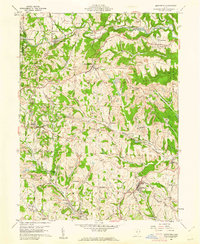 1960 Smithfield1961 Print · USGSJefferson County at the dawn of the sixties shows a landscape transformed by industry and rail. Genealogists can trace family roots through Pine Run Cem and Township Cem, or locate old rail stops like Weems (Smithfield Sta).4 unique versions available
 - 1960 Map of Richmond, 1961 Print
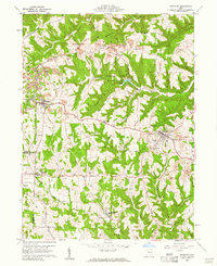 1960 Richmond1961 Print · USGSJefferson County in the early sixties was a landscape of deep-cut ridges and active industry. Researchers can trace family sites at Old Annapolis Cem, explore the grounds of St John Vianney Seminary, or locate early Strip Mines near Richmond.3 unique versions available
 - 1960 Map of Harrisville, 1961 Print
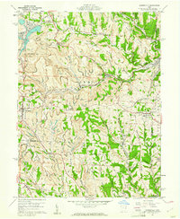 1960 Harrisville1961 Print · USGSEastern Ohio's coal country comes into sharp focus during the early sixties, showing a landscape shaped by industrial mining and small-town life. Genealogists and historians can trace family plots at Olive Branch Cem or locate the sprawling Georgetown Coal Preparation Plant and the Glencastle Mine.5 unique versions available
 - 1960 Map of Cadiz, 1962 Print
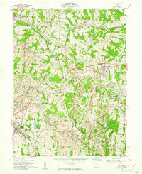 1960 Cadiz1962 Print · USGSEastern Ohio at the dawn of the 1960s shows a landscape shaped by coal and rail near the Harrison and Jefferson County line. Genealogists and historians can trace family roots at Greenwood Cem and Beech Spring Cem or locate industrial sites like Nelms Mine No 1.4 unique versions available
 - 1960 Map of Amsterdam, 1962 Print
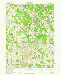 1960 Amsterdam1962 Print · USGSThe tri-county borderlands of Jefferson, Carroll, and Harrison Counties are captured here in the early 1960s as mining reshaped the landscape. Trace the New York Central line through Amsterdam or locate family roots at Simmons Ridge Cem and Germano.3 unique versions available
 - 1961 Map of Piedmont, 1962 Print
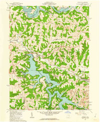 1961 Piedmont1962 Print · USGSHarrison and Belmont counties in the early sixties show a landscape transformed by the Muskingum Watershed Conservancy District. Genealogists and historians can locate the Quaker Cem, trace the Baltimore and Ohio rail lines, and find early coal Strip Mines.4 unique versions available
 - 1961 Map of Flushing, 1962 Print
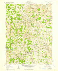 1961 Flushing1962 Print · USGSEastern Ohio hill country at the start of the sixties shows a region of deep-cut valleys and active industry. Researchers can trace the path of the Baltimore and Ohio RR and locate local landmarks like Nottingham Ch and the many Strip Mines that dot the landscape.3 unique versions available
 - 1961 Map of Scio, 1963 Print
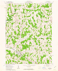 1961 Scio1963 Print · USGSHarrison and Carroll counties are shown in the early 1960s, a landscape where railroad lines and extractive industries meet rural village life. Researchers can locate the Gen Custer Mon in New Rumley or trace the early footprint of Leesville Reservoir near Scio.2 unique versions available
 - 1961 Map of Tippecanoe, 1963 Print
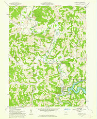 1961 Tippecanoe1963 Print · USGSHarrison County in the early sixties centers on the industrial and agricultural rhythm of the Stillwater Creek valley. Trace your family roots at Feed Springs Cem, locate the old kilns near Newport, or follow the Baltimore and Ohio rail line.3 unique versions available
 - 1961 Map of Uhrichsville, 1963 Print
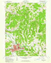 1961 Uhrichsville1963 Print · USGSThe twin cities of Uhrichsville and Dennison are captured in the early sixties at the height of their rail-and-river industrial era. Genealogists and local historians can trace family locations through Union Cem, FUHR Hospital, and the many outlying strip mines that powered the local economy.5 unique versions available
 - 1961 Map of Jewett, 1963 Print
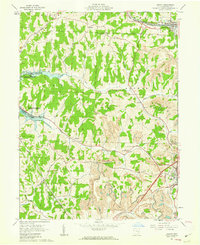 1961 Jewett1963 Print · USGSThe industrial and social landscape of Harrison County comes into focus in the early 1960s, showing a region defined by extensive coal extraction. Genealogists and historians can trace sites like Infirmary Cem, the County Fairground, and the coal-rich terrain near Jewett.4 unique versions available
Showing maps 1-25 of 113
Top cities of Harrison County
- Cadiz historical maps
- Hopedale historical maps
- Jewett historical maps
- Scio historical maps
- Bowerston historical maps
- Moorefield historical maps
See more
Frequently asked questions
- What are the different types of historical maps available for Harrison County?
- What is the oldest map of Harrison County?
- Where can I purchase historical maps of Harrison County for my home or office?
- Where can I download high-res historical maps of Harrison County?
- Are there historical topographic maps available for Harrison County?
- Is there historical aerial imagery available for Harrison County?
- Where are historical maps of Harrison County sourced from?