Old Maps of Ironton, Ohio for Genealogy
Trace your family roots with 28 historic maps of Ironton. These high-res maps reveal old neighborhoods, homesites, landmarks, and streets — helping you uncover where your ancestors lived and how the area evolved over time.
- Explore historic neighborhoods: Identify where your relatives may have lived in the 1800s or 1900s.
- Compare maps over time: Trace the changes in streets, buildings, and landmarks for multi-generational research.
- Perfect for genealogy & ancestry research: Used by family historians and researchers to map out lineage and migration.
These maps are an incredible resource for exploring your personal connection to Ironton's past.
Ironton, OH maps
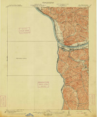
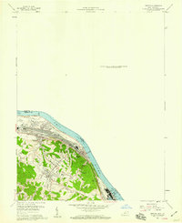
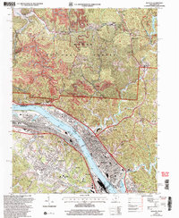
(28)- 1898 Map of Ironton, 1955 Print
 1898 Ironton1955 Print · USGSSouthern Ohio's iron-producing region and the bustling riverfront at Ironton are documented here just before the turn of the century. Genealogists can trace family footprints near Vesuvius Furnace, Woodland Cemetery, and old post offices like Culbertson P.O.
 - 1900 Map of Ironton, 1918 Print
 1900 Ironton1918 Print · USGSThe Ohio River valley and the iron-rich hills of Lawrence County are seen here at the turn of the century during a peak in industrial activity. Genealogists and historians can trace defunct post offices like Orr P.O. and explore the rail corridors of the Ironton R.R. and Cincinnati Hamilton & Dayton R.R.2 unique versions available
 - 1901 Map of Ceredo, 1953 Print
 1901 Ceredo1953 Print · USGSThe tri-state convergence of West Virginia, Ohio, and Kentucky comes alive in this early 20th-century survey of the Ohio River valley. Genealogists and rail historians can trace the vital transport networks of Kenova and Ceredo, alongside family-named landmarks like Walker Br and Rice Run.2 unique versions available
 - 1903 Map of Kenova
 1903 Kenova1903 Print · USGSThe tri-state river junction at Ashland and Kenova was a bustling industrial hub after the turn of the century. Trace early rail lines and mining settlements like Coalton and Boghead, or locate family landmarks along the Little Sandy River and Means Tunnel.5 unique versions available
 - 1904 Map of Kenova
 1904 Kenova1904 Print · USGSThe tri-state confluence of the Ohio River and Big Sandy River hums with early industrial activity at the start of the century. Genealogists can trace rail-side settlements and remote homesteads along Blaine Creek and near Mt Savage or Webbville.
 - 1913 Map of Ceredo
 1913 Ceredo1913 Print · USGSThe confluence of the Ohio and Big Sandy rivers comes alive in this pre-war survey of the West Virginia-Ohio borderlands. Genealogists and rail historians can trace the early footprints of Kenova, Ceredo, and the winding path of Twelvepole Creek.4 unique versions available
 - 1953 Map of Ashland, 1955 Print
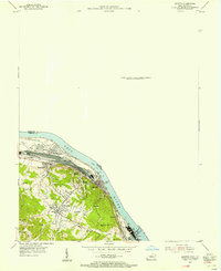
 1953 Ashland1955 Print · USGSAshland was a thriving river and rail hub during the mid-fifties, dominated by its industrial waterfront and expanding hillside suburbs. Local researchers can trace family roots through the Rose Hill Burial Park, Summit settlement, and the grounds of the Federal Correctional Institution.
 - 1953 Map of Ironton, 1955 Print
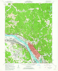
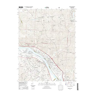
 1953 Ironton1955 Print · USGSThe Ohio River bank was a hive of industrial and residential growth in the early fifties as the railroad and river trade intersected. Trace the development of communities like Flatwoods and Russell or locate family burial sites at Rude Cem and Baldridge Cem.
 - 1957 Map of Huntington, 1966 Print
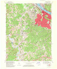
 1957 Huntington1966 Print · USGSThe industrial heart of the Ohio River valley is captured here in the mid-sixties, showing the growth of Huntington and Ashland. Researchers can trace the extensive rail networks of the Chesapeake and Ohio RR and locate sites like the Chief Cornstalk Hunting Ground.3 unique versions available
 - 1958 Map of Ashland, 1959 Print
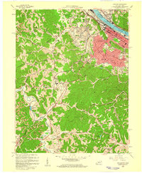 1958 Ashland1959 Print · USGSAshland and the Ohio River valley are shown here during a mid-century period of heavy rail traffic and institutional growth. Researchers can locate the Federal Correctional Institution, numerous hillside Strip Mines, and local landmarks like Rose Hill Burial Park.
 - 1958 Map of Ironton, 1959 Print
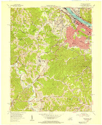
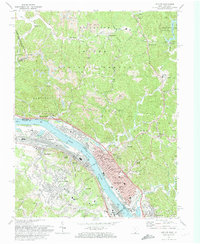
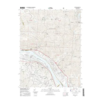
 1958 Ironton1959 Print · USGSThe Ohio River valley was undergoing a mid-century industrial and residential shift in the late fifties. Genealogists and historians can trace family roots through sites like Indian Run Ch, the Bellefonte Memorial Cem, and Caroline Sch.
 - 1960 Map of Huntington
 1960 Huntington1960 Print · USGSThe tri-state river valley thrived in the late fifties as a hub of heavy industry and Appalachian rail transit. Genealogists and historians can trace the connection between river towns like Ashland and Portsmouth or locate family homesteads near Coleman Ridge.
 - 1961 Map of Ironton, 1963 Print
 1961 Ironton1963 Print · USGSThe industrial river valley and the wooded hills of the Wayne National Forest meet in this early 1960s survey of the Ohio-Kentucky border. Genealogists can trace family names at Calvary Cem or locate community hubs like Quinn Chapel and the Vesuvius Furnace (Ruins).2 unique versions available
 - 1968 Map of Ashland, 1970 Print
 1968 Ashland1970 Print · USGSAshland and its surrounding riverfront communities thrived in the late sixties as a hub of industry and education. Genealogists can trace family landmarks like the Boyd County Home, Calvary Cem, and the Federal Youth Center.3 unique versions available
 - 1972 Map of Ironton, 1974 Print
 1972 Ironton1974 Print · USGSThe Ohio River valley and the hills of the Wayne National Forest are shown in the early seventies as the industrial engine of the region persists. Genealogists can locate family sites like Woodland Cemetery, Vesuvius Furnace (Ruins), and Quinn Chapel.4 unique versions available
 - 1981 Map of Ironton, 1982 Print
 1981 Ironton1982 Print · USGSThe tri-state river valley at the start of the eighties shows a landscape shaped by heavy industry, atomic energy, and sprawling national forests. Researchers can trace the legacy of iron production at Harrison Furnace or follow the historic rail lines of the C & O RR and N & W RR.
 - 1982 Map of Huntington, 1983 Print
 1982 Huntington1983 Print · USGSThe tri-state region around Huntington and Ashland is shown in the early 1980s, documenting a landscape shaped by river commerce and coal-country railroads. Trace family roots and old routes through Barboursville, the Gas Field, and the Tug Fork valley.
 - 2002 Map of Ironton, 2006 Print
 2002 Ironton2006 Print · USGSIronton and its neighboring river towns sit at a busy industrial crossroads along the Kentucky and Ohio border at the start of the new millennium. Traces of early iron heritage at Vesuvius Furnace (Ruins) appear alongside active Strip Mines and local landmarks like Woodland Cemetery.
 - 2010 Map of Ashland, 2010 Print
 2010 Ashland2010 Print · USGSCovers Ironton, including Ashland, Russell, and other nearby areas
 - 2011 Map of Ironton, 2011 Print
 2011 Ironton2011 Print · USGSCovers Ironton, including Flatwoods, Russell, and other nearby areas
 - 2013 Map of Ashland, 2013 Print
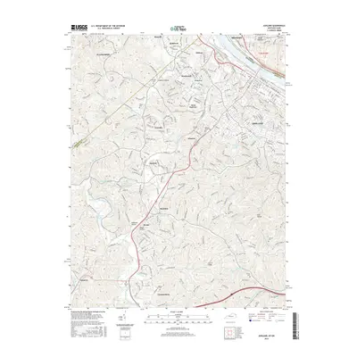
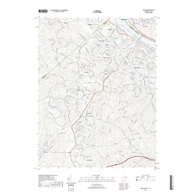
 2013 Ashland2013 Print · USGSCovers Ironton, including Ashland, Russell, and other nearby areas
 - 2013 Map of Ironton, 2013 Print
 2013 Ironton2013 Print · USGSCovers Ironton, including Flatwoods, Russell, and other nearby areas
 - 2016 Map of Ashland, 2016 Print
 2016 Ashland2016 Print · USGSCovers Ironton, including Ashland, Russell, and other nearby areas
 - 2016 Map of Ironton, 2016 Print
 2016 Ironton2016 Print · USGSCovers Ironton, including Flatwoods, Russell, and other nearby areas
 - 2019 Map of Ashland, 2019 Print
 2019 Ashland2019 Print · USGSCovers Ironton, including Ashland, Russell, and other nearby areas
Showing maps 1-25 of 28
Top cities near Ironton
- Huntington historical maps
- Ashland historical maps
- Portsmouth historical maps
- Flatwoods historical maps
- Grayson historical maps
- South Point historical maps
See more
Top neighborhoods of Ironton
- Green Valley historical maps
- Fifth and Lawrence Streets Residential Historic District historical maps
- Rankin Historic District historical maps
Frequently asked questions
- What are the different types of historical maps available for Ironton?
- What is the oldest map of Ironton?
- Where can I purchase historical maps of Ironton for my home or office?
- Where can I download high-res historical maps of Ironton?
- Are there historical topographic maps available for Ironton?
- Is there historical aerial imagery available for Ironton?
- Where are historical maps of Ironton sourced from?