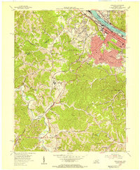
1953 Map of Ashland
USGS Topo · Published 1955About this map
The industrial and riverfront activity of Ashland defines this mid-century survey, where the Ohio River serves as a bustling corridor for the Chesapeake and Ohio and Norfolk and Western railroads. In the city's heart, Central Park and landmarks like the Armory stand amid a grid of developed streets, while the surrounding hills show the expansion of neighborhoods like Westwood, Bellefonte, and Fairview. The map captures a transition from urban density to the winding valleys of the Little Sandy River.
Find a feature on this map
71 named features on this map. Tap any name to fly to it.
Don’t see what you’re looking for? This feature index may not catch every label — zoom into the map to look around manually.
Map Details
Editions of this 1953 Ashland Map
This is the sole edition of this map. No revisions or reprints were ever made.
Other maps of this area

1898 · Ironton
USGS Topo · 1:62,500

1900 · Ironton
USGS Topo · 1:62,500

1901 · Ceredo
USGS Topo · 1:62,500

1903 · Kenova
USGS Topo · 1:125,000

1904 · Kenova
USGS Topo · 1:125,000

1913 · Ceredo
USGS Topo · 1:62,500

1926 · Greenup
USGS Topo · 1:48,000

1930 · Greenup
USGS Topo · 1:62,500

1953 · Rush
USGS Topo · 1:24,000

1953 · Boltsfork
USGS Topo · 1:24,000