1900s (20th Century) Maps of Licking County, Ohio
Explore 56 historic maps of Licking County from the 1900s (20th Century). These maps offer a rare glimpse into what life looked like during the 1900s — showing old roads, neighborhoods, homes, and landmarks that have changed or disappeared over time.
Whether you're researching your family's past, planning a metal detecting trip, or studying how Licking County's landscape evolved across the 1900s, these high-resolution maps are a powerful tool for exploring the history of this region.
- Focus on a specific era: All maps on this page are from the 1900s, giving you a focused view of this time period.
- See what’s changed: Compare century-old streets, trails, and buildings to today's modern landscape using overlays and satellite layers.
- Research with precision: Use these maps for genealogy, historical research, land use analysis, or educational projects.
- View, download, or print: Maps are fully viewable online in high resolution, and can be downloaded or printed for your own records.
Start exploring Licking County's history through authentic maps from the 1900s. This is your window into the past.
Licking County, OH maps
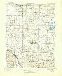
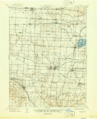
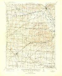
(56)- 1902 Map of Westerville, 1958 Print
 1902 Westerville1958 Print · USGSFranklin and Delaware counties at the turn of the century show a landscape transitioning from rural mill seats to rail-connected suburbs. Genealogists can trace family footprints through historic settlements like Westerville, Gahanna, and the trolley-linked Central College.
 - 1904 Map of Westerville, 1941 Print
 1904 Westerville1941 Print · USGSCentral Ohio at the turn of the century shows a landscape transitioning from rural crossroads to early suburban rail hubs. Genealogists and local historians can trace the paths of the Columbus and Newark Electric R.R. and locate vanished local points like Africa, Central College, and Unhook.2 unique versions available
 - 1907 Map of Thurston, 1960 Print
 1907 Thurston1960 Print · USGSFairfield and Licking counties at the turn of the century are shown here as a bustling landscape of rail junctions and early canal segments. Researchers can trace family roots at New Zion Church, locate the Baltimore Campground, or follow the Hocking Canal near Lockville.
 - 1908 Map of Granville, 1959 Print
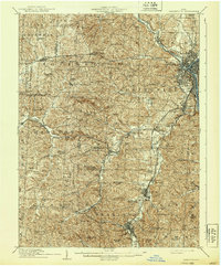
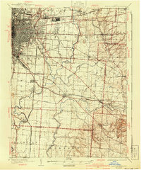
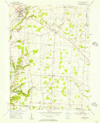
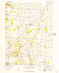
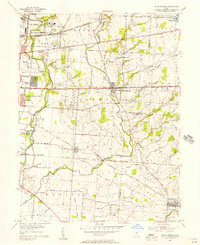
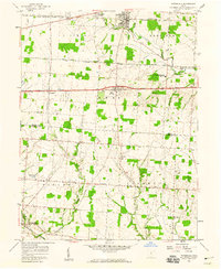
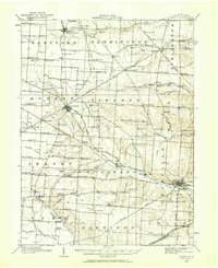 1908 Granville1959 Print · USGSLicking County at the start of the twentieth century remains a landscape of intimate rural communities and academic ambition. Researchers can trace ancestral farmstead locations near dozens of neighborhood hubs like Johnstown, Alexandria, and Denison University.
 - 1909 Map of Newark, 1937 Print
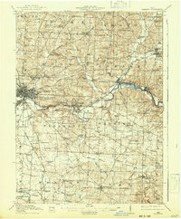
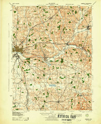
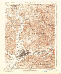 1909 Newark1937 Print · USGSLicking County at the turn of the century shows a bustling rail hub at the meeting of the forks of the Licking River. Genealogists and researchers can trace family roots through numerous country schools like Poodle School and rural parishes including Newton Chapel.2 unique versions available
 - 1909 Map of Thornville, 1938 Print
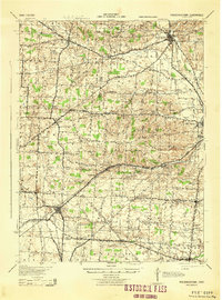
 1909 Thornville1938 Print · USGSLicking, Perry, and Fairfield counties are shown at the turn of the century as the local rail and canal-era economy remained vibrant. Researchers can trace the ancestral locations of numerous rural institutions including Porter School, Fairmount Church, and the Atherton P O at Jacksontown.2 unique versions available
 - 1909 Map of Thurston, 1946 Print
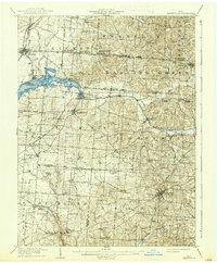
 1909 Thurston1946 Print · USGSCentral Ohio at the start of the twentieth century was a landscape of bustling rail junctions and lakeside retreats. Trace the vanished canal ways and historic rail stops like Lockville, find family landmarks such as Ritter School, or explore the early layout of BUCKEYE LAKE.
 - 1910 Map of Frazeysburg, 1937 Print
 1910 Frazeysburg1937 Print · USGSMuskingum and Licking Counties are captured here during a pivotal era of rail dominance and canal obsolescence. Researchers can locate vanished rural schoolhouses like Pisgah School or trace the early paths of the Ohio Canal near Dresden.2 unique versions available
 - 1910 Map of Zanesville, 1939 Print
 1910 Zanesville1939 Print · USGSMuskingum and Perry counties are shown here in the early twentieth century as Zanesville emerged as a powerhouse of rail and river commerce. Researchers can trace historic transport routes like the National Road or locate local landmarks such as Moxahala Park and the Fultonham (Axline PO).2 unique versions available
 - 1910 Map of Granville, 1944 Print
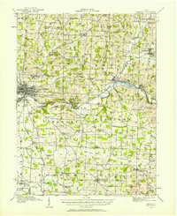
 1910 Granville1944 Print · USGSLicking County at the dawn of the automobile era shows a landscape of tightly-knit farming townships and busy rail corridors. Genealogists can locate family-named landmarks like Hazelton Corners, rural congregations at Wesley Chapel, and numerous local schools such as Wright School.
 - 1912 Map of Gambier, 1958 Print
 1912 Gambier1958 Print · USGSKnox County is captured at a fascinating moment when rural hamlets and small colleges thrived alongside expanding rail lines. Genealogists can locate dozens of country schools like Wildcat School and trace ancestors near Monroe Mills or the Democracy P O.2 unique versions available
 - 1914 Map of Gambier, 1942 Print
 1914 Gambier1942 Print · USGSKnox County in the early twentieth century is captured here as a thriving network of rail-connected towns and rural school districts. Genealogists can locate family-named landmarks like Pike School and Bedell School or trace the early campus of Kenyon College and the State Tuberculosis Hospital.
 - 1915 Map of Marengo, 1946 Print
 1915 Marengo1946 Print · USGSMorrow and Delaware counties are shown in detail during the heyday of the steam railroad and the one-room schoolhouse. Genealogists and historians can locate vanished local landmarks like Swamp Angel School, the County Infirmary, and the Treaty Line.
 - 1915 Map of Fredericktown, 1950 Print
 1915 Fredericktown1950 Print · USGSKnox and Morrow Counties are shown here during the height of the steam-rail era. Genealogists can locate dozens of country schoolhouses like Salem and Updike, alongside family landmarks such as Braddock Mound and the County Infirmary.
 - 1925 Map of East Columbus, 1940 Print
 1925 East Columbus1940 Print · USGSGreater Columbus and its eastern suburbs were rapidly expanding in the 1920s as industry and transit lines bridged the gap between city and farm. Genealogists and historians can trace the paths of the ABANDONED CANAL, the legacy of NORTON FIELD, and old village centers like Canal Winchester and Lithopolis.3 unique versions available
 - 1943 Map of Gambier
 1943 Gambier1943 Print · USGSKnox County during the Second World War shows a landscape of institutional growth and deep-rooted rural communities. Genealogists can trace family footprints across dozens of local schoolhouses like Cherry Hall Sch and historic centers such as Democracy P O or Martinsburg.
 - 1943 Map of Marengo
 1943 Marengo1943 Print · USGSCentral Ohio's agricultural heartland is documented here during the early war years, showing a landscape defined by small-town rail hubs and a dense network of rural schoolhouses. Researchers can trace family history through dozens of named sites like Chestnut Grove Sch, the County Infirmary, and settlements such as Westfield and Fulton.
 - 1943 Map of East Columbus
 1943 East Columbus1943 Print · USGSEastern Columbus and the Refugee Tract are captured here during the mobilization of the early 1940s. Genealogists and historians can trace the foundations of modern aviation at Port Columbus or find vanished landmarks like the Childrens Home and Norton Field.
 - 1943 Map of Fredericktown
 1943 Fredericktown1943 Print · USGSRural Knox County is captured here in the 1940s, showing a landscape of small townships connected by the Baltimore and Ohio RR and local schoolhouse districts. Genealogists can trace family footprints at Woodland Hall Sch, Bethel Ch, and ancient landmarks like Raleigh Mound.
 - 1947 Map of Columbus, 1948 Print
 1947 Columbus1948 Print · USGSCentral Ohio in the late 1940s is captured in this survey, showing the post-war transition of its rail hubs and military airfield expansions. Genealogists and historians can trace the paths of the Ohio Canal, the Pennsylvania RR lines, and the Camp Sherman Military Reservation.
 - 1950 Map of Marion
 1950 Marion1950 Print · USGSCentral Ohio was a powerhouse of rail and river industry at the mid-century point, serving as a vital corridor between the Great Lakes and the Ohio River valley. Genealogists and rail historians can trace the paths of the Erie RR and Nickel Plate Road through towns like Bucyrus, Galion, and Upper Sandusky.
 - 1955 Map of Sunbury, 1956 Print
 1955 Sunbury1956 Print · USGSMid-century Delaware County comes into focus as Sunbury and Galena maintain their historic rail connections along the PENNSYLVANIA line. Researchers can trace rural lineages through numerous local sites like Fancher Cem, New Bethel Ch, and the emerging Hoover Reservoir.2 unique versions available
 - 1955 Map of New Albany, 1956 Print
 1955 New Albany1956 Print · USGSNortheast Franklin County comes into focus in the mid-1950s as a collection of rural hamlets and emerging reservoir lands. Genealogists can trace family roots through sites like Jersey Chapel, Ayers Cem, and the old Township Sch.
 - 1955 Map of Reynoldsburg, 1956 Print
 1955 Reynoldsburg1956 Print · USGSThe eastern edges of Columbus and the growing suburbs of Reynoldsburg and Whitehall appear here in the mid-fifties. Genealogists can trace family footprints at Forest Lawn Cemetery or Asbury Ch, while others can find industrial sites like the Claycraft kilns.
 - 1958 Map of Pataskala, 1959 Print
 1958 Pataskala1959 Print · USGSPataskala and Pickerington are shown here in the late fifties, during a period of transition along the National Road. Genealogists can locate family landmarks such as Union Cem, Mt Zion Ch, and the small settlement of Wagram.4 unique versions available
Showing maps 1-25 of 56
Top cities of Licking County
Frequently asked questions
- What are the different types of historical maps available for Licking County?
- What is the oldest map of Licking County?
- Where can I purchase historical maps of Licking County for my home or office?
- Where can I download high-res historical maps of Licking County?
- Are there historical topographic maps available for Licking County?
- Is there historical aerial imagery available for Licking County?
- Where are historical maps of Licking County sourced from?