1960s Maps of Licking County, Ohio
Explore 26 historic maps of Licking County from the 1960s. These maps offer a rare glimpse into what life looked like during the 1960s — showing old roads, neighborhoods, homes, and landmarks that have changed or disappeared over time.
Whether you're researching your family's past, planning a metal detecting trip, or studying how Licking County's landscape evolved across the 1960s, these high-resolution maps are a powerful tool for exploring the history of this region.
- Focus on a specific era: All maps on this page are from the 1960s, giving you a focused view of this time period.
- See what’s changed: Compare century-old streets, trails, and buildings to today's modern landscape using overlays and satellite layers.
- Research with precision: Use these maps for genealogy, historical research, land use analysis, or educational projects.
- View, download, or print: Maps are fully viewable online in high resolution, and can be downloaded or printed for your own records.
Start exploring Licking County's history through authentic maps from the 1960s. This is your window into the past.
Licking County, OH maps
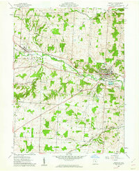
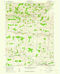
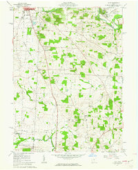
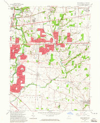
(26)- 1961 Map of Columbus
 1961 Columbus1961 Print · USGSCentral and Southern Ohio are captured here in the early sixties, as the region's industrial rail hubs and military bases reached their peak. Genealogists and historians can trace the transition from urban Columbus to rural townships along the Scioto River, locating Lockbourne USAF and old junctions like Washington Court House.
 - 1961 Map of Hanover, 1962 Print
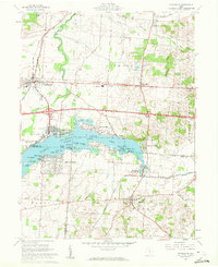
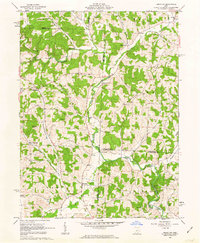
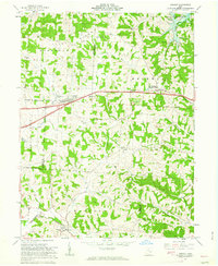
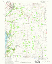
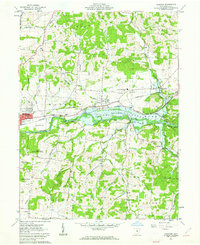 1961 Hanover1962 Print · USGSLicking County’s river valleys were entering a new era in the early sixties as the Dillon Reservoir transformed the local landscape. Researchers can trace the paths of the Pennsylvania Railroad and locate rural landmarks like Hazel Dell Ch and Claylick.5 unique versions available
 - 1961 Map of Millersport, 1962 Print
 1961 Millersport1962 Print · USGSCentral Ohio in the early sixties is captured here at the intersection of early canal history and mid-century recreation. Trace the path of the OHIO CANAL (ABANDONED) near Millersport or locate family roots at Refugee Cem and Fletcher Chapel.3 unique versions available
 - 1961 Map of Newark, 1962 Print
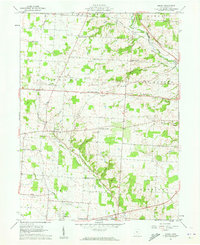
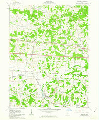
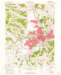 1961 Newark1962 Print · USGSNewark and the Licking River forks are shown here in the early 1960s as the region's industrial base and suburban footprint expanded. Researchers can trace historic earthworks at the Octagon State Memorial, family plots in Cedar Hill Cemetery, and the local rail network of the B & O.5 unique versions available
 - 1961 Map of Fredonia, 1962 Print
 1961 Fredonia1962 Print · USGSCentral Ohio farm country comes into focus in the early sixties, showing a landscape defined by crossroads hamlets and river forks. Genealogists can trace family names at Appleton Cem, McKean Sch, and settlements like Highwater.4 unique versions available
 - 1961 Map of Granville, 1962 Print
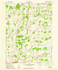
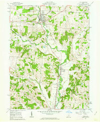
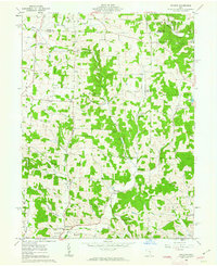
 1961 Granville1962 Print · USGSLicking County at the start of the sixties reveals a landscape of collegiate life and rail-side settlements. Trace family history at Harrison Ch, explore the grounds of Denison Univ, or locate old homesteads near Union Station.3 unique versions available
 - 1961 Map of Thornville, 1962 Print
 1961 Thornville1962 Print · USGSThe Buckeye Lake region in the early sixties showcases a landscape defined by lakeside recreation and historic surveying boundaries. Trace family roots at Friendship Cem or study the rail connections at Thornport and Thornville.5 unique versions available
 - 1961 Map of Centerburg, 1962 Print
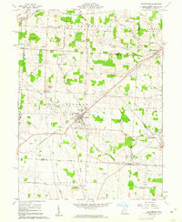 1961 Centerburg1962 Print · USGSKnox County is captured at the start of the 1960s, centered on the strategic rail junction at Centerburg. Genealogists and local historians can trace family plots at Houck Cem and Moreland Cem or locate old community landmarks like Milford Ch and Rich Hill.3 unique versions available
 - 1961 Map of Olive Green, 1962 Print
 1961 Olive Green1962 Print · USGSCentral Ohio farm country comes to life in the early 1960s, showing a landscape of small crossroads and creek-side settlements. Researchers can trace the path of the Pennsylvania railroad or locate rural landmarks like the Covered Bridge and Pagetown Cem.3 unique versions available
 - 1961 Map of Homer, 1962 Print
 1961 Homer1962 Print · USGSKnox County at the start of the sixties reveals a landscape of quiet crossroads and family-owned farms. Genealogists can trace property lines and old burial grounds like Dowell Cem and Hyatt Cem near settlements such as Lock and Brandon.3 unique versions available
 - 1961 Map of Utica, 1962 Print
 1961 Utica1962 Print · USGSThe Licking and Knox county line comes alive in the early sixties, showing a landscape defined by the North Fork and the railroad. Genealogists can trace family roots at Bell Ch Cem or Maple Cem, while researchers can locate the old Township Sch and Chatham settlement.3 unique versions available
 - 1961 Map of Jersey, 1962 Print
 1961 Jersey1962 Print · USGSLicking County crossroads and rural hamlets are captured here in the early sixties as local farming communities maintained their traditional layout. Genealogists can locate family-named sites like Hazelton Corners and numerous small burial grounds including Swisher Cem and Moreland Cem.3 unique versions available
 - 1961 Map of Johnstown, 1962 Print
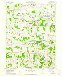
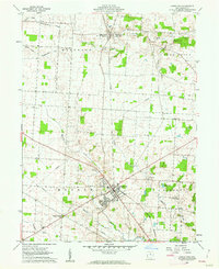 1961 Johnstown1962 Print · USGSCentral Ohio’s agricultural heartland is captured here in the early sixties, centered on the village of Johnstown. Researchers can trace old family roots through sites like Green Hill Cemetery, Twelve Corners Cem, and the rail corridor of the New York Central.4 unique versions available
 - 1961 Map of Hunt, 1962 Print
 1961 Hunt1962 Print · USGSKnox County in the early sixties centers on the scholarly grounds of Kenyon College and the surrounding agricultural valleys. Researchers can trace family roots at St Johns Cem or follow the legacy of the Baltimore and Ohio railroad through Hunt.4 unique versions available
 - 1961 Map of Glenford, 1963 Print
 1961 Glenford1963 Print · USGSThe Licking and Perry County border in the early sixties was a landscape defined by historic rail junctions and ancient landmarks. Genealogists and researchers can locate family sites near Glenford, Ellis Chapel, and the Highland Cem or trace the early oil industry and Indian Mound site.3 unique versions available
 - 1961 Map of Hickman, 1963 Print
 1961 Hickman1963 Print · USGSLicking and Knox counties come alive in the early sixties as a network of oil and gas fields spreads across the landscape. You can trace family roots through Hickman and Purity, or locate rural landmarks like Burrell Chapel and the Covered Bridge over Rocky Fork.4 unique versions available
 - 1962 Map of Columbus
 1962 Columbus1962 Print · USGSCentral Ohio during the early sixties reveals a transition from the industrial corridors of Columbus to the forested ridges of the south. Genealogists and historians can trace the rail networks of the Baltimore & Ohio RR and find local landmarks like Washington Court House and Camp Sherman Military Reservation.
 - 1962 Map of Marion
 1962 Marion1962 Print · USGSCentral Ohio during the post-war era showcases a dense network of railroad towns and emerging interstate highways. Genealogists can trace family roots in smaller settlements like Houcktown and Marseilles or locate landmarks near Indian Lake.
 - 1962 Map of Perryton, 1963 Print
 1962 Perryton1963 Print · USGSLicking and Coshocton counties are shown in the early sixties as a rural landscape of winding creek valleys and dispersed hamlets. Researchers can trace family history at Perry Chapel, locate the Union Sch, or find the old Covered Bridge and Ashcraft Ford.3 unique versions available
 - 1962 Map of Gratiot, 1963 Print
 1962 Gratiot1963 Print · USGSLicking and Muskingum counties come together during the early 1960s, a landscape defined by the high ground of Flint Ridge and small crossroads towns. Researchers can locate family landmarks like the Poplar Fork Cem or trace the route of the New York Central past a historic Covered Bridge.3 unique versions available
 - 1962 Map of Toboso, 1963 Print
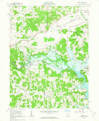 1962 Toboso1963 Print · USGSMuskingum County at the start of the 1960s reveals a landscape defined by the river and the rail. Genealogists and historians can trace family locations near Stone Ch and Irville, or follow the path of the Baltimore and Ohio Railroad through the Licking Gorge.4 unique versions available
 - 1964 Map of Reynoldsburg, 1965 Print
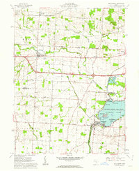
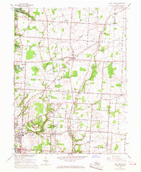
 1964 Reynoldsburg1965 Print · USGSEastern Franklin County and parts of Licking and Fairfield counties are captured in the mid-sixties during a period of significant suburban growth. Researchers can trace old family cemetery sites like Pisgah Cem, early rail lines, and the footprint of Port Columbus as it stood decades ago.5 unique versions available
 - 1966 Map of Marion, 1968 Print
 1966 Marion1968 Print · USGSCentral Ohio in the mid-sixties is captured during a period of rapid highway expansion and industrial connectivity. Genealogists and historians can trace rail-and-river networks through towns like Marion, Urbana, and Mount Vernon, or locate landmarks such as Malabar Farm and Black Hand Rock.3 unique versions available
 - 1966 Map of New Albany, 1968 Print
 1966 New Albany1968 Print · USGSFranklin and Licking counties are captured here in the mid-sixties, as rural communities like New Albany and Gahanna began to expand. Genealogists and local historians can trace family-named sites such as Havens Corners, Burnside Cem, and Jersey Chapel.3 unique versions available
 - 1967 Map of Sunbury, 1969 Print
 1967 Sunbury1969 Print · USGSDelaware County's rural character meets the growing reach of the capital's parklands in the late sixties. Genealogists and local historians can trace family roots through several landmarks, including Vans Valley Cem, New Bethel Ch, and the settlement at Center Village.3 unique versions available
Showing maps 1-25 of 26
Top cities of Licking County
Frequently asked questions
- What are the different types of historical maps available for Licking County?
- What is the oldest map of Licking County?
- Where can I purchase historical maps of Licking County for my home or office?
- Where can I download high-res historical maps of Licking County?
- Are there historical topographic maps available for Licking County?
- Is there historical aerial imagery available for Licking County?
- Where are historical maps of Licking County sourced from?