Old Maps of Harrisville Township, Ohio for Hiking & Exploration
Hike through history with 52 historic maps of Harrisville Township. Explore old trails, ghost towns, and forgotten backroads — perfect for outdoor adventurers and local explorers.
- Rediscover forgotten places: Map out old mining camps, roads, and footpaths that no longer exist on modern maps.
- Layer with modern tools: Combine with LiDAR or satellite views to plan hikes through historical terrain.
- Made for exploration: Popular among hikers, overlanders, and local history lovers.
Use these maps to find adventure and explore the hidden past of Harrisville Township.
Harrisville Township, OH maps
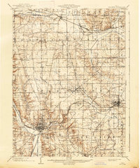
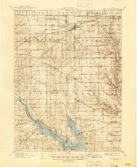
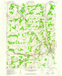
(52)- 1901 Map of Wooster, 1961 Print
 1901 Wooster1961 Print · USGSWayne County was a bustling corridor of rail and agriculture at the turn of the century, dominated by the growth of Wooster and Orrville. Researchers can trace historic institutions like Wooster University or locate the Mennonite Home and State Experiment Station.
 - 1903 Map of Wooster, 1938 Print
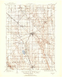
 1903 Wooster1938 Print · USGSWayne County is shown at the height of its early rail-and-river economy, with every township and rural hamlet meticulously plotted. Researchers can trace historic landmarks like Wooster University, the Mennonite Home, and the State Experiment Station as they appeared just after the turn of the century.2 unique versions available
 - 1904 Map of Medina, 1954 Print
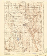
 1904 Medina1954 Print · USGSMedina and its surrounding townships are captured in the early 1900s, showing a landscape defined by the intersection of early pikes and competing steam and electric railroads. Genealogists can trace family connections in vanished stops and crossroads like River Styx, Abbeyville, and Sherman Corners.2 unique versions available
 - 1904 Map of Wellington, 1958 Print
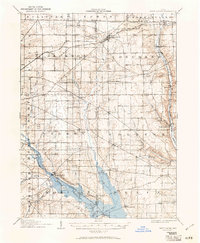
 1904 Wellington1958 Print · USGSNorth-central Ohio at the turn of the century is a network of growing rail towns and agricultural townships. Genealogists can trace family roots through settlements like Wellington, Homerville, and Lodi, while following the paths of the Wheeling and Lake Erie RR and Salt Creek.
 - 1906 Map of Medina, 1941 Print
 1906 Medina1941 Print · USGSIn Medina County at the dawn of the twentieth century, the rural landscape is a bustling network of electric rail lines and crossroads hamlets. Trace the early paths of the Cleveland Southwestern and Columbus Electric RR and find vanished rail stops like Lester or the community of River Styx.
 - 1906 Map of Wellington, 1942 Print
 1906 Wellington1942 Print · USGSNorth-central Ohio at the opening of the twentieth century was a landscape of thriving rail-junction towns and fertile creek bottoms. Genealogists and historians can trace the early footprints of Wellington, Sullivan, and Lodi as they were connected by the Baltimore and Ohio and several electric rail lines.
 - 1906 Map of West Salem, 1961 Print
 1906 West Salem1961 Print · USGSIn the early 1900s, this area of Northern Ohio was a web of small rail-side settlements and rural townships. Genealogists and historians can trace old homesteads and local landmarks like the Eight Square Ch, the village of Jeromesville, and the Mohicanville Reservoir.
 - 1908 Map of West Salem, 1946 Print
 1908 West Salem1946 Print · USGSNorth Central Ohio's rural landscape is captured here in the early twentieth century, showing the transition from early surveying reserves to a rail-connected farm economy. Researchers can locate early township centers and rail stops like Polk, Congress, and Eight Square Ch.
 - 1950 Map of Cleveland
 1950 Cleveland1950 Print · USGSCovers Harrisville Township, including Cleveland, Akron, and other nearby areas
 - 1950 Map of Marion
 1950 Marion1950 Print · USGSCentral Ohio was a powerhouse of rail and river industry at the mid-century point, serving as a vital corridor between the Great Lakes and the Ohio River valley. Genealogists and rail historians can trace the paths of the Erie RR and Nickel Plate Road through towns like Bucyrus, Galion, and Upper Sandusky.
 - 1951 Map of Canton
 1951 Canton1951 Print · USGSThe industrial heartland of Ohio and Pennsylvania reached its mid-century peak during this era of heavy rail and river transit. Genealogists and historians can trace the development of steel towns like Aliquippa and Weirton alongside the Ohio River and major lines of the Pennsylvania RR.
 - 1953 Map of Canton
 1953 Canton1953 Print · USGSThe industrial heartland of Ohio and Pennsylvania is captured at its mid-century peak in this detailed regional survey. Genealogists and historians can trace the vast rail networks of the Pennsylvania RR and find local landmarks like Nimisila Reservoir and Tappan Reservoir.
 - 1956 Map of Cleveland, 1967 Print
 1956 Cleveland1967 Print · USGSNortheast Ohio and Western Pennsylvania are shown at their industrial height during the mid-fifties, from the steel mills to the lakeshore. Researchers can trace the massive Ravenna Arsenal, the Ohio Turnpike, and vanished rail sidings of the B & O RR.3 unique versions available
 - 1956 Map of Toledo, 1968 Print
 1956 Toledo1968 Print · USGSNorthwest Ohio and the Lake Erie shoreline are shown in detail during the late fifties, showcasing a landscape of heavy industry, railroads, and island communities. Genealogists and historians can trace rail networks like the Chesapeake & Ohio RR or locate landmarks such as the Erie Proving Ground and Kelleys Island.4 unique versions available
 - 1957 Map of Canton, 1971 Print
 1957 Canton1971 Print · USGSThe industrial heartland of eastern Ohio and western Pennsylvania comes alive in this mid-century survey of the Ohio River Valley. Trace the heritage of rail and river commerce through Pittsburgh, the massive steel towns along the Ohio River, and major junctions on the Pennsylvania RR.3 unique versions available
 - 1961 Map of Toledo
 1961 Toledo1961 Print · USGSThe western basin of Lake Erie and the industrial heart of Northern Ohio are captured here during the post-war era. Researchers can trace historical rail lines like the New York Central or locate landmarks like the Erie Ordnance Depot and Pelee Island.
 - 1961 Map of West Salem, 1962 Print
 1961 West Salem1962 Print · USGSWayne County farmland at the start of the sixties reveals a landscape shaped by historic land grants and early rail lines. Genealogists can trace family roots through numerous sites like Warners-Congress Cem, Fairhaven Ch, and the Burbank Station.2 unique versions available
 - 1961 Map of Creston, 1962 Print
 1961 Creston1962 Print · USGSWayne and Medina counties are seen here in the early sixties, showing a landscape defined by busy rail junctions and small farming townships. Genealogists can locate Maple Mound Cem, the County Home for the Aged, and Canaan Center Cem.3 unique versions available
 - 1961 Map of Leroy, 1963 Print
 1961 Leroy1963 Print · USGSMedina County is captured in the early sixties during a period of transition between its agricultural roots and its role as a lakeside destination. Genealogists can trace family plots at Friendsville Cem or explore the rail-linked economies of Lodi and Seville.3 unique versions available
 - 1961 Map of Lodi, 1963 Print
 1961 Lodi1963 Print · USGSMedina County is captured in the early sixties as a network of rail-side villages and rural crossroads communities. Trace the vanished footprints of old farmsteads through family burial grounds like Vanderhoef Cem and crossroads like Garden Isle or Esselburn.3 unique versions available
 - 1962 Map of Marion
 1962 Marion1962 Print · USGSCentral Ohio during the post-war era showcases a dense network of railroad towns and emerging interstate highways. Genealogists can trace family roots in smaller settlements like Houcktown and Marseilles or locate landmarks near Indian Lake.
 - 1962 Map of Canton
 1962 Canton1962 Print · USGSThe industrial heartland of Eastern Ohio and Western Pennsylvania thrives in the early sixties as steel mills and rail lines dominate the river valleys. Genealogists and historians can trace local landmarks like McKinley National Memorial, Malone College, and industrial sites such as Republic Steel Corp.2 unique versions available
 - 1962 Map of Cleveland
 1962 Cleveland1962 Print · USGSNortheast Ohio and the Pennsylvania borderlands appear here during the industrial peak of the early sixties. Genealogists and historians can trace the expansive rail lines of the Nickel Plate Road and the growth of suburbs from Parma to Lyndhurst.
 - 1966 Map of Marion, 1968 Print
 1966 Marion1968 Print · USGSCentral Ohio in the mid-sixties is captured during a period of rapid highway expansion and industrial connectivity. Genealogists and historians can trace rail-and-river networks through towns like Marion, Urbana, and Mount Vernon, or locate landmarks such as Malabar Farm and Black Hand Rock.3 unique versions available
 - 1986 Map of Mansfield
 1986 Mansfield1986 Print · USGSNorth-central Ohio in the mid-eighties shows a landscape of industrial towns and large-scale water management projects. Researchers can trace historic sites like the Mansfield Reformatory, Malabar Farm State Park, and the racing grounds at Mid-Ohio Race Course.
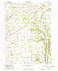
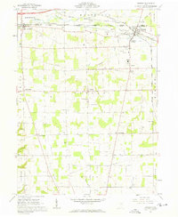
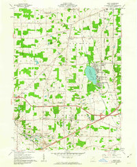
Showing maps 1-25 of 52
Top cities near Harrisville Township
- Brunswick historical maps
- Wooster historical maps
- Medina historical maps
- Ashland historical maps
- Orrville historical maps
- Rittman historical maps
See more
Top neighborhoods of Harrisville Township
Frequently asked questions
- What are the different types of historical maps available for Harrisville Township?
- What is the oldest map of Harrisville Township?
- Where can I purchase historical maps of Harrisville Township for my home or office?
- Where can I download high-res historical maps of Harrisville Township?
- Are there historical topographic maps available for Harrisville Township?
- Is there historical aerial imagery available for Harrisville Township?
- Where are historical maps of Harrisville Township sourced from?