2020s Maps of Monroe County, Ohio
Explore 14 historic maps of Monroe County from the 2020s. These maps offer a rare glimpse into what life looked like during the 2020s — showing old roads, neighborhoods, homes, and landmarks that have changed or disappeared over time.
Whether you're researching your family's past, planning a metal detecting trip, or studying how Monroe County's landscape evolved across the 2020s, these high-resolution maps are a powerful tool for exploring the history of this region.
- Focus on a specific era: All maps on this page are from the 2020s, giving you a focused view of this time period.
- See what’s changed: Compare century-old streets, trails, and buildings to today's modern landscape using overlays and satellite layers.
- Research with precision: Use these maps for genealogy, historical research, land use analysis, or educational projects.
- View, download, or print: Maps are fully viewable online in high resolution, and can be downloaded or printed for your own records.
Start exploring Monroe County's history through authentic maps from the 2020s. This is your window into the past.
Monroe County, OH maps
(14)- 2023 Map of New Matamoras, 2023 Print
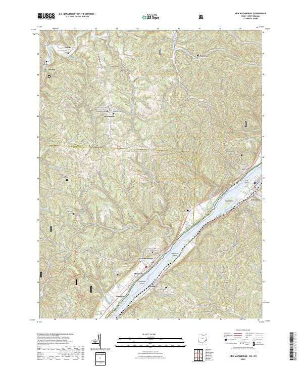 2023 New Matamoras2023 Print · USGSThe Ohio River borderlands are shown here in recent detail, tracing the river's path between the wooded ridges of Monroe County and the West Virginia shoreline. Researchers can locate family landmarks like the Springer Grave, Salem Hall Cem, and the riverfront landing at New Matamoras.
 - 2023 Map of Stafford, 2023 Print
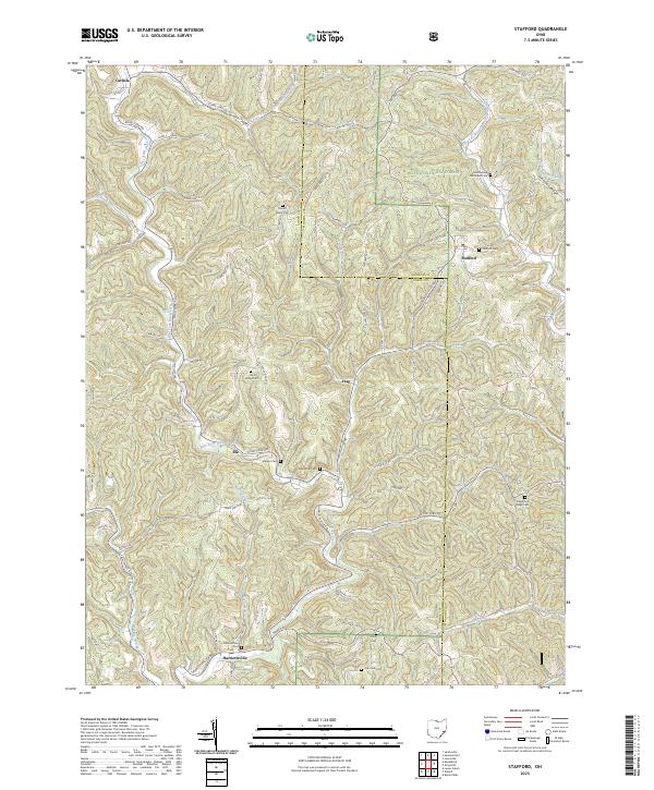 2023 Stafford2023 Print · USGSSoutheast Ohio's ridge-and-valley landscape is documented here in recent years, showing the intersection of Noble and Monroe Counties. Genealogists can locate numerous rural burial sites like Stafford Cem and Harriettsville Cem while tracing historic hamlets such as Elk and Flag.
 - 2023 Map of Woodsfield, 2023 Print
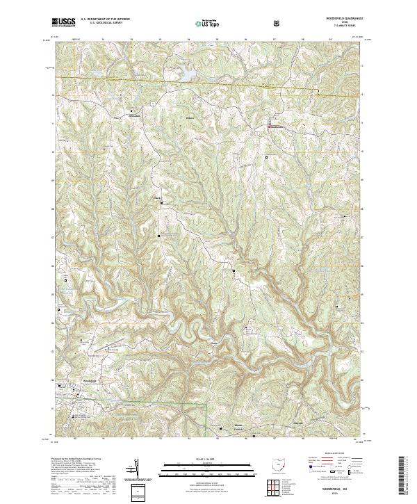 2023 Woodsfield2023 Print · USGSSoutheastern Ohio’s ridgeline settlements and deep creek valleys are captured here in the early twenty-first century. Researchers can locate family sites at Jerusalem Cem or Asbury Chapel Cem and trace the terrain from Mount Carrick to the Wayne National Forest.
 - 2023 Map of Summerfield, 2023 Print
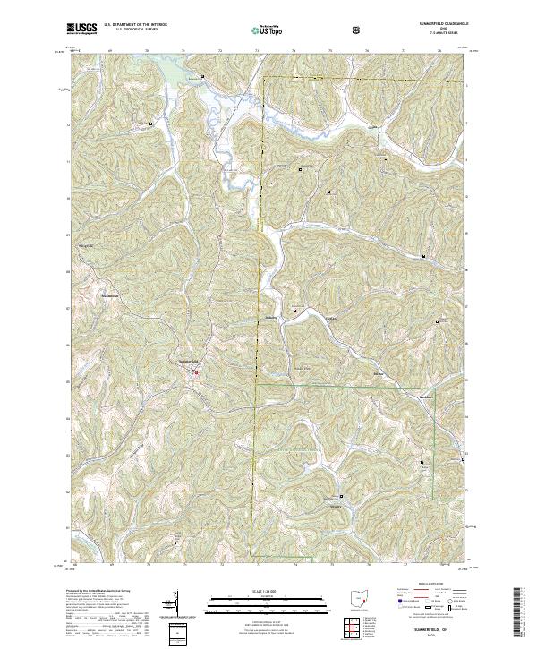 2023 Summerfield2023 Print · USGSThe hill country of Noble and Monroe counties is captured here in the modern era, showing a landscape of deep ridges and rural crossroads. Genealogists can trace family names at the Swazey Methodist Cemetery, Bethesda Cemetery, and the settlement of Summerfield.
 - 2023 Map of Antioch, 2023 Print
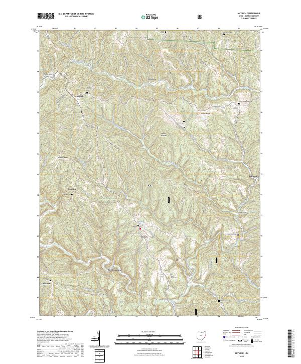 2023 Antioch2023 Print · USGSMonroe County’s rugged hills and narrow valleys are documented here in the early twenty-first century, showing the enduring rural layout of southeastern Ohio. Researchers can trace family history through numerous remote sites like Moffett Methodist Cem, Lentz Cem, and the community of Antioch.
 - 2023 Map of Cameron, 2023 Print
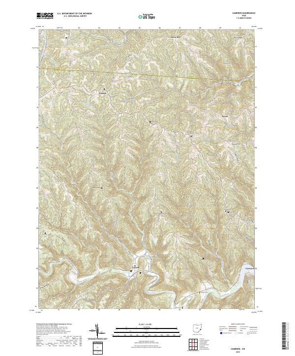 2023 Cameron2023 Print · USGSSoutheast Ohio's ridge-and-hollow country is documented here in the early twenty-first century, showing the enduring rural layout of Monroe County. Genealogists can trace ancestral sites at Zion Methodist Cem, Grandview Cem, and the village of Cameron.
 - 2023 Map of Lewisville, 2023 Print
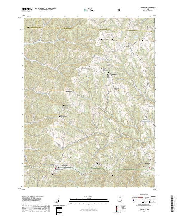 2023 Lewisville2023 Print · USGSMonroe County, Ohio, maintains its rural character in this 2023 survey of the ridge-and-valley landscape near Lewisville. Genealogists and local historians can trace early settlement patterns through numerous sites like Miltonsburg, the Eggar Cem, and Decker.
 - 2023 Map of Dalzell, 2023 Print
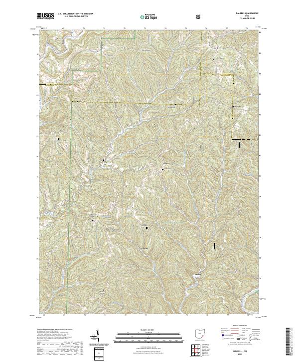 2023 Dalzell2023 Print · USGSWashington County at the start of the 2020s shows a landscape of ridge-top roads and creek-valley settlements. Researchers can locate many local landmarks, including Dalzell Cem, the village of Gasville, and the Scotts Ridge Cem within the Wayne National Forest.
 - 2023 Map of Graysville, 2023 Print
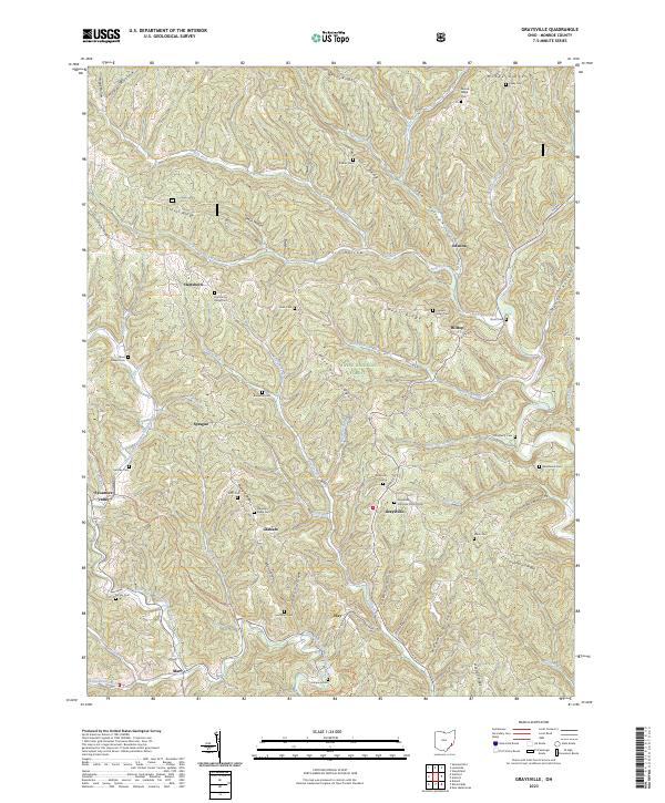 2023 Graysville2023 Print · USGSMonroe County's ridgelines and hollows are captured in this recent survey, showcasing the rural character of Southeast Ohio. Genealogists can trace family names across Conners Ridge Cem, Pleasant Ridge Cem, and the settlement of Graysville.
 - 2023 Map of Rinard Mills, 2023 Print
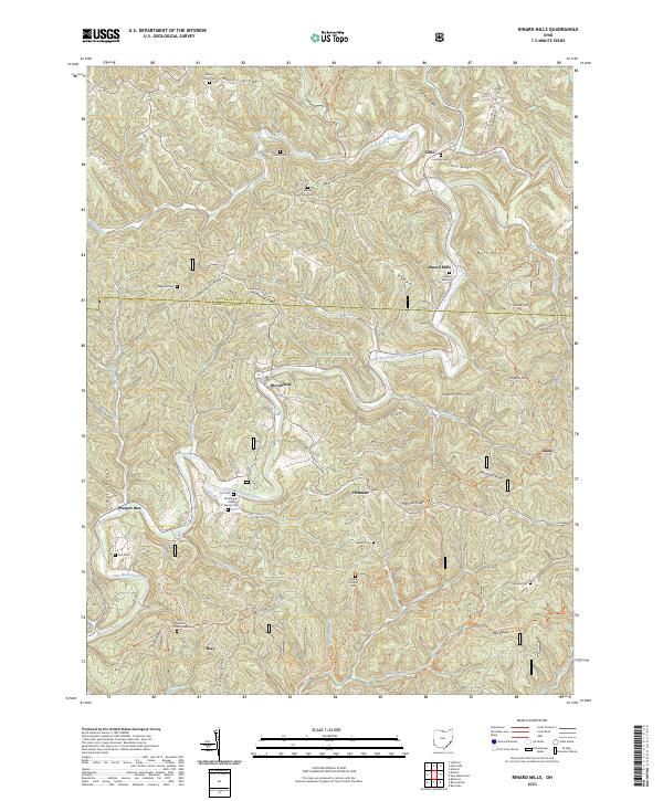 2023 Rinard Mills2023 Print · USGSCrossing the Monroe and Washington County line in southeastern Ohio, this area centers on the winding Little Muskingum River and its rural valley settlements. Genealogists can locate family burial sites like Rinard Mills Cem and Ludlow Catholic Cem or trace the early paths of Shay and Hohman.
 - 2023 Map of Powhatan Point, 2023 Print
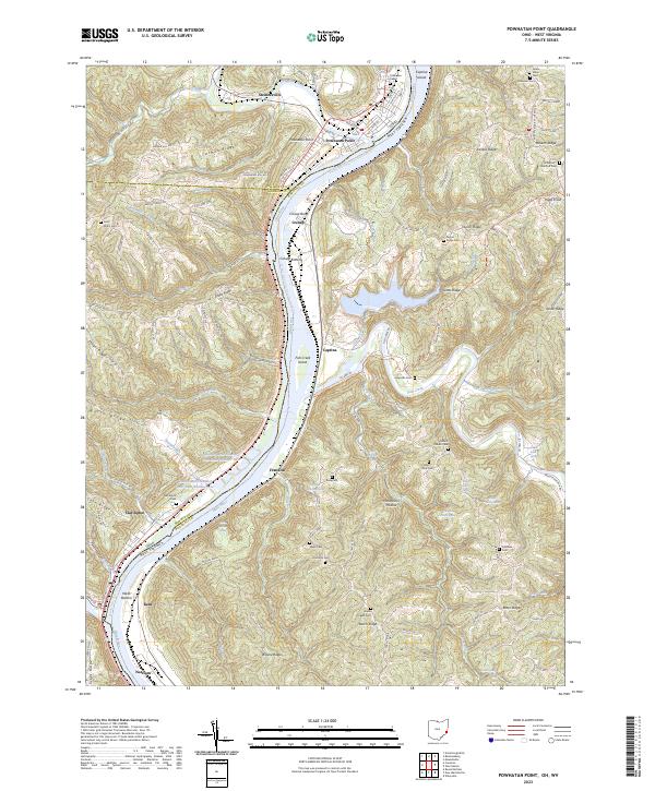 2023 Powhatan Point2023 Print · USGSThe Ohio River borderlands at the turn of the decade reveal a complex landscape of industrial mining and deep-rooted river towns. Researchers can trace historic family burial sites like Saint Johns Cem and Grace Chapel Cem alongside modern operations at Quarto Mine Number Four Dam Number Two.
 - 2023 Map of Paden City, 2023 Print
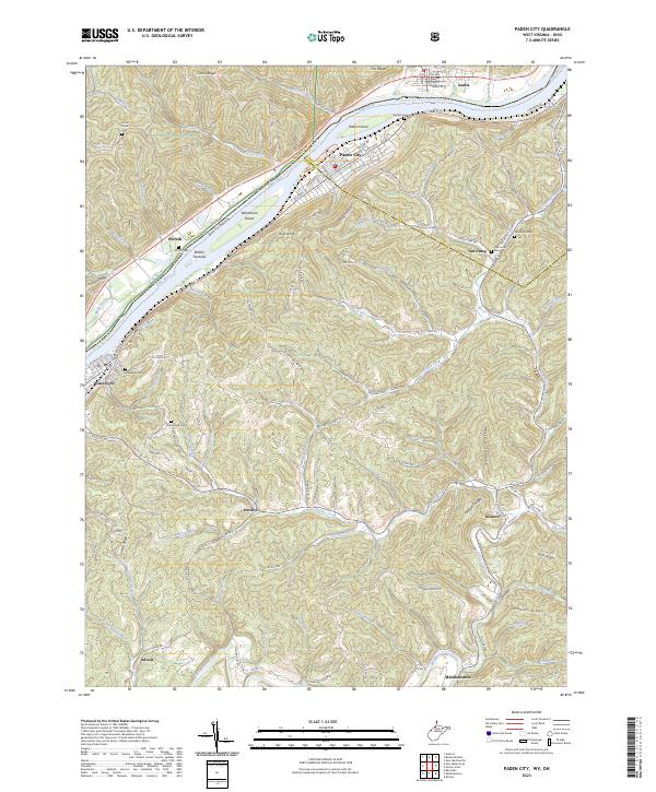 2023 Paden City2023 Print · USGSThe West Virginia and Ohio borderlands along the Ohio River appear in detail on this modern survey. Researchers can trace family history through several burial grounds like Locust Grove Cem and Van Camp Cem or explore the riverfronts of Paden City and Sistersville.
 - 2023 Map of New Martinsville, 2023 Print
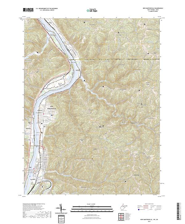 2023 New Martinsville2023 Print · USGSWetzel County, West Virginia, is shown here in its modern configuration where river-bottom settlements meet the high ridges of the Ohio Valley. Genealogists can trace family footprints across dozens of sites like Huff Family Cem, the Wetzel County Courthouse, and the riverfront streets of New Martinsville.
 - 2023 Map of Round Bottom, 2023 Print
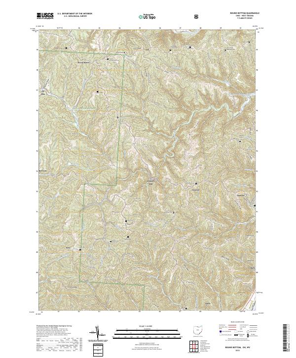 2023 Round Bottom2023 Print · USGSMonroe County, Ohio, remains a landscape of deep ridges and river towns in this modern survey. Genealogists can trace family landmarks like Winklers Mill, Saint Johns Methodist Cem, and McIntire Cem across the high ground above the Ohio River.
End of results
Showing maps 1-14 of 14
Top cities of Monroe County
Frequently asked questions
- What are the different types of historical maps available for Monroe County?
- What is the oldest map of Monroe County?
- Where can I purchase historical maps of Monroe County for my home or office?
- Where can I download high-res historical maps of Monroe County?
- Are there historical topographic maps available for Monroe County?
- Is there historical aerial imagery available for Monroe County?
- Where are historical maps of Monroe County sourced from?