1960s Maps of Monroe County, Ohio
Explore 15 historic maps of Monroe County from the 1960s. These maps offer a rare glimpse into what life looked like during the 1960s — showing old roads, neighborhoods, homes, and landmarks that have changed or disappeared over time.
Whether you're researching your family's past, planning a metal detecting trip, or studying how Monroe County's landscape evolved across the 1960s, these high-resolution maps are a powerful tool for exploring the history of this region.
- Focus on a specific era: All maps on this page are from the 1960s, giving you a focused view of this time period.
- See what’s changed: Compare century-old streets, trails, and buildings to today's modern landscape using overlays and satellite layers.
- Research with precision: Use these maps for genealogy, historical research, land use analysis, or educational projects.
- View, download, or print: Maps are fully viewable online in high resolution, and can be downloaded or printed for your own records.
Start exploring Monroe County's history through authentic maps from the 1960s. This is your window into the past.
Monroe County, OH maps
(15)- 1960 Map of Antioch, 1961 Print
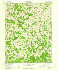
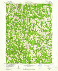 1960 Antioch1961 Print · USGSMonroe County was a landscape of deep timber and winding valley roads in the early sixties. Genealogists and hikers can trace the paths between Antioch, Mechanicsburg, and Fletchers Chapel, or locate old burial sites like Old Otts Cem.4 unique versions available
 - 1960 Map of Powhatan Point, 1961 Print
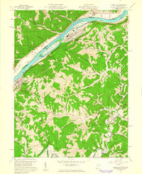
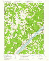
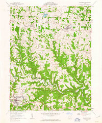
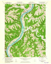 1960 Powhatan Point1961 Print · USGSThe Ohio River valley at the start of the 1960s shows a landscape of industrial growth and rail transit. Trace the river-and-rail economy through Powhatan Point, Natrium, and the facilities at Lock No. 14.5 unique versions available
 - 1960 Map of Rinard Mills, 1961 Print
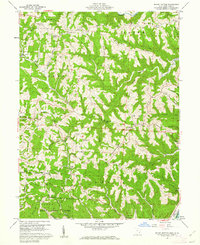
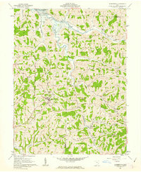
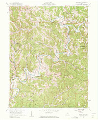 1960 Rinard Mills1961 Print · USGSThe Little Muskingum River valley in the early sixties is shown here as a landscape of timber and ridge-top farming. Genealogists can trace family roots through landmarks like Mt Hope Ch, Rinard Mills, and the Muskingum Valley Ch.3 unique versions available
 - 1960 Map of Graysville, 1961 Print
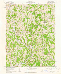
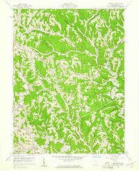 1960 Graysville1961 Print · USGSMonroe County's dissected plateau is shown in the early sixties, a landscape of steep ridges and the Wayne National Forest. Researchers can trace old family holdings through sites like Lamping Cem (Indian Mound) and the Covered Bridge at Sycamore Valley.4 unique versions available
 - 1960 Map of Paden City, 1961 Print
 1960 Paden City1961 Print · USGSThe Ohio River valley thrives in the early sixties as a hub of industry and rail. Genealogists can trace family roots at Kidwell Ch, Stender Cem, and the riverfront communities of Paden City and Sistersville.4 unique versions available
 - 1960 Map of Round Bottom, 1962 Print
 1960 Round Bottom1962 Print · USGSThe Ohio River hills of Monroe County are shown here in the early sixties, a landscape of ridge-top farms and river towns. Researchers can trace family history through sites like Winklers Mill, Emma Grove Cem, and the interior settlement of Round Bottom.4 unique versions available
 - 1960 Map of New Martinsville, 1962 Print
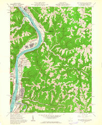 1960 New Martinsville1962 Print · USGSThe industrial and river life of the Ohio Valley is captured here at the start of the 1960s, centered on the growing hub of New Martinsville. Genealogists and historians can trace the B & O rail lines, old schools like Steelton Sch, and numerous family-named landmarks from Wells Bottom to Schupbach Ridge.4 unique versions available
 - 1960 Map of Cameron, 1962 Print
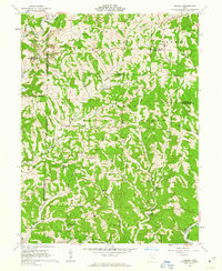
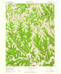 1960 Cameron1962 Print · USGSMonroe County in the early sixties remains a landscape of high ridges and deep hollows where rural life followed the contours of the land. Genealogists and historians can trace family roots at Pugh Cem, find the rural crossroads of Cameron, and locate old landmarks like Zion Ch.4 unique versions available
 - 1960 Map of New Matamoras, 1962 Print
 1960 New Matamoras1962 Print · USGSThe Ohio River valley was a thriving industrial and transport corridor in the early sixties, anchored by the riverfront centers of Sistersville and New Matamoras. Trace the old Baltimore and Ohio rail line, find ridge-top settlements like Jericho, or locate rural landmarks like Friendly Ch.4 unique versions available
 - 1961 Map of Clarksburg
 1961 Clarksburg1961 Print · USGSThe mid-century industrial and river landscapes of West Virginia and Ohio are detailed here, centered on the Ohio River. Researchers can trace the Baltimore and Ohio rail lines connecting towns like Parkersburg, Clarksburg, and Monongah.
 - 1961 Map of Summerfield, 1963 Print
 1961 Summerfield1963 Print · USGSSoutheast Ohio's hill country in the early sixties reveals a landscape of ridge-top farms and emerging energy infrastructure. Researchers can trace family roots at Seneca Valley Church or find legacy settlements like Whigville and Summerfield near the Senecaville Reservoir.2 unique versions available
 - 1961 Map of Stafford, 1963 Print
 1961 Stafford1963 Print · USGSSoutheastern Ohio's ridge-and-valley landscape is captured here in the early sixties, showing the rural communities of Stafford and Harriettsville. Researchers can locate several remote churches and cemeteries, such as Zion Ch, Stewart Cem, and Mt Tabor Ch.3 unique versions available
 - 1961 Map of Dalzell, 1963 Print
 1961 Dalzell1963 Print · USGSSoutheast Ohio’s rural landscape is captured here in the early sixties, showing the deeply etched valleys of the Wayne National Forest. Researchers can locate several country congregations and small settlements like Lebanon, Masterton, and Gasville.4 unique versions available
 - 1961 Map of Lewisville, 1963 Print
 1961 Lewisville1963 Print · USGSMonroe County enters the 1960s as a landscape of hilltop farms and emerging energy infrastructure. Genealogists and local historians can trace the locations of numerous family burial sites like the Free Burial Ground and rural centers such as Miltonsburg or Monroefield.2 unique versions available
 - 1961 Map of Woodsfield, 1963 Print
 1961 Woodsfield1963 Print · USGSMonroe County's ridgelands and valleys come into focus in the early sixties, showing a landscape of small farms and gas wells. Genealogists can locate family landmarks like Pioneer Cem, Asbury Chapel, and the village of Beallsville.3 unique versions available
End of results
Showing maps 1-15 of 15
Top cities of Monroe County
Frequently asked questions
- What are the different types of historical maps available for Monroe County?
- What is the oldest map of Monroe County?
- Where can I purchase historical maps of Monroe County for my home or office?
- Where can I download high-res historical maps of Monroe County?
- Are there historical topographic maps available for Monroe County?
- Is there historical aerial imagery available for Monroe County?
- Where are historical maps of Monroe County sourced from?