Old Maps of Waverly Place, Waverly
Explore 31 old maps of Waverly Place, spanning from 1906 to today. These high-resolution historic maps reveal how streets, neighborhoods, landmarks, and natural features evolved over time — perfect for genealogy, metal detecting, research, and local history exploration.
What you can do with these maps:
- See how Waverly Place changed over time: Compare historical maps to modern-day views to trace roads, homesites, rail lines & more.
- View detailed metadata: Each map includes creators, publishers, year, scale, and archive source.
- Overlay maps with satellite & LiDAR: Visualize the past alongside modern tools to explore terrain & human change.
- Trusted historical sources: Maps sourced from the USGS, Library of Congress, and other archives.
- Access maps your way: View online, download high-res files, or order prints for personal or research use.
Start exploring old maps of Waverly Place to uncover forgotten places, hidden landmarks, and the deep history beneath your feet.
Waverly Place, Waverly maps
(31)- 1906 Map of Waverly
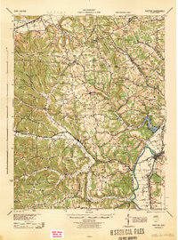
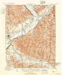 1906 Waverly1906 Print · USGSSouthern Ohio at the turn of the century shows a bustling corridor of river valleys and rail junctions centered on Waverly. Genealogists and historians can trace defunct post offices like Stony Creek Sta Pride PO and rural landmarks like Lilly Chapel or Cars Run School.
 - 1908 Map of Waverly, 1944 Print
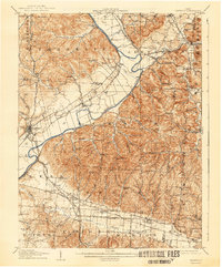 1908 Waverly1944 Print · USGSThe Scioto River valley at the start of the twentieth century was a vital crossroads of five competing railroads. Local historians can trace early mail stops like Robbins Dove PO and rural landmarks such as Lily Chapel or Meadow Run Church.
 - 1915 Map of Piketon, 1959 Print
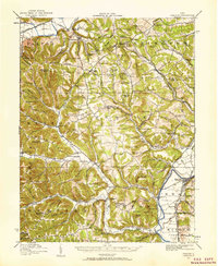 1915 Piketon1959 Print · USGSPike and Ross Counties are shown in the mid-1910s during a height of rural settlement and local industry. Genealogists can locate dozens of country schoolhouses like Yankee Hill School and vanished post offices such as Bethel Pike PO.
 - 1917 Map of Piketon, 1934 Print
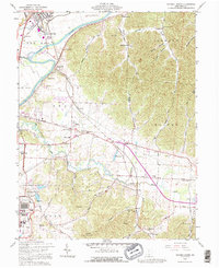
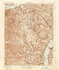 1917 Piketon1934 Print · USGSThe Scioto River valley and its surrounding hill country are captured here during the first World War era, showing a landscape of small farmsteads and ancient earthworks. Genealogists can trace family roots through dozens of named rural landmarks like Seip Mound, Bethel Pike PO, and Mound Cemetery.2 unique versions available
 - 1944 Map of Piketon
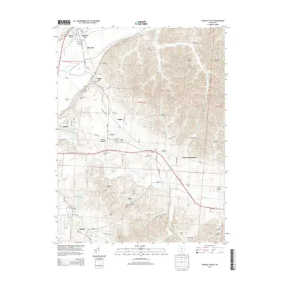
 1944 Piketon1944 Print · USGSSouthern Ohio's hill country meets the Scioto River valley in the mid-1940s, a landscape defined by ancient earthworks and rugged ridge-top schoolhouses. Researchers can locate family landmarks like the County Home, trace the Norfolk and Western RR, or find vanished community hubs like Bethel Pike PO and Morgantown.
 - 1947 Map of Columbus, 1948 Print
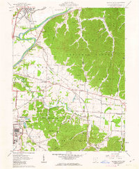
 1947 Columbus1948 Print · USGSCentral Ohio in the late 1940s is captured in this survey, showing the post-war transition of its rail hubs and military airfield expansions. Genealogists and historians can trace the paths of the Ohio Canal, the Pennsylvania RR lines, and the Camp Sherman Military Reservation.
 - 1961 Map of Columbus
 1961 Columbus1961 Print · USGSCentral and Southern Ohio are captured here in the early sixties, as the region's industrial rail hubs and military bases reached their peak. Genealogists and historians can trace the transition from urban Columbus to rural townships along the Scioto River, locating Lockbourne USAF and old junctions like Washington Court House.
 - 1961 Map of Summithill, 1962 Print
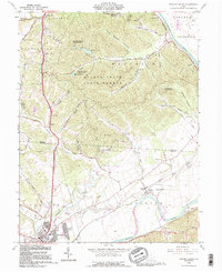
 1961 Summithill1962 Print · USGSSoutheastern Ohio at the start of the sixties reveals a landscape of high ridges and deep creek valleys along the Ross and Pike county line. Genealogists and historians can locate remote burial grounds like Yankee Hill Cem and old landmarks including Mary Chapel and the Township Sch.3 unique versions available
 - 1961 Map of Waverly South, 1963 Print
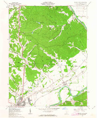
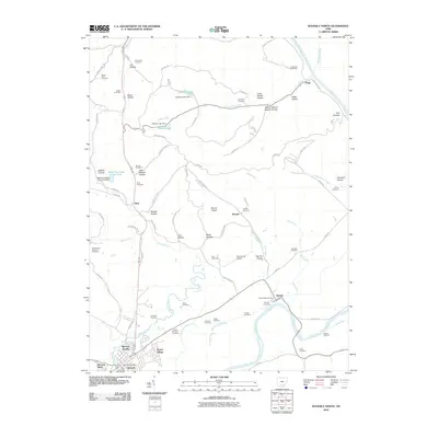
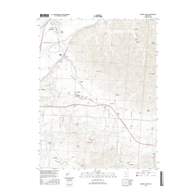
 1961 Waverly South1963 Print · USGSThe Scioto River valley in the early sixties is a landscape of federal utility and rural tradition, featuring the sprawling Atomic Energy Commission reservation alongside the Wayne National Forest. Researchers can trace family history through local landmarks like Piketon Sch, Hamman Ch, and the many small burial grounds including Evergreen Cem.4 unique versions available
 - 1961 Map of Waverly North, 1963 Print
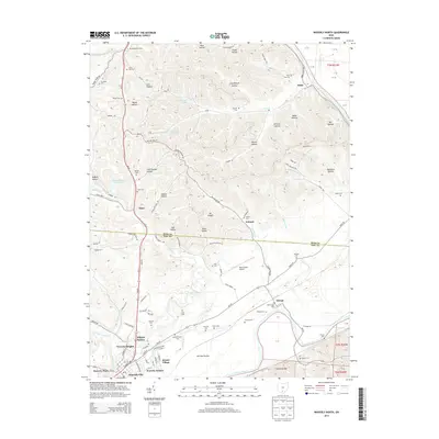
 1961 Waverly North1963 Print · USGSThe Scioto River valley and the southern reaches of the state forest are captured here in the early sixties. Genealogists and local historians can locate several family burial grounds including Hatfield Cem and Foster Cem, alongside the early layout of Bristol Village.4 unique versions available
 - 1962 Map of Columbus
 1962 Columbus1962 Print · USGSCentral Ohio during the early sixties reveals a transition from the industrial corridors of Columbus to the forested ridges of the south. Genealogists and historians can trace the rail networks of the Baltimore & Ohio RR and find local landmarks like Washington Court House and Camp Sherman Military Reservation.
 - 1967 Map of Columbus, 1969 Print
 1967 Columbus1969 Print · USGSCentral Ohio during the late sixties serves as a vital corridor of rail and aviation, from the industrial streets of Springfield to the hangar lines of Lockbourne Air Force Base. Genealogists and researchers can trace the growth of towns like Circleville and London or locate rural landmarks such as St Paul church and the London Correctional Institution.2 unique versions available
 - 1980 Map of Wellston, 1982 Print
 1980 Wellston1982 Print · USGSThe hill country of south-central Ohio in the early eighties shows a landscape of expansive state forests and deep-rooted river towns. Genealogists and historians can trace rural heritage through sites like Buckeye Furnace State Memorial and Mount Zion Cemetery.
 - 1986 Map of Hillsboro
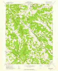
 1986 Hillsboro1986 Print · USGSThe rural landscapes of Highland and Clinton counties appear in the mid-eighties as a busy corridor of railroads and regional airports. Genealogists and historians can trace old community centers like Reesville and Starbucktown alongside significant landmarks like Wilmington College and Fort Hill State Memorial.2 unique versions available
 - 1992 Map of Waverly South, 1995 Print
 1992 Waverly South1995 Print · USGSPike County's river-bottom farms and heavy industry are captured here in the early nineties, centered on the Scioto valley. Researchers can trace family history through dozens of rural sites like Evergreen Cem, Zahns Corners, and the historic Piketon Sch.
 - 1992 Map of Waverly North, 1995 Print
 1992 Waverly North1995 Print · USGSThe Scioto River valley comes alive in this early 1990s record of the Ross and Pike County borderlands. Researchers can trace the path of the Erie Canal (Abandoned) or locate family burial grounds like Sugar Tree Cem and Corwine Cem.
 - 2010 Map of Waverly South, 2010 Print
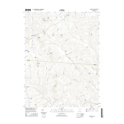
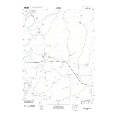 2010 Waverly South2010 Print · USGSCovers Waverly Place, including Waverly, Piketon, and other nearby areas
 - 2010 Map of Summithill, 2010 Print
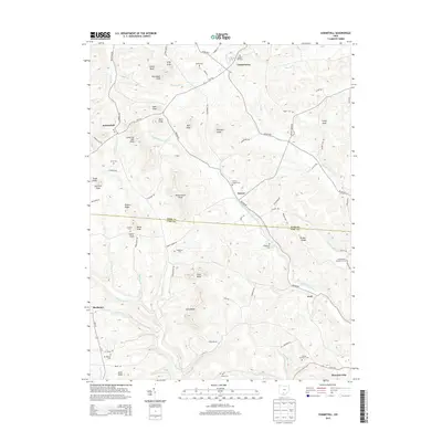
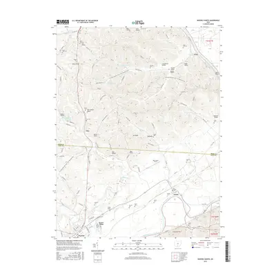
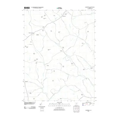 2010 Summithill2010 Print · USGSCovers Waverly Place, including Waverly, Buchanan, and other nearby areas
 - 2010 Map of Waverly North, 2010 Print
 2010 Waverly North2010 Print · USGSCovers Waverly Place, including Waverly, Pee Pee Township, and other nearby areas
 - 2013 Map of Waverly North, 2013 Print
 2013 Waverly North2013 Print · USGSCovers Waverly Place, including Waverly, Pee Pee Township, and other nearby areas
 - 2013 Map of Waverly South, 2013 Print
 2013 Waverly South2013 Print · USGSCovers Waverly Place, including Waverly, Piketon, and other nearby areas
 - 2013 Map of Summithill, 2013 Print
 2013 Summithill2013 Print · USGSCovers Waverly Place, including Waverly, Buchanan, and other nearby areas
 - 2016 Map of Summithill, 2016 Print
 2016 Summithill2016 Print · USGSCovers Waverly Place, including Waverly, Buchanan, and other nearby areas
 - 2016 Map of Waverly South, 2016 Print
 2016 Waverly South2016 Print · USGSCovers Waverly Place, including Waverly, Piketon, and other nearby areas
 - 2016 Map of Waverly North, 2016 Print
 2016 Waverly North2016 Print · USGSCovers Waverly Place, including Waverly, Pee Pee Township, and other nearby areas
Showing maps 1-25 of 31
Frequently asked questions
- What are the different types of historical maps available for Waverly Place?
- What is the oldest map of Waverly Place?
- Where can I purchase historical maps of Waverly Place for my home or office?
- Where can I download high-res historical maps of Waverly Place?
- Are there historical topographic maps available for Waverly Place?
- Is there historical aerial imagery available for Waverly Place?
- Where are historical maps of Waverly Place sourced from?