Old Maps of Fremont, Ohio for Academic Research
Study the evolution of Fremont with 33 high-resolution historic maps. Whether you're teaching, researching, or modeling changes in land use, these maps provide essential visual documentation of urban, environmental, and geographic change.
- Analyze long-term change: Track patterns in development, transportation, and natural features.
- Ideal for environmental or urban studies: Support academic projects with primary historical map data.
- Use in the classroom or lab: Educators and researchers rely on these maps to bring historical context to life.
These maps are a powerful tool for teaching, research, and visualizing how Fremont has changed over the decades.
Fremont, OH maps
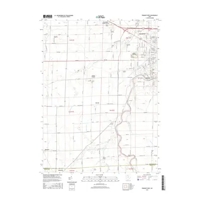
(33)- 1901 Map of Fremont, 1961 Print
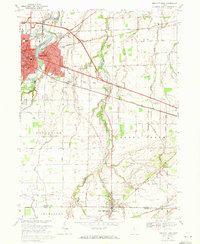
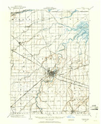 1901 Fremont1961 Print · USGSSandusky County at the dawn of the twentieth century is a bustling corridor of steam and electric rail lines. Trace the industrial footprint of Fremont and locate vanished rural junctions like Kingsway, Havens, and the Seneca Indian Reservation.
 - 1903 Map of Fremont, 1934 Print
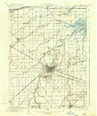 1903 Fremont1934 Print · USGSNorthwest Ohio at the turn of the century was a bustling intersection of heavy rail and river commerce centered on the Sandusky River. Researchers can trace the early footprints of Fremont and Green Spring or locate smaller stops along the Wheeling and Lake Erie and the electric line to Ballville.2 unique versions available
 - 1956 Map of Toledo, 1968 Print
 1956 Toledo1968 Print · USGSNorthwest Ohio and the Lake Erie shoreline are shown in detail during the late fifties, showcasing a landscape of heavy industry, railroads, and island communities. Genealogists and historians can trace rail networks like the Chesapeake & Ohio RR or locate landmarks such as the Erie Proving Ground and Kelleys Island.4 unique versions available
 - 1957 Map of Lindsey, 1960 Print
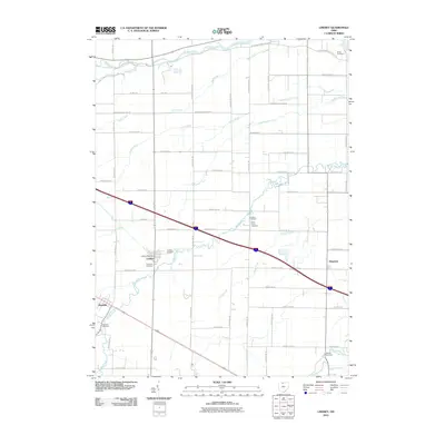
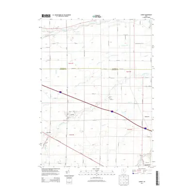
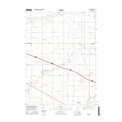
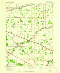 1957 Lindsey1960 Print · USGSNorthwest Ohio's agricultural heartland is captured in the late fifties, just as the turnpike began to reshape the rural landscape of Sandusky and Ottawa counties. Researchers can trace family-named crossroads and landmarks like Lindsey, Kingsway, and the Township Sch along the New York Central Line.
 - 1957 Map of Wightmans Grove, 1960 Print
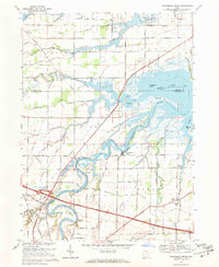
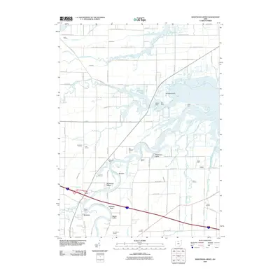
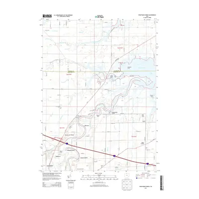
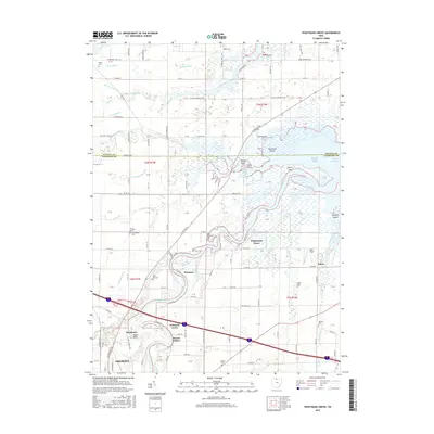
 1957 Wightmans Grove1960 Print · USGSCoastal Sandusky County near Muddy Creek Bay comes into focus during the late fifties as the turnpike first cut through the landscape. Researchers can locate vanished landmarks like Booktown, Shannon, and Township Sch alongside the bend of the Sandusky River.
 - 1958 Map of Fremont West, 1960 Print
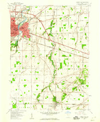
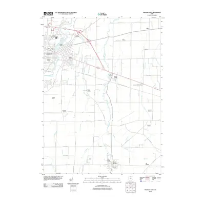
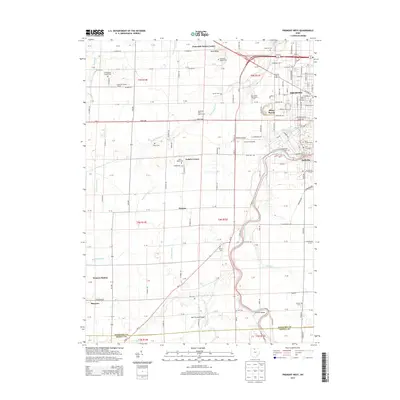
 1958 Fremont West1960 Print · USGSThe western outskirts of Fremont and the Sandusky River valley are documented here in the late fifties, showcasing a landscape of active oil fields and river crossings. Researchers can trace family history through several rural burial grounds like Hite Cem or locate the Mull Covered Bridge and St Marys Ch.
 - 1958 Map of Fremont East, 1960 Print
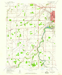
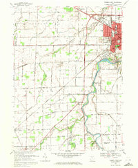
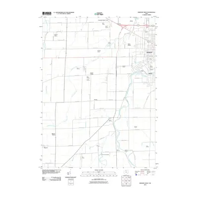
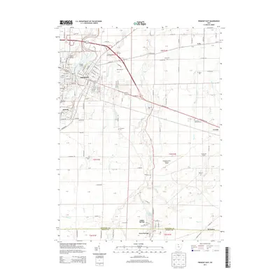
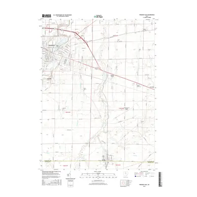
 1958 Fremont East1960 Print · USGSThe Sandusky River valley and the city of Fremont are captured in the late fifties as they grow alongside major rail and highway corridors. Genealogists can locate family landmarks like McGormley Cemetery, the St Francis of Oak Ridge Hospital, and the Old Indian Treaty Boundary.
 - 1961 Map of Toledo
 1961 Toledo1961 Print · USGSThe western basin of Lake Erie and the industrial heart of Northern Ohio are captured here during the post-war era. Researchers can trace historical rail lines like the New York Central or locate landmarks like the Erie Ordnance Depot and Pelee Island.
 - 1969 Map of Wightmans Grove, 1971 Print
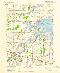
 1969 Wightmans Grove1971 Print · USGSThe Sandusky River delta and the marshes of Ottawa and Sandusky counties are captured here in the late sixties. Trace family history and rural change through sites like Riley Center, Brier Hill Cem, and the riverfront at Wightmans Grove.2 unique versions available
 - 1969 Map of Fremont West, 1971 Print
 1969 Fremont West1971 Print · USGSNorthwest Ohio at the end of the sixties shows a fascinating mix of industrial growth and frontier-era heritage. Genealogists and historians can locate numerous rural burial grounds like St Marys Cem or trace the Indian Treaty Boundary near the Mull Covered Bridge.2 unique versions available
 - 1969 Map of Lindsey, 1971 Print
 1969 Lindsey1971 Print · USGSLindsey and the surrounding Sandusky County farmlands are captured in the late sixties as modern highways began to reshape the rural landscape. Researchers can trace family sites at Roose Cem, visit Bethel Ch, or follow the old Penn Central rail line through Hessville.
 - 1969 Map of Fremont East, 1971 Print
 1969 Fremont East1971 Print · USGSThe Sandusky River valley in the late 1960s reveals a landscape shaped by historical boundaries and industrial growth. Researchers can trace the Old Indian Treaty Boundary, explore family lineage at Beeler Cem, or locate the St Francis of Oak Ridge Hospital.2 unique versions available
 - 1986 Map of Findlay
 1986 Findlay1986 Print · USGSNorthwest Ohio's industrial and agricultural heartland is documented here in the mid-1980s, centered on the major hubs of Findlay, Fostoria, and Tiffin. Researchers can trace the intersections of the BALTIMORE AND OHIO railroad and family sites near Greenlawn Cem or Sagar Ridge.2 unique versions available
 - 2010 Map of Wightmans Grove, 2010 Print
 2010 Wightmans Grove2010 Print · USGSCovers Fremont, including Upton, Muncie Hollow, and other nearby areas
 - 2010 Map of Fremont West, 2010 Print
 2010 Fremont West2010 Print · USGSCovers Fremont, including Ballville, Bettsville, and other nearby areas
 - 2010 Map of Fremont East, 2010 Print
 2010 Fremont East2010 Print · USGSCovers Fremont, including Green Creek, Clyde, and other nearby areas
 - 2010 Map of Lindsey, 2010 Print
 2010 Lindsey2010 Print · USGSCovers Fremont, including Lindsey, Hessville, and other nearby areas
 - 2013 Map of Wightmans Grove, 2013 Print
 2013 Wightmans Grove2013 Print · USGSCovers Fremont, including Upton, Muncie Hollow, and other nearby areas
 - 2013 Map of Fremont West, 2013 Print
 2013 Fremont West2013 Print · USGSCovers Fremont, including Ballville, Bettsville, and other nearby areas
 - 2013 Map of Fremont East, 2013 Print
 2013 Fremont East2013 Print · USGSCovers Fremont, including Green Creek, Clyde, and other nearby areas
 - 2013 Map of Lindsey, 2013 Print
 2013 Lindsey2013 Print · USGSCovers Fremont, including Lindsey, Hessville, and other nearby areas
 - 2016 Map of Lindsey, 2016 Print
 2016 Lindsey2016 Print · USGSCovers Fremont, including Lindsey, Hessville, and other nearby areas
 - 2016 Map of Fremont East, 2016 Print
 2016 Fremont East2016 Print · USGSCovers Fremont, including Green Creek, Clyde, and other nearby areas
 - 2016 Map of Wightmans Grove, 2016 Print
 2016 Wightmans Grove2016 Print · USGSCovers Fremont, including Upton, Muncie Hollow, and other nearby areas
 - 2016 Map of Fremont West, 2016 Print
 2016 Fremont West2016 Print · USGSCovers Fremont, including Ballville, Bettsville, and other nearby areas
Showing maps 1-25 of 33
Top cities near Fremont
- Tiffin historical maps
- Green Creek historical maps
- Ballville historical maps
- Clyde historical maps
- Port Clinton historical maps
- Oak Harbor historical maps
See more
Top neighborhoods of Fremont
Frequently asked questions
- What are the different types of historical maps available for Fremont?
- What is the oldest map of Fremont?
- Where can I purchase historical maps of Fremont for my home or office?
- Where can I download high-res historical maps of Fremont?
- Are there historical topographic maps available for Fremont?
- Is there historical aerial imagery available for Fremont?
- Where are historical maps of Fremont sourced from?