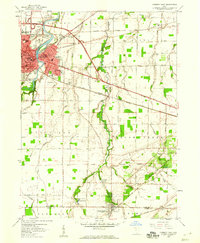
1958 Map of Fremont East
USGS Topo · Published 1960About this map
Fremont sits at a geographic crossroads in the late 1950s, anchored by the Sandusky River and a dense network of transportation lines. The map reveals the city's mid-century footprint, including institutional landmarks like the Army Reserve Training Center and Atkinson School. To the southeast, the village of Green Springs is defined by the St Francis of Oak Ridge Hospital and the nearby Green Springs State Nursery. The rural landscape between these hubs is bisected by the New York Chicago and St Louis railroad and the General Mc Pherson Highway. A notable historical detail is the Old Indian Treaty Boundary, which cuts diagonally across the townships of Ballville and Green Creek, marking an earlier era of territorial division. Numerous family-named burial grounds, such as Mt Lebanon Cemetery and Schoch Cemetery, are scattered throughout the agricultural landscape.
Find a feature on this map
57 named features on this map. Tap any name to fly to it.
Don’t see what you’re looking for? This feature index may not catch every label — zoom into the map to look around manually.
Map Details
Editions of this 1958 Fremont East Map
This is the sole edition of this map. No revisions or reprints were ever made.
Other maps of this area

1901 · Bellevue
USGS Topo · 1:62,500

1901 · Fremont
USGS Topo · 1:62,500

1903 · Bellevue
USGS Topo · 1:62,500

1903 · Fremont
USGS Topo · 1:62,500

1906 · Tiffin
USGS Topo · 1:62,500

1915 · Siam
USGS Topo · 1:62,500

1956 · Toledo
USGS Topo · 1:250,000
1957 · Lindsey
USGS Topo · 1:24,000

1957 · Vickery
USGS Topo · 1:24,000
1957 · Wightmans Grove
USGS Topo · 1:24,000