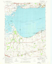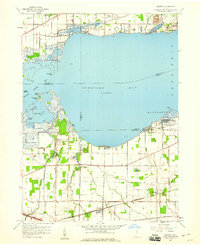
1957 Map of Vickery
USGS Topo · Published 1960About this map
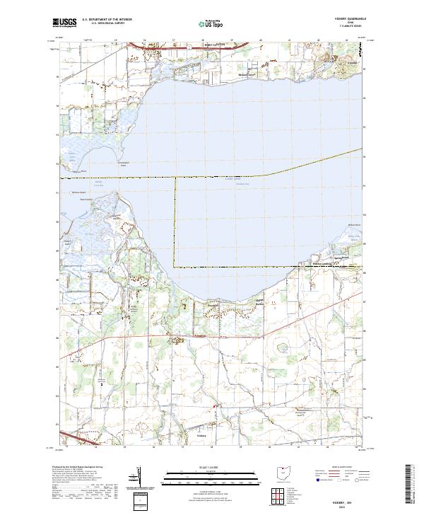
The southern shoreline of Sandusky Bay is defined by a complex network of wetlands and tidal features, including The Bogs and several islands such as Hickory Island and Graveyard Island. This late-1950s landscape shows a transition from the marshy edges of Lake Erie to the established agricultural and industrial zones of Sandusky and Erie counties. Inland, the community of Vickery serves as a local hub near the Chicago and St Louis Road, while the lakefront supports specialized activities at the Ohio Agricultural Experimental Station and a large Quarry near Gypsum. Small settlements like Whites Landing and Bayshore dot the coast, connected by rural routes such as Wahl Road and Plasterbed Road. Notable local landmarks like the Township Sch and Riley Grange highlight the social and educational centers of this mid-century Ohio farming and coastal region.
Find a feature on this map
48 named features on this map. Tap any name to fly to it.
Don’t see what you’re looking for? This feature index may not catch every label — zoom into the map to look around manually.
Map Details
Editions of this 1957 Vickery Map
This is the sole edition of this map. No revisions or reprints were ever made.
Historical Maps of Port Clinton Through Time
7 maps found