1970s Maps of Beaver County, Oklahoma
Explore 42 historic maps of Beaver County from the 1970s. These maps offer a rare glimpse into what life looked like during the 1970s — showing old roads, neighborhoods, homes, and landmarks that have changed or disappeared over time.
Whether you're researching your family's past, planning a metal detecting trip, or studying how Beaver County's landscape evolved across the 1970s, these high-resolution maps are a powerful tool for exploring the history of this region.
- Focus on a specific era: All maps on this page are from the 1970s, giving you a focused view of this time period.
- See what’s changed: Compare century-old streets, trails, and buildings to today's modern landscape using overlays and satellite layers.
- Research with precision: Use these maps for genealogy, historical research, land use analysis, or educational projects.
- View, download, or print: Maps are fully viewable online in high resolution, and can be downloaded or printed for your own records.
Start exploring Beaver County's history through authentic maps from the 1970s. This is your window into the past.
Beaver County, OK maps
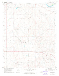
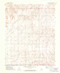
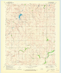
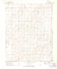
(42)- 1970 Map of Knowles, 1972 Print
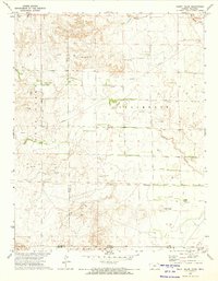
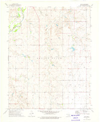
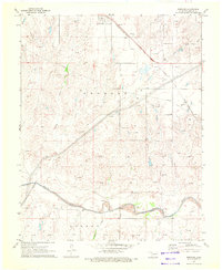 1970 Knowles1972 Print · USGSKnowles and the surrounding High Plains of Beaver County are captured here during the height of the region's energy production in the early seventies. Genealogists and historians can trace the Missouri-Kansas-Texas railroad corridor and the network of Gas Wells that dotted the landscape near the Beaver River.
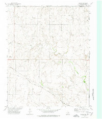
 - 1970 Map of Gate, 1972 Print
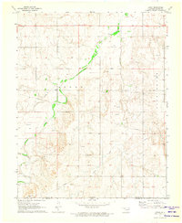
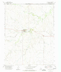
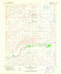 1970 Gate1972 Print · USGSThe Oklahoma panhandle town of Gate is captured here during its mid-century energy boom. Researchers can trace the Missouri-Kansas-Texas rail line and locate rural landmarks like Zelma Cem, Cline Cem, and Gate Lake.
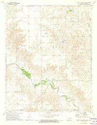
 - 1970 Map of Gate NE, 1972 Print
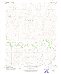
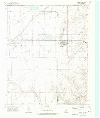
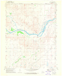 1970 Gate NE1972 Print · USGSBeaver County is captured in the early seventies, showing a landscape defined by the winding Cimarron River and increasing energy infrastructure. Researchers can locate Gate Cem and trace water history via the Old Settlers Irrigation Ditch.
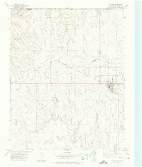
 - 1970 Map of Gate NW, 1973 Print
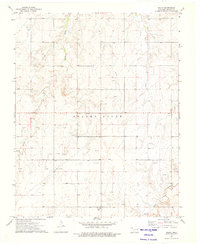
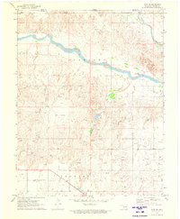 1970 Gate NW1973 Print · USGSThe Oklahoma panhandle and Kansas border come alive in 1970, showing a landscape of river bends and rail lines. Genealogists and researchers can locate the town of Knowles, the Knowles Cem, and the path of the Missouri-Kansas-Texas railroad.
 - 1970 Map of Mocane NW, 1973 Print
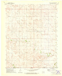
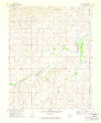
 1970 Mocane NW1973 Print · USGSBeaver County is shown here in the early seventies, dominated by the energy industry and the rail corridor. Researchers can trace the path of the Missouri - Kansas - Texas railroad and locate industrial sites like the Gas Plant and Sandpit.
 - 1970 Map of Mocane SE, 1973 Print
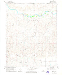
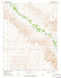
 1970 Mocane SE1973 Print · USGSThe Oklahoma Panhandle in the early seventies shows a landscape defined by the Beaver River and the expanding natural gas industry. Local historians can trace the network of pipelines and gas wells alongside natural landmarks like Duck Pond Creek.
 - 1970 Map of Mocane, 1973 Print
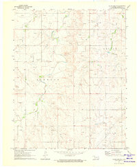
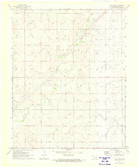
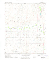
 1970 Mocane1973 Print · USGSBeaver County, Oklahoma, is shown in the early 1970s as an active center for the regional energy and rail industries. Researchers can trace the path of the Missouri-Kansas-Texas railroad through Mocane or locate numerous Gas Wells and a riverfront Landing Strip.
 - 1971 Map of Clear Lake NW, 1973 Print
 1971 Clear Lake NW1973 Print · USGSBeaver County, Oklahoma, is shown during a period of significant energy production in the early seventies. Genealogists and historians can trace the intersection of section lines and watercourses like Clear Creek and Duck Pond Creek alongside numerous Gas Wells.
 - 1971 Map of Clear Lake SW, 1973 Print
 1971 Clear Lake SW1973 Print · USGSBeaver County and the Oklahoma Panhandle are shown at the height of the early 1970s energy boom. Genealogists and local historians can trace rural school sites like Garrett Sch and family burial grounds at Baker Cem or Sophia Cem.2 unique versions available
 - 1971 Map of Clear Lake, 1973 Print
 1971 Clear Lake1973 Print · USGSIn the early 1970s, the Oklahoma Panhandle in Beaver County was a hub of energy production and ranching. Genealogists and historians can trace industrial footprints through numerous Gas Wells and landmarks like Clear Lake and the Landing Strip.
 - 1971 Map of Clear Lake SE, 1973 Print
 1971 Clear Lake SE1973 Print · USGSBeaver County energy development was in full swing during the early 1970s, as shown by this detailed survey of the Oklahoma panhandle. Researchers can trace the extensive Logan Oil and Gas Field and find scattered landmarks like Midway and Coon Creek.
 - 1971 Map of Logan, 1973 Print
 1971 Logan1973 Print · USGSThe Oklahoma-Texas borderlands in the early seventies reveal a landscape transitioning from ranching to an energy-driven economy. Researchers can trace the Logan Gas Field infrastructure and local landmarks like Kiowa Cemetery and Indian Hill.
 - 1971 Map of Logan NW, 1973 Print
 1971 Logan NW1973 Print · USGSThe Oklahoma Panhandle in the early seventies reveals a landscape of energy extraction and remote rural life. Trace local history through Highland Chapel, Clear Lake Cem, and the waters of Evans Chambers Lake.2 unique versions available
 - 1971 Map of Kismet SW, 1973 Print
 1971 Kismet SW1973 Print · USGSSeward County, Kansas, is captured in the early 1970s as an active energy landscape centered on the Cimarron River. Researchers can trace old family burial sites at Bixler Cem and locate the numerous Oil Wells that defined the local economy.
 - 1971 Map of Mocane SW, 1973 Print
 1971 Mocane SW1973 Print · USGSBeaver County in the early seventies shows a landscape defined by the winding Beaver River and a growing energy economy. Researchers can trace numerous family-named natural gas sites, a major Pipeline, and rural landmarks like Spring Creek and Clear Creek.
 - 1971 Map of Logan NE, 1973 Print
 1971 Logan NE1973 Print · USGSBeaver County is captured in the early 1970s as the regional energy sector and ranching life intertwined. Genealogists and historians can locate Madison Cem, Fairview Cem, and the industry at the Pumping Station near Kiowa Creek.
 - 1971 Map of Slapout, 1973 Print
 1971 Slapout1973 Print · USGSThe Oklahoma Panhandle near Slapout is documented in the early seventies during a period of significant energy development. Local historians can trace family ties at Poplar Grove Cem and Fairview Ch or map the growth of natural gas infrastructure through dozens of Gas Wells.
 - 1972 Map of Magoun, 1974 Print
 1972 Magoun1974 Print · USGSThe High Plains borderlands of Texas and Oklahoma are captured here in the early 1970s, as energy production and rail transit defined the local economy. Researchers can locate Fairmont Cem, trace the ATCHISON TOPEKA AND SANTA FE railroad, and find the small settlement at Magoun.
 - 1972 Map of Proffitt Lake SW, 1974 Print
 1972 Proffitt Lake SW1974 Print · USGSThe Kansas-Oklahoma border country comes into focus in the early 1970s as energy production and ranching define the landscape. Trace family history at Little Congregational Cem or follow the winding course of Crooked Creek past a remote Painter Landing Strip.
 - 1972 Map of Follett, 1974 Print
 1972 Follett1974 Print · USGSFollett and the northeastern Texas Panhandle are captured here in the early seventies as the local energy economy expanded along the rail lines. Genealogists and historians can trace the town’s development near St Johns Ch, Fairview Cem, and the Atchison Topeka and Santa Fe railroad.
 - 1972 Map of Mount Helen, 1974 Print
 1972 Mount Helen1974 Print · USGSThe Kansas-Oklahoma borderlands in the early seventies reveal a landscape shaped by historical demarcations and modern energy production. Researchers can trace the Old Indian Treaty Boundary and locate family-interest landmarks like Mount Helen, Springs, and numerous early Gas Well sites.
 - 1972 Map of Darrouzett, 1975 Print
 1972 Darrouzett1975 Print · USGSDarrouzett at the edge of the Texas Panhandle is shown here in the early 1970s, at the intersection of energy production and rail transit. Researchers can trace the local Cem, the Atchison Topeka and Santa Fe rail line, and the winding White Woman Creek.
 - 1973 Map of Booker, 1975 Print
 1973 Booker1975 Print · USGSThe high plains town of Booker is captured in the early 1970s, showing a landscape defined by the Atchison Topeka and Santa Fe railroad and energy production. Local researchers can trace family landmarks like Heart Cem, Kiowa Cem, and the Booker Independent Sch.
 - 1973 Map of Balko, 1976 Print
 1973 Balko1976 Print · USGSBeaver County, Oklahoma, is shown here in the 1970s as a landscape defined by ranching and energy extraction. Researchers can trace the development of Balko and locate historic industrial markers such as the OIL FIELD and the Caliche Pit.
 - 1973 Map of Boyd, 1976 Print
 1973 Boyd1976 Print · USGSSettlement and energy production define this Oklahoma Panhandle landscape in the early seventies. Researchers can trace the rural community of Boyd alongside Anthony Ch, Bethany Cem, and an extensive network of Gas Well sites.
Showing maps 1-25 of 42
Top cities of Beaver County
- Beaver historical maps
- Forgan historical maps
- Gate historical maps
- Knowles historical maps
- Slapout historical maps
Frequently asked questions
- What are the different types of historical maps available for Beaver County?
- What is the oldest map of Beaver County?
- Where can I purchase historical maps of Beaver County for my home or office?
- Where can I download high-res historical maps of Beaver County?
- Are there historical topographic maps available for Beaver County?
- Is there historical aerial imagery available for Beaver County?
- Where are historical maps of Beaver County sourced from?