1980s Maps of Choctaw County, Oklahoma
Explore 7 historic maps of Choctaw County from the 1980s. These maps offer a rare glimpse into what life looked like during the 1980s — showing old roads, neighborhoods, homes, and landmarks that have changed or disappeared over time.
Whether you're researching your family's past, planning a metal detecting trip, or studying how Choctaw County's landscape evolved across the 1980s, these high-resolution maps are a powerful tool for exploring the history of this region.
- Focus on a specific era: All maps on this page are from the 1980s, giving you a focused view of this time period.
- See what’s changed: Compare century-old streets, trails, and buildings to today's modern landscape using overlays and satellite layers.
- Research with precision: Use these maps for genealogy, historical research, land use analysis, or educational projects.
- View, download, or print: Maps are fully viewable online in high resolution, and can be downloaded or printed for your own records.
Start exploring Choctaw County's history through authentic maps from the 1980s. This is your window into the past.
Choctaw County, OK maps
(7)- 1980 Map of New Oberlin, 1981 Print
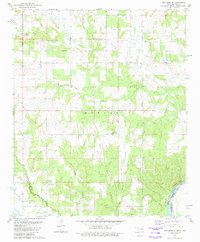 1980 New Oberlin1981 Print · USGSThe Oklahoma-Texas borderlands along the Red River are captured here during the late twentieth century. Genealogists and historians can trace rural landmarks and family burial grounds such as Crowder Cem, Oberlin Cem, and Iron Stob Ch.
 - 1980 Map of Lake West, 1981 Print
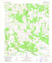 1980 Lake West1981 Print · USGSThe Oklahoma-Texas borderlands along the Red River are captured here in the mid-1970s. Local historians can trace family ties at Good Springs Ch or map the drainage of Whitegrass Creek and Slash Creek through the rural township of Bennington.
 - 1980 Map of Direct, 1981 Print
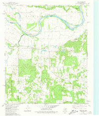 1980 Direct1981 Print · USGSThe Red River border between Texas and Oklahoma is captured here in the late seventies, showing the rural communities along the river's winding path. Genealogists can trace the rural landscape around Direct, find the location of Pyles Cem, or locate the crossroads at Unity.
 - 1980 Map of Bluff, 1981 Print
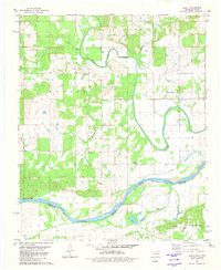 1980 Bluff1981 Print · USGSThe Oklahoma-Texas border comes into focus in the early eighties as the Red River separates Choctaw and Lamar counties. Researchers can trace rural life through landmarks like St Paul Ch, Bluff Cem, and the small settlement of Gay.2 unique versions available
 - 1980 Map of Grant, 1981 Print
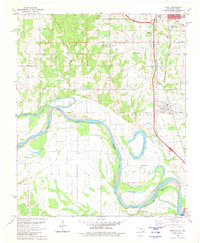 1980 Grant1981 Print · USGSChoctaw County at the turn of the 1980s shows the winding Red River valley as it marks the Oklahoma-Texas border. Genealogists and local historians can trace rural communities through landmarks like Goodland, Sweet Hill Cem, and Mt Pleasant Ch.
 - 1985 Map of Antlers
 1985 Antlers1985 Print · USGSSoutheastern Oklahoma’s timber and river country is captured here during the mid-eighties, centered on the crossroads at Antlers. Researchers can trace the Burlington Northern rail line through rural communities like Moyers and Jumbo, or locate the historic grounds of Fort Towson.2 unique versions available
 - 1985 Map of Paris
 1985 Paris1985 Print · USGSThe Red River Valley in the mid-eighties shows a landscape of military training grounds and rail-connected agricultural towns. Genealogists and historians can trace local landmarks like Allens Chapel Cem, the grounds of Camp Maxey, and the early footprint of Paris Junior College.
End of results
Showing maps 1-7 of 7
Top cities of Choctaw County
- Hugo historical maps
- Boswell historical maps
- Fort Towson historical maps
- Sawyer historical maps
- Soper historical maps
- Grant historical maps
Frequently asked questions
- What are the different types of historical maps available for Choctaw County?
- What is the oldest map of Choctaw County?
- Where can I purchase historical maps of Choctaw County for my home or office?
- Where can I download high-res historical maps of Choctaw County?
- Are there historical topographic maps available for Choctaw County?
- Is there historical aerial imagery available for Choctaw County?
- Where are historical maps of Choctaw County sourced from?