Old Maps of Choctaw County, Oklahoma for Hiking & Exploration
Hike through history with 159 historic maps of Choctaw County. Explore old trails, ghost towns, and forgotten backroads — perfect for outdoor adventurers and local explorers.
- Rediscover forgotten places: Map out old mining camps, roads, and footpaths that no longer exist on modern maps.
- Layer with modern tools: Combine with LiDAR or satellite views to plan hikes through historical terrain.
- Made for exploration: Popular among hikers, overlanders, and local history lovers.
Use these maps to find adventure and explore the hidden past of Choctaw County.
Choctaw County, OK maps
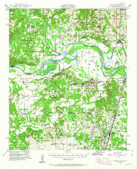
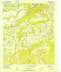
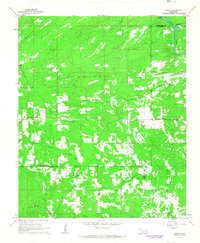
(159)- 1901 Map of Antlers
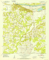
 1901 Antlers1901 Print · USGSThe Choctaw Nation territory is captured here during the transitional years before Oklahoma statehood, when the railroad began to reshape the landscape. Genealogists and historians can trace early settlements like Mayhew, the site of Spencer Academy, and the path of the St. Louis and San Francisco line.
 - 1901 Map of Alikchi
 1901 Alikchi1901 Print · USGSChoctaw Nation territory is captured here just before the turn of the century, showing a landscape of river-fed valleys and early educational outposts. Researchers can trace the grounds of Old Spencer Academy, the site of Fort Towson, and the remote Alikchi settlement.5 unique versions available
 - 1903 Map of Paris
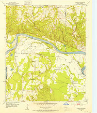
 1903 Paris1903 Print · USGSThe Red River borderlands of the Indian Territory and Texas are shown here at the start of the century. Genealogists and researchers can trace early settlements and social hubs like Grant, Oberlin, and the Camp Ground along the winding banks of the Red River.
 - 1912 Map of Antlers
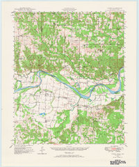
 1912 Antlers1912 Print · USGSSoutheastern Oklahoma’s river valleys and growing rail towns are captured here in the decade following statehood. Genealogists can trace family roots through numerous rural landmarks like Niles Store, the Asphalt Mine, and early school sites such as Timber Hill School.3 unique versions available
 - 1925 Map of Antlers
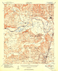
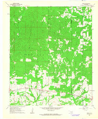
 1925 Antlers1925 Print · USGSSoutheastern Oklahoma's river valleys and rail lines are documented here in the years following statehood. Genealogists can trace family roots through numerous local landmarks like Armstrong Academy, the Asphalt Mine, and many rural sites like Nelson Chapel School.
 - 1948 Map of Grant, 1963 Print
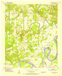
 1948 Grant1963 Print · USGSThe Red River borderlands of Oklahoma and Texas are shown here in the late 1940s, featuring the extensive Camp Maxey Military Reservation. Researchers can trace the St Louis San Francisco Railway through Grant and locate dozens of local landmarks like Hills Chapel School and Goodland Cem.2 unique versions available
 - 1948 Map of Direct, 1968 Print
 1948 Direct1968 Print · USGSThe Red River valley at the close of the 1940s reveals a landscape of isolated farming communities and local schools spanning the Oklahoma-Texas border. Genealogists and historians can trace the foundations of New Oberlin or locate remote landmarks like Iron Stob School and Arch Chapel Cem.
 - 1949 Map of Direct
 1949 Direct1949 Print · USGSThe Oklahoma and Texas borderlands along the Red River are captured here in the late 1940s. Local historians can trace the vanished Oberlin Ferry and old country schools like Crowder Springs School or visit family sites at Forest Grove Cem and Monkstown.2 unique versions available
 - 1949 Map of Grant
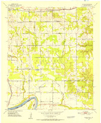
 1949 Grant1949 Print · USGSThe Red River borderlands of Oklahoma and Texas are captured here just after the war, showing a rural landscape dominated by large river bends and military expansion. You can trace early community hubs like Grant and Arthur City or locate local landmarks like Hills Chapel School and Forest Chapel.2 unique versions available
 - 1950 Map of Mcalester
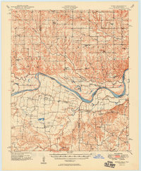
 1950 Mcalester1950 Print · USGSThe Ouachita Mountains and the coal country of Southeast Oklahoma are shown here in the late 1940s. Genealogists and historians can trace the rail-driven growth of McAlester, Wilburton, and Antlers alongside the rugged terrain of Kiamichi Mountain.2 unique versions available
 - 1951 Map of Slate Shoals, 1952 Print
 1951 Slate Shoals1952 Print · USGSLamar County, Texas, and Choctaw County, Oklahoma, are separated by the winding Red River in this early 1950s study. Genealogists can locate several remote landmarks, including the Pee Dee Sch and rural burials at Newbether Cem.3 unique versions available
 - 1951 Map of Frogville, 1952 Print
 1951 Frogville1952 Print · USGSThe Oklahoma-Texas borderlands along the Red River are captured here in the early fifties, showing a landscape defined by meandering river bends. Genealogists can locate numerous local burial sites and schools like Frogville Cem, Everidge Cem, and Lake View Sch.3 unique versions available
 - 1951 Map of Shoals, 1952 Print
 1951 Shoals1952 Print · USGSThe northern banks of the Red River are captured here in the early fifties, showing a rural community defined by its schools and rail lines. Genealogists can trace family landmarks like Shoat Springs Cem, Ervin Sch, and the settlement of Shoals.2 unique versions available
 - 1951 Map of Kiomatia, 1952 Print
 1951 Kiomatia1952 Print · USGSThe Red River valley at the Texas-Oklahoma border comes alive in the early fifties, showing a dense network of rural schools and river-bottom farms. Genealogists can trace family footprints at Kiomatia, Siloam Church, and the Kiomatia Agricultural School.
 - 1951 Map of Woodland, 1952 Print
 1951 Woodland1952 Print · USGSThe Red River Valley's borderlands in the early fifties are captured here as a landscape of small agricultural hamlets and riverfront boundaries. Researchers can trace rural community life through landmarks like Lone Star Sch, Woodland Cem, and the crossing at Pin Hook.2 unique versions available
 - 1953 Map of Texarkana, 1964 Print
 1953 Texarkana1964 Print · USGSThe Texas-Arkansas borderlands are captured here in the mid-fifties, during a decade of massive military and hydraulic engineering projects. Genealogists and researchers can locate family landmarks like Old Boston Cem, Siloam Ch, and the vast Red River Arsenal.4 unique versions available
 - 1956 Map of Texarkana
 1956 Texarkana1956 Print · USGSThe Ark-La-Tex borderlands come alive in the mid-fifties, showing the transition from a rail-dependent rural economy to a post-war industrial landscape. Researchers can trace the massive Red River Ordnance Depot and find towns like Talco, Bogata, and Naples.
 - 1961 Map of Darwin, 1963 Print
 1961 Darwin1963 Print · USGSSoutheastern Oklahoma’s river bottoms and timberlands are captured here in the early sixties as small farming communities thrived. Local researchers can map the grounds of the Mc Leod Honor Farm or find family roots near Darwin Ch and Old Farris.2 unique versions available
 - 1961 Map of Antlers East, 1963 Print
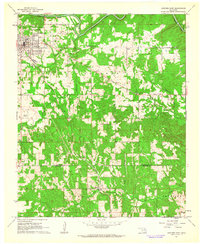 1961 Antlers East1963 Print · USGSAntlers and the rural southeast Oklahoma countryside are captured here in the early sixties, showing the area's transition from town to timberland. Genealogists and local historians can trace family locations near Hamden, Dela, and the Odd Fellows Cem.2 unique versions available
 - 1961 Map of Antlers West, 1963 Print
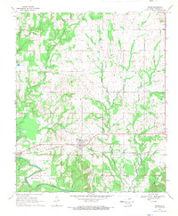
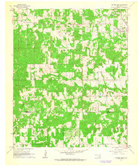 1961 Antlers West1963 Print · USGSPushmataha County is captured here in the early sixties, showing the rural landscape around the town of Antlers. Genealogists and historians can trace local landmarks like Edwards Cem or follow the ST LOUIS SAN FRANCISCO rail line.2 unique versions available
 - 1962 Map of McAlester
 1962 McAlester1962 Print · USGSSoutheastern Oklahoma and western Arkansas are shown here during the early sixties, a time of transition for the region's mountain communities and timberlands. Researchers can trace the paths of the Kansas City Southern RR through Heavener or locate settlements like Talihina and Broken Bow near the Kiamichi Mountains.2 unique versions available
 - 1962 Map of Sobol, 1964 Print
 1962 Sobol1964 Print · USGSThe Kiamichi Mountains and the Little River valley are captured here in the early sixties as rural Oklahoma life centered on small settlements and timber. Trace family roots at Ringold Cem and Sobol Cem, or locate landmarks like the Sobol Lookout Tower.3 unique versions available
 - 1962 Map of Swink, 1964 Print
 1962 Swink1964 Print · USGSSoutheastern Oklahoma’s timbered creek valleys and rail corridors are captured here in the early sixties. Researchers can trace family ties at the Swink Cem, locate the old Elliott Sch, or follow the St Louis - San Francisco railroad through Swink.3 unique versions available
 - 1965 Map of McAlester
 1965 McAlester1965 Print · USGSSoutheastern Oklahoma and western Arkansas appear here in the mid-1960s, showing the intersection of the timber industry and the growing reservoir system. Genealogists can trace family roots through settlements like Antlers, Idabel, and Kiowa or follow the historic routes of the Kansas City Southern Ry.3 unique versions available
 - 1968 Map of Soper, 1971 Print
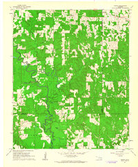
 1968 Soper1971 Print · USGSChoctaw County at the end of the 1960s shows a landscape defined by the St Louis - San Francisco railroad and the waters of Muddy Boggy Creek. Genealogists and local historians can trace family locations near Soper Cemetery, Kent Church, and the settlement at Jasper.
Showing maps 1-25 of 159
Top cities of Choctaw County
- Hugo historical maps
- Boswell historical maps
- Fort Towson historical maps
- Sawyer historical maps
- Soper historical maps
- Grant historical maps
Frequently asked questions
- What are the different types of historical maps available for Choctaw County?
- What is the oldest map of Choctaw County?
- Where can I purchase historical maps of Choctaw County for my home or office?
- Where can I download high-res historical maps of Choctaw County?
- Are there historical topographic maps available for Choctaw County?
- Is there historical aerial imagery available for Choctaw County?
- Where are historical maps of Choctaw County sourced from?