1990s Maps of Cimarron County, Oklahoma
Explore 9 historic maps of Cimarron County from the 1990s. These maps offer a rare glimpse into what life looked like during the 1990s — showing old roads, neighborhoods, homes, and landmarks that have changed or disappeared over time.
Whether you're researching your family's past, planning a metal detecting trip, or studying how Cimarron County's landscape evolved across the 1990s, these high-resolution maps are a powerful tool for exploring the history of this region.
- Focus on a specific era: All maps on this page are from the 1990s, giving you a focused view of this time period.
- See what’s changed: Compare century-old streets, trails, and buildings to today's modern landscape using overlays and satellite layers.
- Research with precision: Use these maps for genealogy, historical research, land use analysis, or educational projects.
- View, download, or print: Maps are fully viewable online in high resolution, and can be downloaded or printed for your own records.
Start exploring Cimarron County's history through authentic maps from the 1990s. This is your window into the past.
Cimarron County, OK maps
(9)- 1996 Map of Furnish Canyon East, 2000 Print
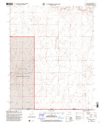
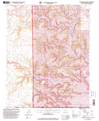 1996 Furnish Canyon East2000 Print · USGSThe tri-state border region of Colorado, New Mexico, and Oklahoma is shown here in the mid-1990s as a land of deep canyons and mesa tops. Researchers can trace remote 4WD trails to find the Dunlap Ranch, a lone Grave, and several scattered Mine sites.
 - 1996 Map of Tubs Springs, 2000 Print
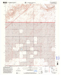
 1996 Tubs Springs2000 Print · USGSThe high plains of the Colorado and Oklahoma border are captured here in the late nineties, where ranching life persists within the Comanche National Grassland. Researchers can trace remote water sources and landmarks like Tubs Springs, Little Dandy Windmill, and a local Cem.
 - 1998 Map of Felt, 2001 Print
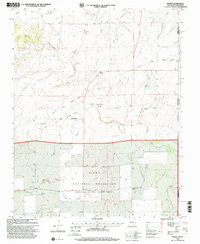
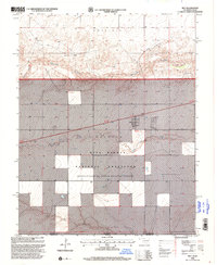 1998 Felt2001 Print · USGSThe Oklahoma Panhandle meets the Texas border in the late nineties, documenting a landscape of shortgrass prairie and essential water management. Genealogists and local historians can trace the settlement of Felt or locate landmarks like the Felt Picnic Area and the Beaver River.
 - 1998 Map of Felt SW, 2001 Print
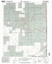
 1998 Felt SW2001 Print · USGSThe Oklahoma Panhandle is captured in the late nineties, showing the intersection of three states within the Rita Blanca National Grassland. Genealogists and historians can trace the remote markers of Wheeless and Gresham or the tech-history of the USCG Loran-Tac-C Station.
 - 1998 Map of Conrad SW, 2001 Print
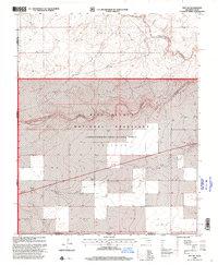
 1998 Conrad SW2001 Print · USGSThe Oklahoma-Texas borderlands are captured here in the late nineties, where the High Plains meet the Beaver River valley. Local historians can trace the bounds of the Rita Blanca National Grassland and locate a remote Landing Strip.
 - 1998 Map of Boise City SW, 2001 Print
 1998 Boise City SW2001 Print · USGSThe high plains of the Oklahoma-Texas border are captured here in the late nineties, documenting the vast Rita Blanca National Grassland. Genealogists can trace property boundaries in Gresham and Cleveland or locate old water sources like Aqua Fria Creek.2 unique versions available
 - 1998 Map of Moses, 2001 Print
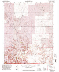
 1998 Moses2001 Print · USGSThe high plains of Union County are captured here in the late twentieth century, showing a landscape defined by the historic Santa Fe Trail. Genealogists and local historians can locate early burial sites like Puertocito Cem and landmarks such as the Knowles Sch and Old Moses.
 - 1998 Map of Rardin Hill, 2001 Print
 1998 Rardin Hill2001 Print · USGSThe high plains of Union County where New Mexico meets Oklahoma and Texas are captured here in the late nineties. Genealogists and local historians can locate Creeds Chapel Cem or trace ranching lifelines like Mock Windmill and Mason Windmill.
 - 1998 Map of Boise City SE, 2001 Print
 1998 Boise City SE2001 Print · USGSThe Oklahoma-Texas borderlands are captured here in the late nineties as they intersect within the Rita Blanca National Grassland. Researchers can trace old property lines and survey sections near Beaver Creek and the township of Cleveland.2 unique versions available
End of results
Showing maps 1-9 of 9
Top cities of Cimarron County
Frequently asked questions
- What are the different types of historical maps available for Cimarron County?
- What is the oldest map of Cimarron County?
- Where can I purchase historical maps of Cimarron County for my home or office?
- Where can I download high-res historical maps of Cimarron County?
- Are there historical topographic maps available for Cimarron County?
- Is there historical aerial imagery available for Cimarron County?
- Where are historical maps of Cimarron County sourced from?