1900s (20th Century) Maps of Cache Wye, Oklahoma
Explore 10 historic maps of Cache Wye from the 1900s (20th Century). These maps offer a rare glimpse into what life looked like during the 1900s — showing old roads, neighborhoods, homes, and landmarks that have changed or disappeared over time.
Whether you're researching your family's past, planning a metal detecting trip, or studying how Cache Wye's landscape evolved across the 1900s, these high-resolution maps are a powerful tool for exploring the history of this region.
- Focus on a specific era: All maps on this page are from the 1900s, giving you a focused view of this time period.
- See what’s changed: Compare century-old streets, trails, and buildings to today's modern landscape using overlays and satellite layers.
- Research with precision: Use these maps for genealogy, historical research, land use analysis, or educational projects.
- View, download, or print: Maps are fully viewable online in high resolution, and can be downloaded or printed for your own records.
Start exploring Cache Wye's history through authentic maps from the 1900s. This is your window into the past.
Cache Wye, OK maps
(10)- 1937 Map of Cache
 1937 Cache1937 Print · USGSComanche County reveals its dual nature in the late thirties, split between the high peaks of the Wichita Mountains and the rural farmsteads to the south. Genealogists and historians can locate vanished landmarks like Quilla Sch, Deyo Sch, and the Cache Cem during the height of the local rail-and-ranch economy.
 - 1937 Map of Quanah Mountain
 1937 Quanah Mountain1937 Print · USGSComanche County during the late 1930s shows a landscape of conservation and transition between the Wichita Mountains and the plains. Researchers can locate New Deal-era infrastructure at C C C Camp No 870 and cultural sites like Post Oak Mission.
 - 1942 Map of Cache
 1942 Cache1942 Print · USGSComanche County during the late 1930s reveals a unique landscape where the Wichita Mountains Wildlife Refuge meets the rail-side towns of the plains. Genealogists can trace rural life through sites like Post Oak Mission, Devo Memorial Chapel, and the Spring Valley Sch.3 unique versions available
 - 1949 Map of Quanah Mountain, 1953 Print
 1949 Quanah Mountain1953 Print · USGSComanche County reveals a complex landscape of wildlife preservation and Comanche heritage just after the war. You can trace the locations of the Old Star House, Post Oak Mission, and Quanah Parker Camp alongside the granite peaks of Elk Mountain and Quanah Mountain.2 unique versions available
 - 1955 Map of Lawton, 1958 Print
 1955 Lawton1958 Print · USGSSouthwestern Oklahoma and North Texas are shown here in the mid-fifties, dominated by the Wichita Mountains and the vital Red River watershed. Genealogists and historians can trace the foundations of Lawton alongside rural landmarks like Rainy Mountain Church and Pleasant Hill School.5 unique versions available
 - 1956 Map of Quanah Mountain, 1959 Print
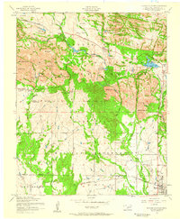 1956 Quanah Mountain1959 Print · USGSThe Wichita Mountains in the mid-fifties reveal a landscape of military training grounds and wildlife conservation just north of the rail lines. Trace the development of Indiahoma and Cache, find the curious Official Dog Town, and locate family sites near Quanah Parker Lake.4 unique versions available
 - 1956 Map of Cache, 1960 Print
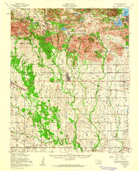 1956 Cache1960 Print · USGSSouthwestern Oklahoma at the peak of the mid-century era shows a landscape defined by federal land reserves and rural rail towns. Researchers can trace family history at the Deyo Memorial Chapel or explore the early footprints of Cache and Indiahoma.3 unique versions available
 - 1981 Map of Lawton
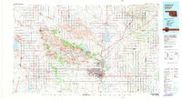 1981 Lawton1981 Print · USGSSouthwestern Oklahoma in the early eighties shows a landscape shaped by military history and the rising peaks of the Wichitas. Researchers can trace the boundaries of the Fort Sill Military Reservation and locate early settlements like Meers, Chattanooga, and Richards Spur.
 - 1991 Map of Quanah Mountain, 1992 Print
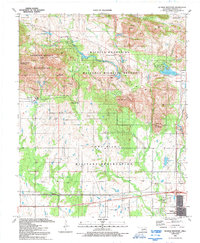 1991 Quanah Mountain1992 Print · USGSThe Wichita Mountains at the start of the 1990s reveal a landscape split between wildlife conservation and military operations. Trace the early mining history at Bonanza Mine or explore the transition from the Charons Garden Wilderness to the Fort Sill Military Reservation.2 unique versions available
 - 1997 Map of Quanah Mountain, 1999 Print
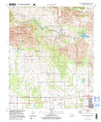 1997 Quanah Mountain1999 Print · USGSComanche County during the late nineties reveals a stark division between preserved wilderness and military territory. Genealogists and historians can trace old landmarks like the Peprington Mine, the settlement of Cache, and family-favored spots like Eagle Park.2 unique versions available
End of results
Showing maps 1-10 of 10
Top cities near Cache Wye
Frequently asked questions
- What are the different types of historical maps available for Cache Wye?
- What is the oldest map of Cache Wye?
- Where can I purchase historical maps of Cache Wye for my home or office?
- Where can I download high-res historical maps of Cache Wye?
- Are there historical topographic maps available for Cache Wye?
- Is there historical aerial imagery available for Cache Wye?
- Where are historical maps of Cache Wye sourced from?