Old Maps of Custer County, Oklahoma for Metal Detecting
Plan your next treasure hunt with 202 historic maps of Custer County. Find old homesites, ghost towns, trails, and gathering spots that may be lost to time — perfect for identifying promising metal detecting locations.
- Locate forgotten sites: Uncover places like long-lost settlements, abandoned rail lines, or gathering spots.
- Plan better hunts: Use map overlays combined with LiDAR or satellite views to narrow in on historically rich areas.
- Made for detectorists: Thousands of hobbyists use these maps to discover relics, coins, and hidden history.
Use these historic maps to boost your research and find new opportunities beneath the surface of Custer County.
Custer County, OK maps
(202)- 1955 Map of Clinton, 1964 Print
 1955 Clinton1964 Print · USGSWestern Oklahoma during the mid-century transition shows a landscape of growing reservoirs and active military flight lines. Genealogists and historians can locate rural landmarks such as Mountain View Church, Berlin School, and the Riverside Indian School Reserve.3 unique versions available
 - 1956 Map of Cordell, 1958 Print
 1956 Cordell1958 Print · USGSWashita County during the mid-fifties reveals a landscape of thriving rail towns and deep-rooted rural congregations. Genealogists can trace family footprints across the St Louis - San Francisco line and through local landmarks like Old Crow Cem or Bessie.2 unique versions available
 - 1957 Map of Clinton
 1957 Clinton1957 Print · USGSWestern Oklahoma in the mid-fifties is captured here as a landscape of river-valley settlements and emerging energy fields. Genealogists can trace family roots through numerous rural landmarks like the Swapping Back Indian School, Hebron Church, and the Riverside Indian School Reserve.
 - 1957 Map of Butler, 1958 Print
 1957 Butler1958 Print · USGSCuster County in the late fifties shows a rural landscape defined by the Washita River and the Santa Fe railroad. Researchers can trace family history through numerous rural landmarks like Prairie View Ch, Anthon Cem, and the village of Stafford.2 unique versions available
 - 1957 Map of Clinton, 1958 Print
 1957 Clinton1958 Print · USGSCuster County was a thriving network of rail-side towns and rural school districts during the mid-fifties. Genealogists can trace family names through the Masonic Cem and Independence Cem, while collectors can map the route of the St Louis and San Francisco railroad.2 unique versions available
 - 1957 Map of Dill City, 1958 Print
 1957 Dill City1958 Print · USGSWestern Oklahoma during the late fifties centers on the expansive Clinton-Sherman Air Force Base and the crossroads of the Santa Fe and Rock Island railroads. Genealogists can trace family names through dozens of rural sites like Kerns Cem, Novis Cem, and the Parkersburg Sch.3 unique versions available
 - 1960 Map of Hammon, 1961 Print
 1960 Hammon1961 Print · USGSHammon and the surrounding High Plains communities are caught here at a mid-century peak of rail and river activity. Local researchers can trace the routes of the Missouri Kansas Texas railroad and locate rural landmarks like Thompson Cem and Moorewood.
 - 1961 Map of Eakly, 1962 Print
 1961 Eakly1962 Print · USGSSettlement and farming patterns in central Oklahoma are captured here in the early sixties, just as the Fort Cobb Reservoir began to transform the local drainage. Genealogists and historians can locate numerous rural burial grounds and meeting houses, including Missouri Cem Ch, High Point Cem, and the Indian Cem.2 unique versions available
 - 1961 Map of Elk City, 1963 Print
 1961 Elk City1963 Print · USGSThe Beckham County plains in the early sixties reveal a landscape shaped by Route 66 and the energy industry. Genealogists and historians can trace rural family sites like Hefner Church, the Ural Cemetery, and local landmarks such as Merritt School.
 - 1961 Map of Leedey, 1963 Print
 1961 Leedey1963 Print · USGSIn the early 1960s, Western Oklahoma's agrarian character was defined by the intersection of rail lines and quiet rural communities. Researchers can trace the legacy of early settlers through numerous landmarks like Evergreen Cem, Liberty Center Ch, and the winding Canadian River.2 unique versions available
 - 1962 Map of Putnam, 1964 Print
 1962 Putnam1964 Print · USGSWestern Oklahoma’s canyonlands and rural townships are captured here in the early sixties as the energy industry began to dot the plains. Researchers can locate many family burial sites and country congregations like Fairview Cem, Liberty Cem, and Independence Ch.2 unique versions available
 - 1962 Map of Aledo, 1964 Print
 1962 Aledo1964 Print · USGSDewey County in the early sixties shows a landscape of braided riverbeds and prairie settlements centered on the Canadian River. Local historians can trace old community hubs like Webb and Aledo, or find rural landmarks like Prairie Bell Ch and Riverview Cem.
 - 1964 Map of Oakwood, 1965 Print
 1964 Oakwood1965 Print · USGSWestern Oklahoma is captured here in the mid-1960s as a landscape of rural townships and developing oil fields. Researchers can trace family roots through several country churches and cemeteries like Mt Pleasant Ch, Mt Hope Cem, and the village of Eagle City.2 unique versions available
 - 1964 Map of Weatherford, 1966 Print
 1964 Weatherford1966 Print · USGSWestern Oklahoma life in the mid-sixties centers on the busy railroad corridors and the winding course of the Canadian River. Researchers can trace old family sites like Mound Olive Cem, the Indian Mission Ch, and the evocative Dead Women Crossing.
 - 1976 Map of Clinton SE
 1976 Clinton SE1976 Print · USGSCuster County agricultural patterns and rural crossroads are captured in this mid-seventies aerial survey. Local historians can trace the course of Bear Creek and the small settlement of Indianapolis through high-resolution photographic detail.
 - 1976 Map of Butler NW
 1976 Butler NW1976 Print · USGSCuster County agricultural patterns are captured in detail in the mid-seventies, showing the prairie landscape north of Butler. Researchers can trace the path of West Barnitz Creek and the intricate grid of section-line roads and farmsteads.
 - 1976 Map of Butler NE
 1976 Butler NE1976 Print · USGSCuster County land patterns are captured in the mid-1970s through this detailed orthophoto study of central Oklahoma. Researchers can examine the natural drainage and land use along East Barnitz Creek and West Barnitz Creek.
 - 1976 Map of Butler SW
 1976 Butler SW1976 Print · USGSCuster County land and water patterns are captured here in the mid-1970s, showcasing the development of the region's water infrastructure. Trace the early shoreline of Foss Reservoir and the winding course of the Washita River across the plains.
 - 1976 Map of Dill City NE
 1976 Dill City NE1976 Print · USGSWashita County in the mid-seventies shows a landscape defined by agricultural precision and significant water infrastructure. You can trace the winding path of Turkey Creek as it feeds into Clinton Lake and locate the settlement of Foss.
 - 1976 Map of Clinton SW
 1976 Clinton SW1976 Print · USGSCuster County comes into sharp focus during the mid-seventies in this detailed aerial study of the Oklahoma prairie. You can trace the winding Washita River and the 1970s boundaries of Clinton and Arapaho during a period of agricultural growth.
 - 1976 Map of Clinton NW
 1976 Clinton NW1976 Print · USGSCuster County land patterns and rural crossroads are captured in detail during the mid-seventies. Local historians can trace the street layouts of Custer City or examine the agricultural developments surrounding Independence.
 - 1976 Map of Clinton NE
 1976 Clinton NE1976 Print · USGSCuster County agricultural lands are captured in this mid-seventies aerial survey, showing the rural grid system and winding watercourses. Researchers can identify farmstead layouts near Thomas, the location of Foley, and the drainage of Deer Creek.
 - 1976 Map of Butler SE
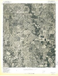 1976 Butler SE1976 Print · USGSCuster County in the mid-seventies is captured in this aerial survey of its farming heartland and river bottoms. Genealogists and local historians can trace the rural landscape around Stafford and Ralph along the Washita River.
 - 1983 Map of Bessie, 1984 Print
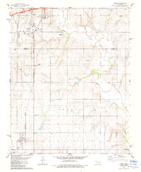 1983 Bessie1984 Print · USGSWashita County and Custer County meet along the river in the early 1980s, where the railroad network serves the local agricultural economy. Researchers can locate family sites at John Old Crow Cem, Peace Ch, and the Oklahoma Veterans Center.
 - 1983 Map of Foss Dam, 1984 Print
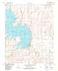 1983 Foss Dam1984 Print · USGSCuster County was defined by its water and wildlife in the early 1980s as Foss Reservoir reached its modern extent. You can trace the development of Foss State Park and locate regional landmarks like Cheyenne Point and the Washita River channel.
Showing maps 1-25 of 202
Top cities of Custer County
- Weatherford historical maps
- Clinton historical maps
- Thomas historical maps
- Arapaho historical maps
- Custer City historical maps
- Butler historical maps
Frequently asked questions
- What are the different types of historical maps available for Custer County?
- What is the oldest map of Custer County?
- Where can I purchase historical maps of Custer County for my home or office?
- Where can I download high-res historical maps of Custer County?
- Are there historical topographic maps available for Custer County?
- Is there historical aerial imagery available for Custer County?
- Where are historical maps of Custer County sourced from?