Old Maps of Delaware County, Oklahoma for Metal Detecting
Plan your next treasure hunt with 160 historic maps of Delaware County. Find old homesites, ghost towns, trails, and gathering spots that may be lost to time — perfect for identifying promising metal detecting locations.
- Locate forgotten sites: Uncover places like long-lost settlements, abandoned rail lines, or gathering spots.
- Plan better hunts: Use map overlays combined with LiDAR or satellite views to narrow in on historically rich areas.
- Made for detectorists: Thousands of hobbyists use these maps to discover relics, coins, and hidden history.
Use these historic maps to boost your research and find new opportunities beneath the surface of Delaware County.
Delaware County, OK maps
(160)- 1896 Map of Pryor, 1963 Print
 1896 Pryor1963 Print · USGSThe Cherokee Nation comes into focus during the late nineteenth century as railroads began to transform the Indian Territory landscape. Genealogists and historians can trace essential river crossings like Sixkiller Ferry and Adams Ford or locate early settlements such as Bushyhead and Mazie.
 - 1899 Map of Siloam Springs, 1954 Print
 1899 Siloam Springs1954 Print · USGSThe borderlands of the Cherokee Nation and Northwest Arkansas come alive in this late nineteenth-century survey. Genealogists can trace early homesteads and community life through Shoaps Store, Round Spring Church, and the settlement of Maysville.
 - 1901 Map of Vinita
 1901 Vinita1901 Print · USGSIndian Territory at the turn of the century shows a landscape of burgeoning railroad towns and Cherokee Nation settlements. Genealogists can trace family roots in early townsites like Vinita, Bluejacket, and Chelsea or locate rural homesteads near Cabin Creek.2 unique versions available
 - 1901 Map of Pryor
 1901 Pryor1901 Print · USGSIndian Territory at the turn of the century shows a landscape transitioning from tribal lands to a rail-connected frontier. Genealogists and historians can trace early river crossings like Markham Ferry and Dirteater Ford alongside frontier settlements like Choteau and Bushyhead.5 unique versions available
 - 1903 Map of Siloam Springs, 1904 Print
 1903 Siloam Springs1904 Print · USGSThe border of Arkansas and the Cherokee Nation comes to life in this survey from the turn of the century. Genealogists and historians can trace the early layout of Siloam Springs or locate small landmarks like Shoaps Store and Round Spring Church.
 - 1904 Map of Siloam Springs
 1904 Siloam Springs1904 Print · USGSThe Arkansas and Indian Territory borderlands are captured here at the turn of the century, prior to Oklahoma statehood. Researchers can trace the early layout of Siloam Springs and locate vanished landmarks like Shoaps Store or the Round Spring Church.7 unique versions available
 - 1907 Map of Wyandotte, 1954 Print
 1907 Wyandotte1954 Print · USGSThe Tri-State border region at the start of the twentieth century shows a landscape of river ferries and early rail towns. Trace the locations of family landmarks like Hickory Grove Church, Goad Eagle Ferry, and rural schools from Afton to Seneca.2 unique versions available
 - 1909 Map of Wyandotte
 1909 Wyandotte1909 Print · USGSNortheastern Oklahoma’s river valleys and prairies are captured here just after statehood, during a period of rapid rail expansion and tribal land transition. Researchers can trace early river crossings like Rodwhite Ferry and locate historic community centers such as Hickory Grove Church or the Bluejacket School.2 unique versions available
 - 1913 Map of Vinita
 1913 Vinita1913 Print · USGSNortheast Oklahoma at the height of its rail-and-ranch era is meticulously detailed here just as the state was entering its second decade. Genealogists can trace family roots through dozens of local landmarks like W H School, Big Cabin, and the Blue Hawk School.3 unique versions available
 - 1954 Map of Tulsa
 1954 Tulsa1954 Print · USGSNortheast Oklahoma and the Ozark border are shown here during a period of massive industrial and infrastructure growth. Researchers can trace the legacy of the Tri-State Mining District and the development of major reservoirs like Grand Lake O' The Cherokees.2 unique versions available
 - 1958 Map of Tulsa, 1968 Print
 1958 Tulsa1968 Print · USGSNortheast Oklahoma and the Ozark borderlands are captured here during a massive era of reservoir construction and highway expansion. Researchers can trace the mid-century footprints of Tulsa, the sprawling Lake O' the Cherokees, and historical sites like Pea Ridge National Military Park.3 unique versions available
 - 1963 Map of Tulsa
 1963 Tulsa1963 Print · USGSThe Oklahoma and Arkansas borderlands are shown here in the early sixties, a time of massive reservoir construction and heavy mining. Genealogists can trace family roots through settlements like Nowata, Pryor, and Jay, or locate historical zinc and lead mines and coal mines.
 - 1964 Map of Cayuga, 1966 Print
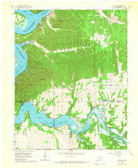 1964 Cayuga1966 Print · USGSDelaware and Ottawa Counties in the mid-1960s show a landscape shaped by the waters of the Neosho and Elk Rivers. Genealogists and historians can trace rural life through the Indian Ceremonial Grounds, Turkey Ford School, and Howard Cemetery.2 unique versions available
 - 1964 Map of Dodge, 1966 Print
 1964 Dodge1966 Print · USGSThe rolling lands of Cow Skin Prairie and the shores of Lake O' the Cherokees appear here in the mid-1960s. Genealogists can trace local roots through numerous sites like Olympus Cem, Dodge Ch, and Pollan Cem.2 unique versions available
 - 1965 Map of South West City, 1966 Print
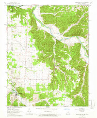 1965 South West City1966 Print · USGSThe tri-state border region of Missouri, Oklahoma, and Arkansas was a landscape of quiet prairie and river bluffs during the mid-sixties. Researchers can locate numerous family burial sites and rural congregations, from Williams-Hays Cem to Liberty Ch near South West City.
 - 1965 Map of Tiff City, 1966 Print
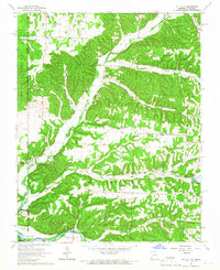 1965 Tiff City1966 Print · USGSMissouri and Oklahoma meet along these river valleys in the mid-1960s, a period of quiet rural life defined by small hill communities. Genealogists can locate family landmarks such as Keenon Cem, Hart Sch, and the Council House Indian Reservation.3 unique versions available
 - 1971 Map of Kenwood, 1972 Print
 1971 Kenwood1972 Print · USGSDelaware County's wooded hills and hollows are documented here in the early seventies, featuring the Kenwood settlement and protected game lands. Trace family history at the Old Eucha Cem and Welsh Cem or explore the drainage of Salina Creek.2 unique versions available
 - 1971 Map of Jay SE, 1972 Print
 1971 Jay SE1972 Print · USGSDelaware County's rural landscape is captured in the early seventies, centered on the complex shoreline and steep ridges of the Ozark Plateau. Researchers can trace family sites and local landmarks like Cloud Creek Cem, the Lone Prairie Lookout Tower, and New Green Ch.2 unique versions available
 - 1971 Map of Jay, 1973 Print
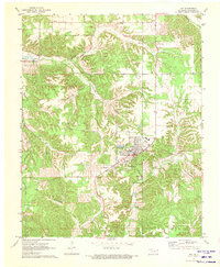 1971 Jay1973 Print · USGSDelaware County and the community of Jay are captured here in the early seventies as the region's topography transitioned from Ozark hollows to the waters of the Grand Lake. Genealogists can locate family burial sites like Duffield Memorial Cem and Eucha Cem or trace rural landmarks like the Round Spring Ch.2 unique versions available
 - 1971 Map of Sycamore, 1973 Print
 1971 Sycamore1973 Print · USGSDelaware County, Oklahoma, is shown in the early seventies as a rural landscape defined by creek valleys and community landmarks. Genealogists can trace family connections through sites like Indianola Cem, Poynor Ch, and the settlement of Sycamore.
 - 1971 Map of Grove, 1973 Print
 1971 Grove1973 Print · USGSThe Grand Lake shoreline in the early 1970s reveals a landscape of growing recreation and deep-rooted rural history. Genealogists can locate family landmarks like Buzzard Cem, while historians can trace the Old RR Grade and the Seaplane Base near Monkey Island.2 unique versions available
 - 1971 Map of Cherokee City, 1973 Print
 1971 Cherokee City1973 Print · USGSThe Arkansas-Oklahoma borderlands appear here in the early seventies, dominated by the Old Indian Treaty Boundary. Researchers can trace local genealogy through family-named landmarks and cemeteries like Coats Cem and the settlement of Bloomfield.2 unique versions available
 - 1971 Map of Ketchum, 1973 Print
 1971 Ketchum1973 Print · USGSNortheastern Oklahoma at the start of the 1970s shows a landscape shaped by massive water projects and established rural communities. Genealogists can locate family landmarks like Carselowey Cem, the Foursquare Gospel Ch, and the small settlement of Success.
 - 1971 Map of Salina SE, 1973 Print
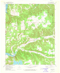 1971 Salina SE1973 Print · USGSMayes County in the early 1970s features a rugged landscape of wooded hills and major water projects. Local historians and genealogists can trace family roots through landmarks like Ross Mayes Cem, Blue Springs Ch, and Wickliffe Sch.2 unique versions available
 - 1971 Map of Spavinaw, 1973 Print
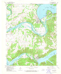 1971 Spavinaw1973 Print · USGSOklahoma's lake country is captured here in the early seventies, dominated by the massive engineering of the Pensacola Dam. Researchers can trace old family sites at Military Cem, explore the town of Spavinaw, or follow the Old Grade Railroad.
Showing maps 1-25 of 160
Top cities of Delaware County
- Grove historical maps
- Jay historical maps
- West Siloam Springs historical maps
- Colcord historical maps
- Kansas historical maps
- Bernice historical maps
Frequently asked questions
- What are the different types of historical maps available for Delaware County?
- What is the oldest map of Delaware County?
- Where can I purchase historical maps of Delaware County for my home or office?
- Where can I download high-res historical maps of Delaware County?
- Are there historical topographic maps available for Delaware County?
- Is there historical aerial imagery available for Delaware County?
- Where are historical maps of Delaware County sourced from?