1970s Maps of Delaware County, Oklahoma
Explore 21 historic maps of Delaware County from the 1970s. These maps offer a rare glimpse into what life looked like during the 1970s — showing old roads, neighborhoods, homes, and landmarks that have changed or disappeared over time.
Whether you're researching your family's past, planning a metal detecting trip, or studying how Delaware County's landscape evolved across the 1970s, these high-resolution maps are a powerful tool for exploring the history of this region.
- Focus on a specific era: All maps on this page are from the 1970s, giving you a focused view of this time period.
- See what’s changed: Compare century-old streets, trails, and buildings to today's modern landscape using overlays and satellite layers.
- Research with precision: Use these maps for genealogy, historical research, land use analysis, or educational projects.
- View, download, or print: Maps are fully viewable online in high resolution, and can be downloaded or printed for your own records.
Start exploring Delaware County's history through authentic maps from the 1970s. This is your window into the past.
Delaware County, OK maps
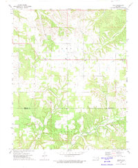
(21)- 1971 Map of Kenwood, 1972 Print
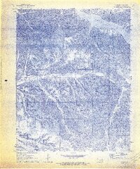 1971 Kenwood1972 Print · USGSDelaware County's wooded hills and hollows are documented here in the early seventies, featuring the Kenwood settlement and protected game lands. Trace family history at the Old Eucha Cem and Welsh Cem or explore the drainage of Salina Creek.2 unique versions available
 - 1971 Map of Jay SE, 1972 Print
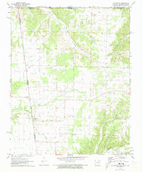
 1971 Jay SE1972 Print · USGSDelaware County's rural landscape is captured in the early seventies, centered on the complex shoreline and steep ridges of the Ozark Plateau. Researchers can trace family sites and local landmarks like Cloud Creek Cem, the Lone Prairie Lookout Tower, and New Green Ch.2 unique versions available
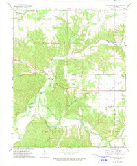
 - 1971 Map of Jay, 1973 Print
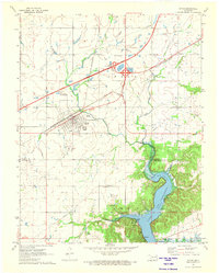
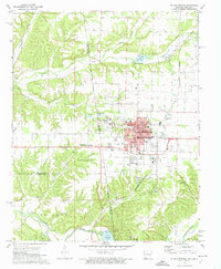
 1971 Jay1973 Print · USGSDelaware County and the community of Jay are captured here in the early seventies as the region's topography transitioned from Ozark hollows to the waters of the Grand Lake. Genealogists can locate family burial sites like Duffield Memorial Cem and Eucha Cem or trace rural landmarks like the Round Spring Ch.2 unique versions available
 - 1971 Map of Sycamore, 1973 Print
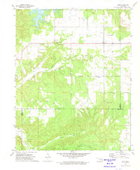
 1971 Sycamore1973 Print · USGSDelaware County, Oklahoma, is shown in the early seventies as a rural landscape defined by creek valleys and community landmarks. Genealogists can trace family connections through sites like Indianola Cem, Poynor Ch, and the settlement of Sycamore.
 - 1971 Map of Grove, 1973 Print
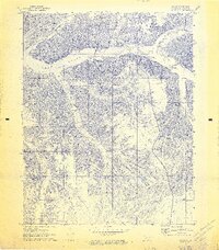
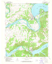
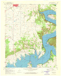
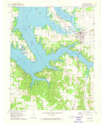 1971 Grove1973 Print · USGSThe Grand Lake shoreline in the early 1970s reveals a landscape of growing recreation and deep-rooted rural history. Genealogists can locate family landmarks like Buzzard Cem, while historians can trace the Old RR Grade and the Seaplane Base near Monkey Island.2 unique versions available
 - 1971 Map of Cherokee City, 1973 Print
 1971 Cherokee City1973 Print · USGSThe Arkansas-Oklahoma borderlands appear here in the early seventies, dominated by the Old Indian Treaty Boundary. Researchers can trace local genealogy through family-named landmarks and cemeteries like Coats Cem and the settlement of Bloomfield.2 unique versions available
 - 1971 Map of Ketchum, 1973 Print
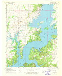
 1971 Ketchum1973 Print · USGSNortheastern Oklahoma at the start of the 1970s shows a landscape shaped by massive water projects and established rural communities. Genealogists can locate family landmarks like Carselowey Cem, the Foursquare Gospel Ch, and the small settlement of Success.
 - 1971 Map of Salina SE, 1973 Print
 1971 Salina SE1973 Print · USGSMayes County in the early 1970s features a rugged landscape of wooded hills and major water projects. Local historians and genealogists can trace family roots through landmarks like Ross Mayes Cem, Blue Springs Ch, and Wickliffe Sch.2 unique versions available
 - 1971 Map of Spavinaw, 1973 Print
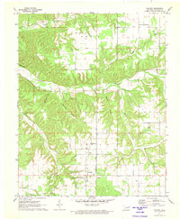
 1971 Spavinaw1973 Print · USGSOklahoma's lake country is captured here in the early seventies, dominated by the massive engineering of the Pensacola Dam. Researchers can trace old family sites at Military Cem, explore the town of Spavinaw, or follow the Old Grade Railroad.
 - 1971 Map of Afton, 1973 Print
 1971 Afton1973 Print · USGSAfton and Bernice sit at the crossroads of Northeastern Oklahoma in the early 1970s, where the turnpike and rail lines meet the Grand Lake shoreline. Genealogists can locate family landmarks like Mt Hope Cem and Sixkiller Cem near the winding Horse Creek.
 - 1971 Map of Bernice, 1973 Print
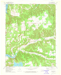
 1971 Bernice1973 Print · USGSDelaware County shoreline and the Neosho River valley appear in detail during the early 1970s as lakefront life centered around Bernice and Cleora. Researchers can trace rural family sites like Wallen Cem, the Cleora Sch, and the winding Old Railroad Grade.2 unique versions available
 - 1971 Map of Chloeta, 1973 Print
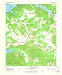 1971 Chloeta1973 Print · USGSDelaware County, Oklahoma, is shown in the early seventies as a landscape of managed wildlife areas and massive reservoirs. Researchers can locate family sites at Yellow Tree Cem, the rural settlement of Chloeta, and the remote Double J Ranch Airfield.2 unique versions available
 - 1971 Map of Colcord NE, 1973 Print
 1971 Colcord NE1973 Print · USGSBenton County, Arkansas, and the surrounding tri-state area are shown in the early seventies as a patchwork of prairie and creek valleys. Researchers can trace the Old Indian Treaty Boundary and locate family burial sites like Wann Cem and Georgia Cem.
 - 1971 Map of Afton NE, 1973 Print
 1971 Afton NE1973 Print · USGSNortheastern Oklahoma in the early seventies shows the intersection of the Missouri-Pacific rail lines and the growing shoreline of Grand Lake. You can trace old transit routes like the Old Railroad Grade and locate family landmarks such as St Elizabeth Mission and Fairland Cem.2 unique versions available
 - 1971 Map of Colcord, 1973 Print
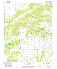
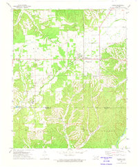
 1971 Colcord1973 Print · USGSThe community of Colcord in the early seventies is revealed here through its rural school-and-church network and complex Ozark terrain. Genealogists can trace family sites at Row Cem, Beck Cem, or the Oldfield Cem near Beaty Creek.
 - 1972 Map of Kansas, 1974 Print
 1972 Kansas1974 Print · USGSNortheastern Oklahoma at the edge of the Cookson Hills reveals a landscape of tight-knit valley communities in the early 1970s. Trace local family history through landmarks like Walnut Grove Mission, the Oaks Cem, and the winding waters of Black Fox Springs.
 - 1972 Map of Leach, 1974 Print
 1972 Leach1974 Print · USGSNortheastern Oklahoma's rural landscape comes into focus during the early seventies, centered on the community of Leach. Genealogists and local historians can trace old community hubs at Lowery Cem, Leach Sch, and the river crossing at Rockyford Ford.2 unique versions available
 - 1972 Map of Siloam Springs NW, 1974 Print
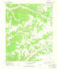
 1972 Siloam Springs NW1974 Print · USGSThe Illinois River valley on the Delaware-Adair county line is shown here in the early 1970s. Researchers can trace rural landmarks like Crittenden Cem, the community of Flint, and the Moseley Sch across the prairie.2 unique versions available
 - 1972 Map of Siloam Springs, 1974 Print
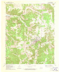
 1972 Siloam Springs1974 Print · USGSSiloam Springs and its rural neighbors are caught in a period of steady growth during the early seventies along the state line. Genealogists and historians can trace family plots at Oak Hill Cemetery or Bell Cem, and locate the historic campus of John Brown University.2 unique versions available
 - 1972 Map of Rose, 1974 Print
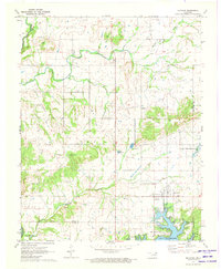
 1972 Rose1974 Print · USGSNortheast Oklahoma in the early 1970s is shown as a network of small family-named settlements and rural schoolhouses. Genealogists can trace family footprints through sites like Little Rock Cem, Smith Chapel, and the Rose Lookout Tower.
 - 1979 Map of Fayetteville, 1980 Print
 1979 Fayetteville1980 Print · USGSNorthwest Arkansas and the tristate corner show a booming corridor of rail-linked towns and highland forests in the late seventies. Researchers can trace historic landmarks like Pea Ridge National Military Park, the Frisco RR, and the University of Arkansas.2 unique versions available
End of results
Showing maps 1-21 of 21
Top cities of Delaware County
- Grove historical maps
- Jay historical maps
- West Siloam Springs historical maps
- Colcord historical maps
- Kansas historical maps
- Bernice historical maps
Frequently asked questions
- What are the different types of historical maps available for Delaware County?
- What is the oldest map of Delaware County?
- Where can I purchase historical maps of Delaware County for my home or office?
- Where can I download high-res historical maps of Delaware County?
- Are there historical topographic maps available for Delaware County?
- Is there historical aerial imagery available for Delaware County?
- Where are historical maps of Delaware County sourced from?