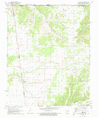
1971 Map of Colcord NE
USGS Topo · Published 1973About this map
Maysville sits at a historic crossroads in the early 1970s, where the Arkansas, Oklahoma, and Missouri borders converge amidst a landscape of prairie and creek bottoms. The western edge of the map is defined by the Old Indian Treaty Boundary, a significant line marking the historical division between state lands and Indian Territory. This survey highlights a rural community anchored by small settlements like Beaty and a series of scattered spiritual and burial sites, including Mount Zion Ch and Pleasant Center Ch. The drainage patterns are intricate, with Honey Creek, Chalybeate Creek, and Beaty Creek carving through the terrain. For genealogists and local historians, the sheet is particularly valuable for its documentation of numerous small family or community cemeteries such as Wann Cem, Lee Cem, and Georgia Cem, which remain as quiet markers of the area's pioneer heritage.
Find a feature on this map
24 named features on this map. Tap any name to fly to it.
Don’t see what you’re looking for? This feature index may not catch every label — zoom into the map to look around manually.
Map Details
Editions of this 1971 Colcord NE Map
This is the sole edition of this map. No revisions or reprints were ever made.
Other maps of this area

1899 · Fayetteville
USGS Topo · 1:125,000

1899 · Siloam Springs
USGS Topo · 1:125,000

1901 · Fayetteville
USGS Topo · 1:125,000

1903 · Siloam Springs
USGS Topo · 1:125,000

1904 · Siloam Springs
USGS Topo · 1:125,000

1904 · Fayetteville
USGS Topo · 1:125,000

1907 · Wyandotte
USGS Topo · 1:125,000

1909 · Wyandotte
USGS Topo · 1:125,000

1940 · Noel
USGS Topo · 1:62,500

1943 · Noel
USGS Topo · 1:62,500