1980s Maps of Garfield County, Oklahoma
Explore 14 historic maps of Garfield County from the 1980s. These maps offer a rare glimpse into what life looked like during the 1980s — showing old roads, neighborhoods, homes, and landmarks that have changed or disappeared over time.
Whether you're researching your family's past, planning a metal detecting trip, or studying how Garfield County's landscape evolved across the 1980s, these high-resolution maps are a powerful tool for exploring the history of this region.
- Focus on a specific era: All maps on this page are from the 1980s, giving you a focused view of this time period.
- See what’s changed: Compare century-old streets, trails, and buildings to today's modern landscape using overlays and satellite layers.
- Research with precision: Use these maps for genealogy, historical research, land use analysis, or educational projects.
- View, download, or print: Maps are fully viewable online in high resolution, and can be downloaded or printed for your own records.
Start exploring Garfield County's history through authentic maps from the 1980s. This is your window into the past.
Garfield County, OK maps
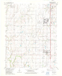
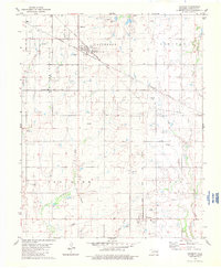
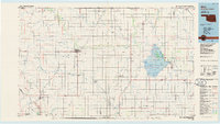
(14)- 1982 Map of Bison
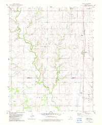 1982 Bison1982 Print · USGSGarfield and Kingfisher Counties are shown here in the early eighties, where historical treaty lines intersect with the Oklahoma energy boom. Researchers can trace the Old Indian Treaty Boundary or locate rural landmarks like Hope Cem and the Pribyl Ranch Landing Strip.2 unique versions available
 - 1982 Map of Barr, 1983 Print
 1982 Barr1983 Print · USGSNorth-central Oklahoma's prairie landscape is captured here in the early eighties, where the Old Indian Treaty Boundary meets a modern energy economy. Researchers can locate family roots at Wildwood Cem and Cimarron Valley Cem or trace rural life around Barr and Kennedy.
 - 1982 Map of Garber, 1983 Print
 1982 Garber1983 Print · USGSGarber and the surrounding Garfield County plains are shown at a peak of energy production in the early eighties. Researchers can trace local lineage at Garber Lutheran Cem and Blackbear Cem or explore the extensive Oil and Gas Field.
 - 1982 Map of Lahoma, 1983 Print
 1982 Lahoma1983 Print · USGSGarfield and Major counties in the early eighties show a landscape of prairie townships and active energy extraction. Genealogists and local researchers can locate Rose Hill Cem, Trinity Ch, and the rail lines of the Burlington Northern.
 - 1982 Map of Waukomis, 1983 Print
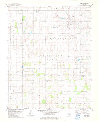
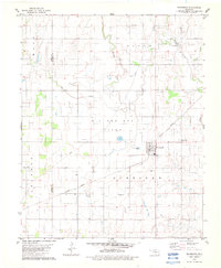
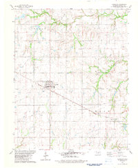
 1982 Waukomis1983 Print · USGSGarfield County is captured in the early eighties as a hub of military aviation, energy production, and small-town life. Researchers can trace the legacy of Vance Air Force Base, the Oil and Gas Field, and local landmarks like Waukomis Cem.
 - 1982 Map of Enid SE, 1983 Print
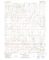
 1982 Enid SE1983 Print · USGSGarfield County in the early eighties shows the expansion of Enid into the surrounding agricultural townships. Researchers can find many rural landmarks like Pioneer-Pleasantvale Sch, Bethany Cem, and the extensive Oil And Gas Field along Skeleton Creek.
 - 1982 Map of Breckinridge, 1983 Print
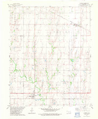
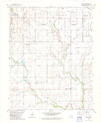
 1982 Breckinridge1983 Print · USGSGarfield County's rural energy and rail corridors are captured in the early eighties as the oil and gas fields shaped the local economy. Genealogists and historians can trace the tracks of the Burlington Northern and locate sites near Breckinridge and Cropper.
 - 1982 Map of Drummond, 1983 Print
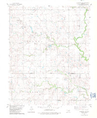
 1982 Drummond1983 Print · USGSDrummond was an active crossroads of industry and agriculture in the early eighties, defined by its rail links and energy production. Researchers can trace the Burlington Northern tracks, locate family plots at Sunnyside Cem, or map the Oil and Gas Field.
 - 1982 Map of Fairmont, 1983 Print
 1982 Fairmont1983 Print · USGSGarfield County’s energy and rail corridors are captured in the early eighties as the petroleum industry reshaped the local economy. Genealogists and historians can trace the town layouts of Fairmont and Douglas or locate family plots at Collett Cem and Zion Cem.
 - 1982 Map of Covington, 1983 Print
 1982 Covington1983 Print · USGSCovington and the surrounding Oklahoma prairie are captured in the early eighties as the regional oil industry and railroad networks matured. Genealogists and researchers can locate St John Cem, the rail siding at Callahan, and the community of Hayward.
 - 1982 Map of Steinerts Lake, 1983 Print
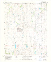
 1982 Steinerts Lake1983 Print · USGSGarfield and Kingfisher Counties are shown here in the early eighties, divided by a historic treaty line. Genealogists can trace family footprints near Bison Cem, Pleasant Valley Ch, and the waters of Steinerts Lake.
 - 1985 Map of Ponca City
 1985 Ponca City1985 Print · USGSNorth-central Oklahoma during the mid-eighties shows a landscape shaped by petroleum and heavy rail. Trace the paths of the Atchison Topeka and Santa Fe through Ponca City or find local landmarks like Northern Oklahoma Junior College and Old Bliss.3 unique versions available
 - 1985 Map of Alva, 1986 Print
 1985 Alva1986 Print · USGSNorthern Oklahoma in the mid-eighties was a landscape of rail-connected prairie towns and unique geologic features. Researchers can trace the legacy of the ATCHISON TOPEKA AND SANTA FE through Alva, locate the State School for Boys, or explore the boundaries of the Great Salt Plains Reservoir.
 - 1986 Map of Fairview
 1986 Fairview1986 Print · USGSMajor County and the Cimarron River valley are shown here in the mid-1980s as the rail networks of the Atchison Topeka and Santa Fe still linked the plains. Researchers can trace rural lineages through settlements like Cheyenne Valley, Bouse Junction, and the terrain surrounding Canton Lake.2 unique versions available
End of results
Showing maps 1-14 of 14
Top cities of Garfield County
- Enid historical maps
- Waukomis historical maps
- North Enid historical maps
- Garber historical maps
- Lahoma historical maps
- Covington historical maps
See more
Frequently asked questions
- What are the different types of historical maps available for Garfield County?
- What is the oldest map of Garfield County?
- Where can I purchase historical maps of Garfield County for my home or office?
- Where can I download high-res historical maps of Garfield County?
- Are there historical topographic maps available for Garfield County?
- Is there historical aerial imagery available for Garfield County?
- Where are historical maps of Garfield County sourced from?