1900s (20th Century) Maps of Garfield County, Oklahoma
Explore 39 historic maps of Garfield County from the 1900s (20th Century). These maps offer a rare glimpse into what life looked like during the 1900s — showing old roads, neighborhoods, homes, and landmarks that have changed or disappeared over time.
Whether you're researching your family's past, planning a metal detecting trip, or studying how Garfield County's landscape evolved across the 1900s, these high-resolution maps are a powerful tool for exploring the history of this region.
- Focus on a specific era: All maps on this page are from the 1900s, giving you a focused view of this time period.
- See what’s changed: Compare century-old streets, trails, and buildings to today's modern landscape using overlays and satellite layers.
- Research with precision: Use these maps for genealogy, historical research, land use analysis, or educational projects.
- View, download, or print: Maps are fully viewable online in high resolution, and can be downloaded or printed for your own records.
Start exploring Garfield County's history through authentic maps from the 1900s. This is your window into the past.
Garfield County, OK maps
(39)- 1955 Map of Enid West, 1957 Print
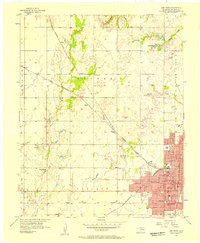 1955 Enid West1957 Print · USGSEnid and the surrounding Garfield County plains are captured here in the mid-fifties during a period of steady civic growth. Researchers can trace the mid-century city grid and its many neighborhood institutions, such as Hoover Sch, Harrison Sch, and the Banner Ch in the nearby countryside.3 unique versions available
 - 1955 Map of Enid East, 1957 Print
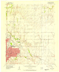 1955 Enid East1957 Print · USGSMid-century Garfield County is revealed as a bustling rail and oil center just as its urban borders began to expand. Genealogists and historians can trace the footprint of Phillips University, the industrial Oil Refinery, and rural landmarks like Pleasant Vale Ch.4 unique versions available
 - 1955 Map of Enid, 1966 Print
 1955 Enid1966 Print · USGSNorth-central Oklahoma's transition from open plains to the blackjack hills of the Osage Indian Reservation is captured in the mid-1950s. Researchers can trace the development of the Naval Reserve Oil Field, the grounds of Vance AFB, and the early footprints of Tulsa and Stillwater.4 unique versions available
 - 1955 Map of Woodward, 1967 Print
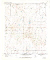
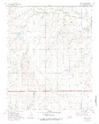
 1955 Woodward1967 Print · USGSNorthwest Oklahoma and the bordering plains are captured during the mid-sixties, showing a landscape defined by river valleys and massive water projects. Researchers can trace family roots in towns like Woodward and Alva or locate landmarks such as the Western Oklahoma State Hospital and Kegelman AF.3 unique versions available
 - 1956 Map of Garber, 1957 Print
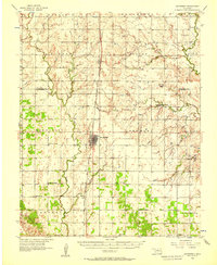
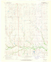
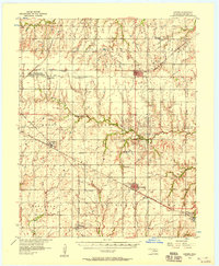 1956 Garber1957 Print · USGSGarfield County in the mid-fifties is a landscape of oil production and railway junctions. Researchers can trace the heritage of rural communities through sites like Sunny Bower Sch, Our Ch, and the old rail siding at Cropper.2 unique versions available
 - 1956 Map of Ames, 1957 Print
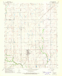
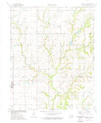
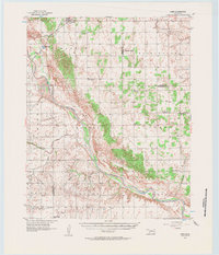 1956 Ames1957 Print · USGSMajor and Garfield counties are captured here in the mid-1950s, centered on the railroad town of Ames and the Cimarron River. Genealogists can trace rural life through landmarks like Antioch Ch, Mound Ridge Sch, and the Cimarron Valley Cem.2 unique versions available
 - 1956 Map of Hennessey, 1957 Print
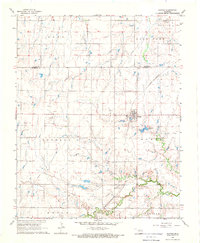
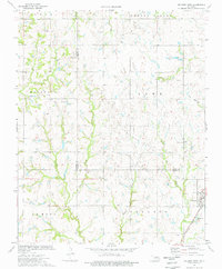
 1956 Hennessey1957 Print · USGSHennessey and the surrounding wheat lands are captured here in the mid-fifties, centered on the busy Chicago Rock Island and Pacific rail corridor. Researchers can trace rural life through landmarks like Lyon Valley Sch (Abandoned), Bison Cem, and Union Chapel.2 unique versions available
 - 1956 Map of Enid, 1957 Print
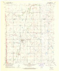
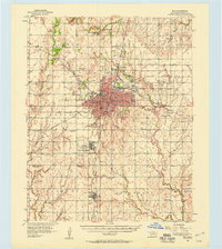 1956 Enid1957 Print · USGSEnid and its surrounding townships thrive in the mid-1950s as a major Oklahoma rail and petroleum hub. Genealogists and historians can trace the foundations of local life at Phillips University, Vance Air Force Base, and rural landmarks like Banner Ch.3 unique versions available
 - 1956 Map of Ringwood, 1957 Print
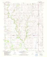
 1956 Ringwood1957 Print · USGSNorthern Oklahoma in the mid-fifties presents a landscape of prairie townships and vital rail hubs. Researchers can trace family roots through numerous rural sites like Pleasant Hill Cem, Parker Ch, and the Vernon Sch (Abandoned).
 - 1958 Map of Enid
 1958 Enid1958 Print · USGSNorthern Oklahoma is mapped here in the late fifties, showcasing a dense network of petroleum production and historic tribal lands. Researchers can trace the legacy of the Osage Indian Reservation, early energy hubs like the Cushing Oil Field, and the Chilocco Indian Agricultural School.2 unique versions available
 - 1958 Map of Woodward
 1958 Woodward1958 Print · USGSNorthwest Oklahoma and the neighboring panhandle borders are shown here during a period of steady mid-century growth. Researchers can trace the rail networks of the Atchison Topeka and Santa Fe and locate landmarks like the Western Oklahoma State Hospital and Port Supply Reservoir.2 unique versions available
 - 1968 Map of Hillsdale, 1969 Print
 1968 Hillsdale1969 Print · USGSNorth-central Oklahoma's agricultural heartland is documented here in the late sixties, just north of Enid. Researchers can trace the Atchison Topeka and Santa Fe line into Hillsdale, locate Hillsdale Cem, and see the early Oil Well sites among the Ninemile Canyons.2 unique versions available
 - 1968 Map of Lamont SE, 1969 Print
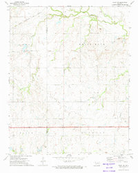
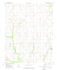
 1968 Lamont SE1969 Print · USGSOklahoma's northern plains are captured here in the late sixties, showing a landscape defined by the Salt Fork drainage and the St Louis - San Francisco railroad. Researchers can trace rural lineages at Mt Vernon Cem and Heitholt Cem or locate mid-century petroleum activity.
 - 1968 Map of Billings, 1969 Print
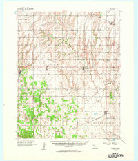
 1968 Billings1969 Print · USGSThe town of Billings and the surrounding plains of Noble and Garfield Counties are captured here in the late sixties. Researchers can trace the diagonal route of the Chicago Rock Island and Pacific railroad and locate local landmarks like Sacred Heart Cem and Billings Union Cem.2 unique versions available
 - 1968 Map of Hunter, 1969 Print
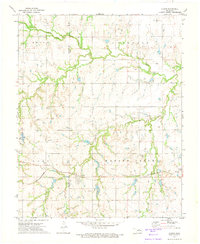
 1968 Hunter1969 Print · USGSThe community of Hunter and the surrounding plains are captured here in the late sixties as the local economy balanced rail transport and oil production. Genealogists and historians can trace the St Louis - San Francisco rail line past White Cem and locate numerous active wells within the West Salt Fork Oil Field.
 - 1968 Map of Kremlin, 1970 Print
 1968 Kremlin1970 Print · USGSGarfield County in the late sixties shows a landscape where prairie agriculture meets industrial development along the rail lines. Genealogists and historians can trace the Kremlin townsite, locate the Valley Center Cem, and map the extent of the Chicago Rock Island and Pacific railroad.2 unique versions available
 - 1969 Map of Jet SE, 1971 Print
 1969 Jet SE1971 Print · USGSNorth-central Oklahoma's plains were defined by competing railroads and sprawling townships in the late sixties. Trace the routes of the Atchison Topeka and Santa Fe and St Louis San Francisco past an early Oil Well.2 unique versions available
 - 1972 Map of Perry NW, 1974 Print
 1972 Perry NW1974 Print · USGSNoble County oil and gas country is captured here in the early seventies during a period of significant highway expansion. Researchers can trace the Chicago Rock Island and Pacific rail line or locate the Palo Cem and White Rock Oil Field.3 unique versions available
 - 1972 Map of Lucien, 1974 Print
 1972 Lucien1974 Print · USGSThe Noble County oil fields and the community of Lucien are captured here during the early seventies. Genealogists and researchers can trace local family landmarks such as Sample Cem, McGuire Cem, and the rail stops of the St Louis - San Francisco.
 - 1974 Map of Marshall West, 1977 Print
 1974 Marshall West1977 Print · USGSThe borderlands of Garfield, Logan, and Kingfisher counties come alive in the mid-1970s, showing a landscape defined by petroleum extraction and rail transport. Trace the local industry through the Skeleton Oil Field or locate family roots near Marshall and the IOOF Cem.
 - 1974 Map of Marshall East, 1977 Print
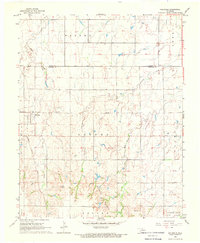
 1974 Marshall East1977 Print · USGSThe Oklahoma prairie at the mid-seventies is captured here as a landscape of agricultural tradition and active petroleum extraction. Researchers can trace rural family histories at Bethel Cem and Bocox Cem or locate industrial sites like the Oil Well near Marshall.
 - 1974 Map of Orlando West, 1977 Print
 1974 Orlando West1977 Print · USGSThe Noble and Logan county line in the mid-1970s shows a landscape of petroleum extraction and rural crossroads. Researchers can trace local genealogy and industry through the Atchison Topeka and Santa Fe rail line, German Cem, and Orlando.
 - 1979 Map of Perry NW, 1984 Print
 1979 Perry NW1984 Print · USGSNoble and Garfield counties are captured here in the late seventies as new highway infrastructure began to reshape the rural landscape. Researchers can trace the Chicago Rock Island and Pacific rail line or locate local landmarks like Antelope Valley Ch and Polo Cem.
 - 1982 Map of Bison
 1982 Bison1982 Print · USGSGarfield and Kingfisher Counties are shown here in the early eighties, where historical treaty lines intersect with the Oklahoma energy boom. Researchers can trace the Old Indian Treaty Boundary or locate rural landmarks like Hope Cem and the Pribyl Ranch Landing Strip.2 unique versions available
 - 1982 Map of Barr, 1983 Print
 1982 Barr1983 Print · USGSNorth-central Oklahoma's prairie landscape is captured here in the early eighties, where the Old Indian Treaty Boundary meets a modern energy economy. Researchers can locate family roots at Wildwood Cem and Cimarron Valley Cem or trace rural life around Barr and Kennedy.
Showing maps 1-25 of 39
Top cities of Garfield County
- Enid historical maps
- Waukomis historical maps
- North Enid historical maps
- Garber historical maps
- Lahoma historical maps
- Covington historical maps
See more
Frequently asked questions
- What are the different types of historical maps available for Garfield County?
- What is the oldest map of Garfield County?
- Where can I purchase historical maps of Garfield County for my home or office?
- Where can I download high-res historical maps of Garfield County?
- Are there historical topographic maps available for Garfield County?
- Is there historical aerial imagery available for Garfield County?
- Where are historical maps of Garfield County sourced from?