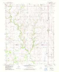
1982 Map of Bison
USGS Topo · Published 1982About this map
The Old Indian Treaty Boundary slices diagonally across this prairie landscape, marking a historical division within the Oklahoma plains. The rural character of the region is defined by a mix of agriculture and energy extraction, as seen in the expansive Sumner Oil and Gas Field and the Hennessey Oil and Gas Field. Settlement is centered around the small community of Bison and the nearby Buffalo Springs. Waterways like Turkey Creek and the curiously named Hell Gone Creek meander through the terrain, which is dotted with remote infrastructure like the Pribyl Ranch Landing Strip and the Miller Landing Strip. Genealogists will find local history at Hope Cem and Hennessey Cem, which serve as quiet markers of the families who settled this portion of Garfield and Kingfisher Counties.
Find a feature on this map
18 named features on this map. Tap any name to fly to it.
Don’t see what you’re looking for? This feature index may not catch every label — zoom into the map to look around manually.
Map Details
Editions of this 1982 Bison Map
2 editions found
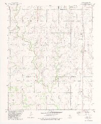
Other maps of this area

1893 · Hennessey
USGS Topo · 1:62,500

1893 · Ames
USGS Topo · 1:62,500

1955 · Enid
USGS Topo · 1:250,000

1955 · Woodward
USGS Topo · 1:250,000

1956 · Ames
USGS Topo · 1:62,500

1956 · Hennessey
USGS Topo · 1:62,500

1956 · Enid
USGS Topo · 1:62,500

1956 · Ringwood
USGS Topo · 1:62,500

1958 · Enid
USGS Topo · 1:250,000

1958 · Woodward
USGS Topo · 1:250,000