Loading...
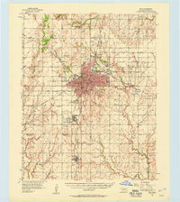
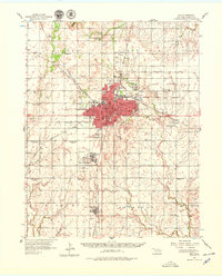
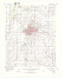
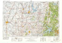
Loading map...1956 Map of Enid
USGS Topo · Published 1957About this map
Enid serves as the industrial and educational anchor of Garfield County in the mid-1950s, defined by its complex network of converging railroads including the St Louis San Francisco and the Chicago Rock Island and Pacific. The city's landscape is marked by the presence of Phillips University and the Enid State Sch, while an Oil Refinery and numerous Oil Tanks highlight the region's energy-based economy. To the south, the massive footprint of Vance Air Force Base stands in contrast to the surrounding rural townships.
Find a feature on this map
71 named features on this map. Tap any name to fly to it.
Don’t see what you’re looking for? This feature index may not catch every label — zoom into the map to look around manually.
Map Details
Date Portrayed1956
Date Published1957
PublisherU.S. Geological Survey
Map TypeTopographic
Scale1:62,500
Physical Dimensions19 x 21.4 inches
Editions of this 1956 Enid Map
3 editions found
Historical Maps of Enid Through Time
4 maps found


Featured Locations
Source Details
SourceU.S. Geological Survey
CopyrightPublic Domain