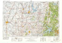
1956 Map of Enid
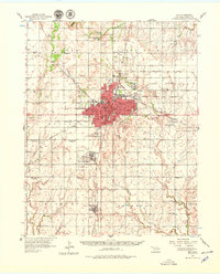
USGS Topo · Published 1979About this map
The railroad hub of Enid dominates this mid-century landscape, serving as a vital intersection for the Atchison Topeka and Santa Fe, the Chicago Rock Island and Pacific, and the St Louis and San Francisco lines. This industrial and agricultural center is detailed through its various public institutions, from the Enid State Sch to the expansive Oil Refinery and Oil Tanks that reflect the region's energy economy. To the south, Vance Air Force Base stands as a significant military presence, while the surrounding countryside is dotted with rural schools like the Spring Valley Sch and Pioneer Sch. Several markers of earlier settlement patterns are preserved here, including the Turkey Creek Sch (Abandoned) and Highland Sch (Abandoned). Local landmarks such as Lake Hellums and Government Springs Park offer a view into the community's recreational spaces during this era of growth.
Find a feature on this map
73 named features on this map. Tap any name to fly to it.
Don’t see what you’re looking for? This feature index may not catch every label — zoom into the map to look around manually.
Map Details
Editions of this 1956 Enid Map
3 editions found
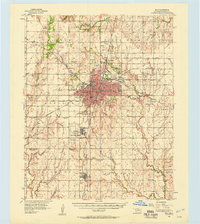
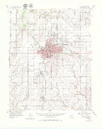
Historical Maps of Enid Through Time
4 maps found