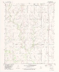
1982 Map of Bison
USGS Topo · Published 1982About this map
Turkey Creek and Buffalo Creek wind through this central Oklahoma landscape, where the agricultural sections of Sumner and Washington townships meet. The map documents a rural environment shaped by natural water sources like Buffalo Springs and the meandering paths of Hell Creek and Gone Creek. The Old Indian Treaty Boundary runs north-to-south through the center of the sheet, providing a historical marker of land division that predates the grid of the Oil and Gas Field development seen here. Cultural landmarks include the community of Bison and two local burial grounds, Hope Cem and Hennessey Cem. The presence of the Pribyl Ranch Landing Strip and Miller Landing Strip indicates the importance of private aviation for local ranching and industry during the early 1980s.
Find a feature on this map
19 named features on this map. Tap any name to fly to it.
Don’t see what you’re looking for? This feature index may not catch every label — zoom into the map to look around manually.
Map Details
Editions of this 1982 Bison Map
2 editions found
Other maps of this area

1893 · Hennessey
USGS Topo · 1:62,500

1893 · Ames
USGS Topo · 1:62,500

1955 · Enid
USGS Topo · 1:250,000

1955 · Woodward
USGS Topo · 1:250,000

1956 · Ames
USGS Topo · 1:62,500

1956 · Hennessey
USGS Topo · 1:62,500

1956 · Enid
USGS Topo · 1:62,500

1956 · Ringwood
USGS Topo · 1:62,500

1958 · Enid
USGS Topo · 1:250,000

1958 · Woodward
USGS Topo · 1:250,000