2020s Maps of Geary, Oklahoma
Explore 3 historic maps of Geary from the 2020s. These maps offer a rare glimpse into what life looked like during the 2020s — showing old roads, neighborhoods, homes, and landmarks that have changed or disappeared over time.
Whether you're researching your family's past, planning a metal detecting trip, or studying how Geary's landscape evolved across the 2020s, these high-resolution maps are a powerful tool for exploring the history of this region.
- Focus on a specific era: All maps on this page are from the 2020s, giving you a focused view of this time period.
- See what’s changed: Compare century-old streets, trails, and buildings to today's modern landscape using overlays and satellite layers.
- Research with precision: Use these maps for genealogy, historical research, land use analysis, or educational projects.
- View, download, or print: Maps are fully viewable online in high resolution, and can be downloaded or printed for your own records.
Start exploring Geary's history through authentic maps from the 2020s. This is your window into the past.
Geary, OK maps
(3)- 2022 Map of Geary North, 2022 Print
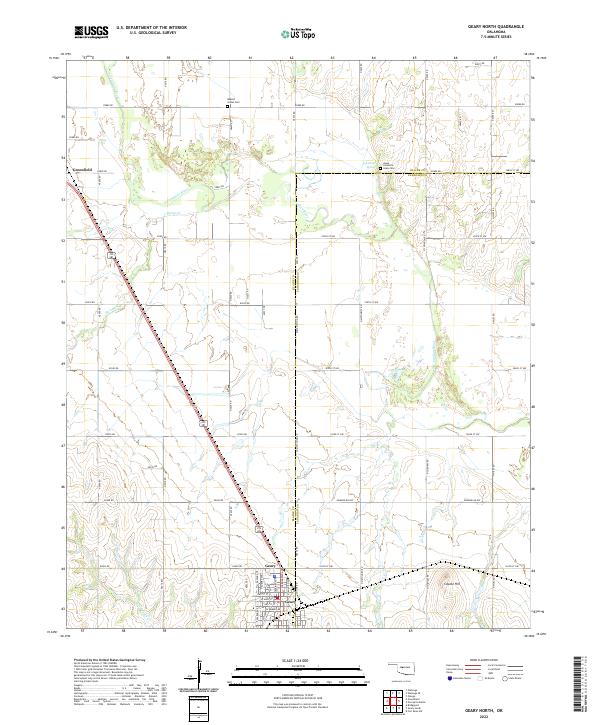 2022 Geary North2022 Print · USGSThe river bottomlands and prairies of Blaine and Canadian counties appear here in the early twenty-first century. Genealogists and historians can locate the Jesse Chisholm Grave Site, the Indian Cem, and the town of Geary.
 - 2022 Map of Fort Reno SW, 2022 Print
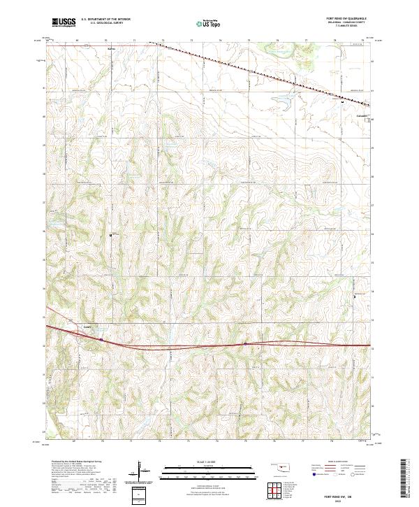 2022 Fort Reno SW2022 Print · USGSCanadian County is captured here in the early twenty-first century, showcasing a landscape of section-line roads and prairie reservoirs. Genealogists can locate family landmarks like Sunny Hill Cem and Calumet Cem or trace the winding course of Powder Face Cr.
 - 2022 Map of Geary South, 2022 Print
 2022 Geary South2022 Print · USGSCentral Oklahoma's river-carved landscape is documented here, showing the convergence of three counties along the Canadian River. Genealogists and historians can trace local roots at Graceland Cem, follow the path of Old 66 Rd, or locate the Hinton Municipal Airport.
End of results
Showing maps 1-3 of 3
Top cities near Geary
- El Reno historical maps
- Hinton historical maps
- Calumet historical maps
- Greenfield historical maps
- Bridgeport historical maps
- Lookeba historical maps
Frequently asked questions
- What are the different types of historical maps available for Geary?
- What is the oldest map of Geary?
- Where can I purchase historical maps of Geary for my home or office?
- Where can I download high-res historical maps of Geary?
- Are there historical topographic maps available for Geary?
- Is there historical aerial imagery available for Geary?
- Where are historical maps of Geary sourced from?