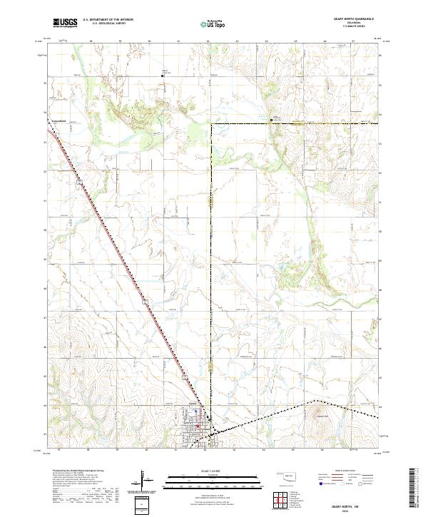
2022 Map of Geary North
USGS Topo · Published 2022About this map
The Jesse Chisholm Grave Site sits north of the N Canadian River, marking a point of deep historical significance on this map along the border of Blaine and Canadian counties. The landscape is defined by the winding river valley and its tributaries like Horse Cr and Lumpmouth Cr, which shape the rural section lines and local roads. To the south, the city of Geary serves as a primary hub, while the smaller settlement of Greenfield occupies the western edge.
Find a feature on this map
93 named features on this map. Tap any name to fly to it.
Don’t see what you’re looking for? This feature index may not catch every label — zoom into the map to look around manually.
Map Details
Editions of this 2022 Geary North Map
This is the sole edition of this map. No revisions or reprints were ever made.
Other maps of this area

1893 · Fort Reno
USGS Topo · 1:62,500

1893 · Loyal
USGS Topo · 1:62,500

1941 · Fort Reno
USGS Topo · 1:62,500

1942 · Fort Reno
USGS Topo · 1:62,500

1942 · Geary
USGS Topo · 1:62,500

1949 · Fort Reno
USGS Topo · 1:62,500

1955 · Clinton
USGS Topo · 1:250,000

1957 · Clinton
USGS Topo · 1:250,000

1967 · Fort Reno SW
USGS Topo · 1:24,000

1972 · Watonga
USGS Topo · 1:24,000