2020s Maps of Grant County, Oklahoma
Explore 24 historic maps of Grant County from the 2020s. These maps offer a rare glimpse into what life looked like during the 2020s — showing old roads, neighborhoods, homes, and landmarks that have changed or disappeared over time.
Whether you're researching your family's past, planning a metal detecting trip, or studying how Grant County's landscape evolved across the 2020s, these high-resolution maps are a powerful tool for exploring the history of this region.
- Focus on a specific era: All maps on this page are from the 2020s, giving you a focused view of this time period.
- See what’s changed: Compare century-old streets, trails, and buildings to today's modern landscape using overlays and satellite layers.
- Research with precision: Use these maps for genealogy, historical research, land use analysis, or educational projects.
- View, download, or print: Maps are fully viewable online in high resolution, and can be downloaded or printed for your own records.
Start exploring Grant County's history through authentic maps from the 2020s. This is your window into the past.
Grant County, OK maps
(24)- 2022 Map of Nardin, 2022 Print
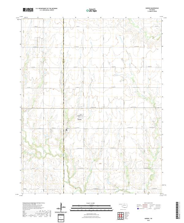 2022 Nardin2022 Print · USGSThe Kay and Grant County line area comes into focus in this recent survey of Nardin and its surrounding prairies. Researchers can trace local heritage through the streets of Nardin and the nearby Mount Olive Cem, or follow the winding paths of Thompson Cr and Big Antelope Cr.
 - 2022 Map of Eddy, 2022 Print
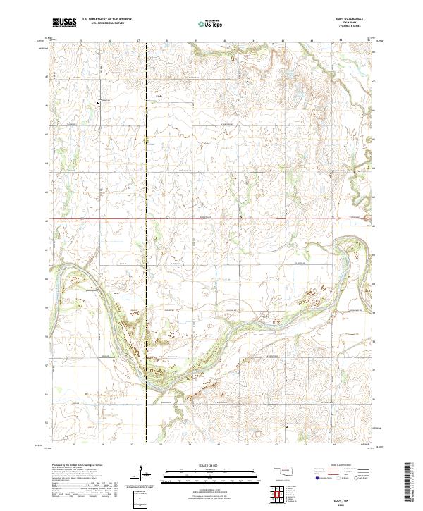 2022 Eddy2022 Print · USGSNorthwestern Oklahoma farmland meets the winding Salt Fork Arkansas River in this modern survey of the border between Grant and Kay counties. Researchers can locate the community of Eddy and trace family heritage at New Hope Cem or Riverview Cem.
 - 2022 Map of Medford NE, 2022 Print
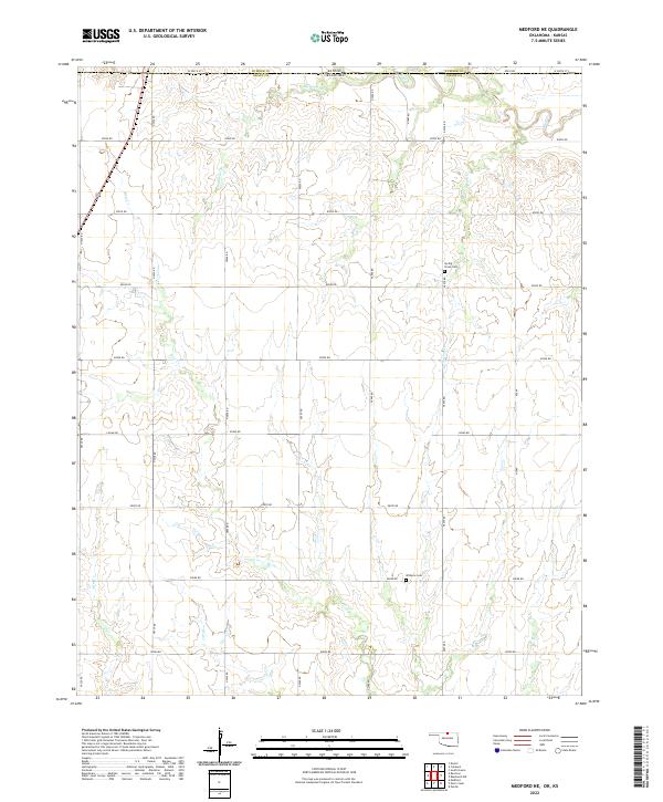 2022 Medford NE2022 Print · USGSThe Kansas-Oklahoma border comes alive in this 2020s survey of Grant and Sumner counties. Genealogists and local researchers can trace the rural landscape through the section-line roads and family histories tied to Spring Creek Cemetery and Williams Cemetery.
 - 2022 Map of Lamont NW, 2022 Print
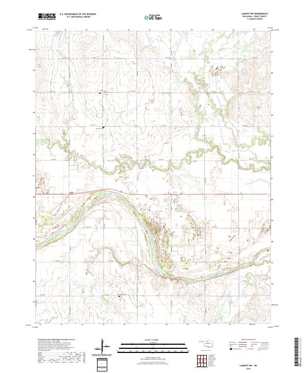 2022 Lamont NW2022 Print · USGSOklahoma's northern prairie landscape is captured in this contemporary look at Grant County's rural township sections. Genealogists can pin down family land near landmarks like Liberty Cem, Goldsmith Cem, and the shifting banks of the Salt Fork Arkansas River.
 - 2022 Map of Lamont SE, 2022 Print
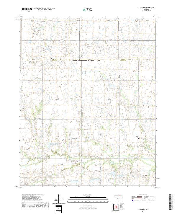 2022 Lamont SE2022 Print · USGSNear the Garfield and Grant county line in the early 2020s, this area shows a landscape shaped by agricultural grid roads and modern water management. Genealogists and local historians can locate Mount Vernon Cem, Heitholt Cem, and the small Bobbitt Airport among the forks of Red Rock Cr.
 - 2022 Map of Blackwell NW, 2022 Print
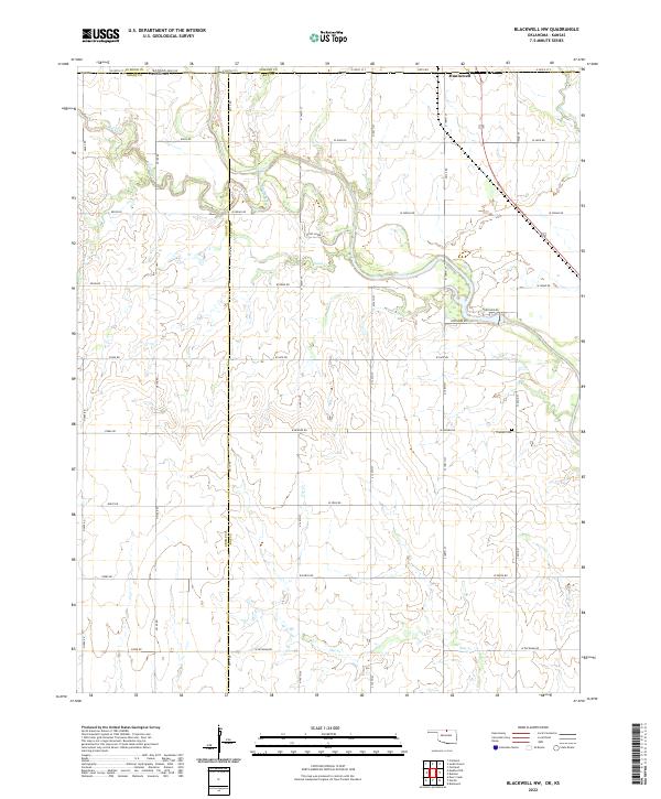 2022 Blackwell NW2022 Print · USGSThe Kansas-Oklahoma borderlands south of Hunnewell are mapped here in the early 2020s. Genealogists and local historians can trace rural landmarks and family plots like Triumph Cemetery and the many winding branches of Bluff Creek.
 - 2022 Map of Pond Creek NW, 2022 Print
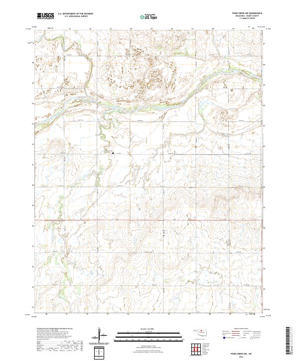 2022 Pond Creek NW2022 Print · USGSGrant County is captured in this recent survey of northern Oklahoma’s river valleys and agricultural plains. Researchers can locate family landmarks like Friends Cem and Mount Zion Cem along the Salt Fork Arkansas River.
 - 2022 Map of Medford, 2022 Print
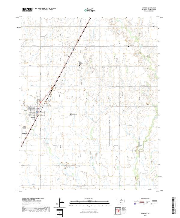 2022 Medford2022 Print · USGSMedford serves as the Grant County seat in this modern survey of the North Central Oklahoma prairie. Genealogists and historians can trace several community-defining landmarks, including the Grant County Courthouse, Czecko Slovak Cem, and Rosemound Cem.
 - 2022 Map of Manchester, 2022 Print
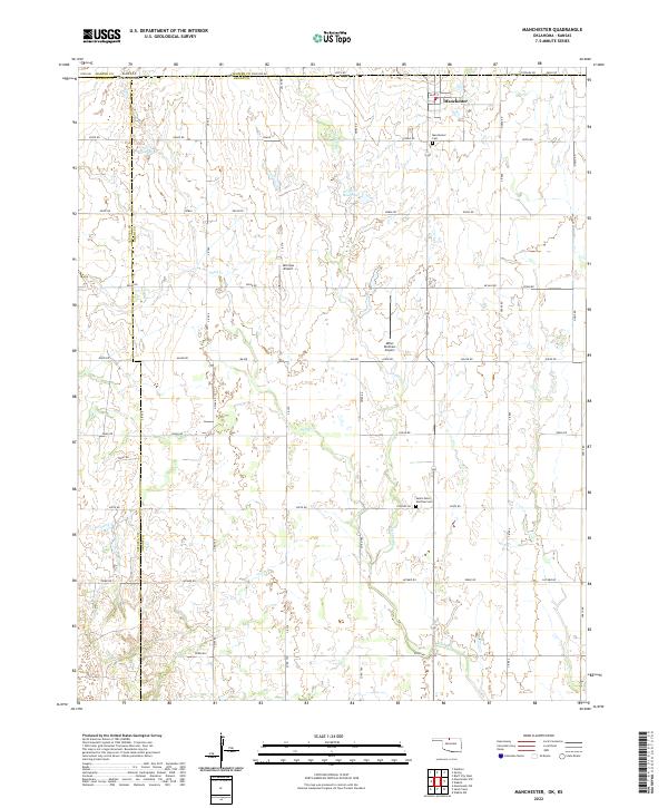 2022 Manchester2022 Print · USGSManchester sits right on the state line in the early 2020s, anchoring a landscape of rural farmsteads and grid-line roads. Researchers can trace family sites at Manchester Cem and Saints Peter and Paul Cem or locate McCrays Airport.
 - 2022 Map of Jet SE, 2022 Print
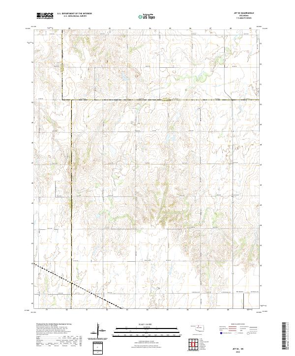 2022 Jet SE2022 Print · USGSThe Alfalfa, Grant, and Garfield county borders meet in this agricultural landscape mapped in the 2020s. Researchers can trace rural aviation at Tlc Airport and the seasonal hydrology of Coldwater Cr and Wagon Cr.
 - 2022 Map of Wakita SE, 2022 Print
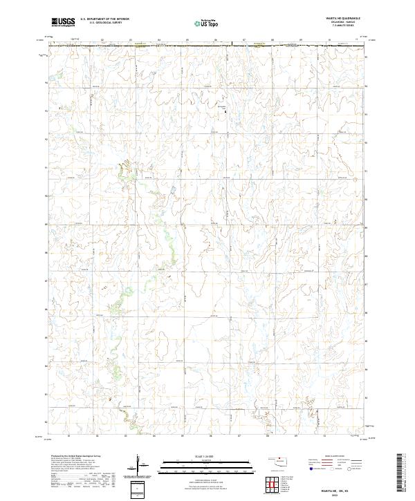
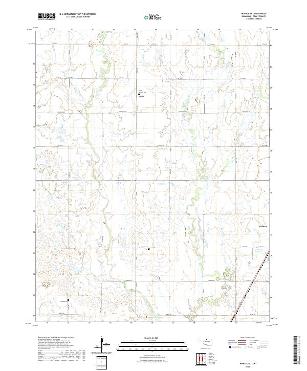 2022 Wakita SE2022 Print · USGSNorthern Oklahoma's rural landscape comes into focus in this recent survey of the country near the Kansas border. Genealogists can locate several family burial sites, including Saint Anthony Cem near Clyde and Klondike Cem further south.
 - 2022 Map of Hillsdale, 2022 Print
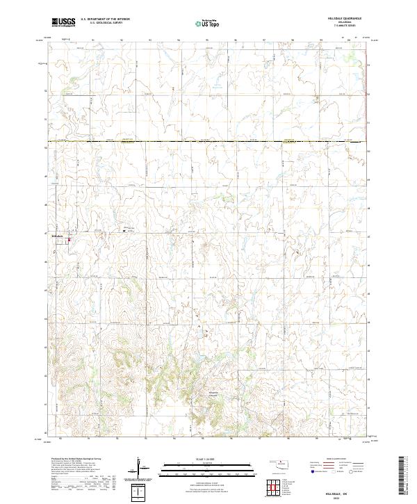 2022 Hillsdale2022 Print · USGSNorth-central Oklahoma's agricultural heartland is documented here in the early twenty-first century, spanning the border of Grant and Garfield Counties. Genealogists and local historians can locate the Hillsdale Cemetery and trace the paths of Sand Creek and the Ninemile Canyons.
 - 2022 Map of Hunter, 2022 Print
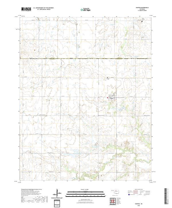 2022 Hunter2022 Print · USGSHunter and the surrounding Garfield County farmland are captured here in the early 2020s, showing a landscape defined by prairie agriculture and modern reservoirs. Genealogists can trace family connections at White Cem or follow the shoreline of Thompson Lake.
 - 2022 Map of Wakita, 2022 Print
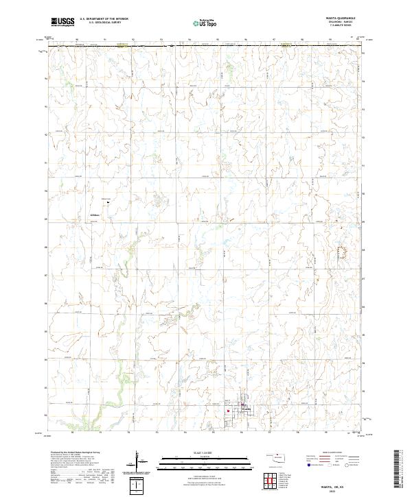 2022 Wakita2022 Print · USGSGrant County is captured in the early 2020s, showing the intersection of local town life and the wide agricultural grid of the Oklahoma borderlands. Researchers can trace the layout of Wakita, locate the Gibbon Cem, and follow the path of Duel Cr.
 - 2022 Map of Billings, 2022 Print
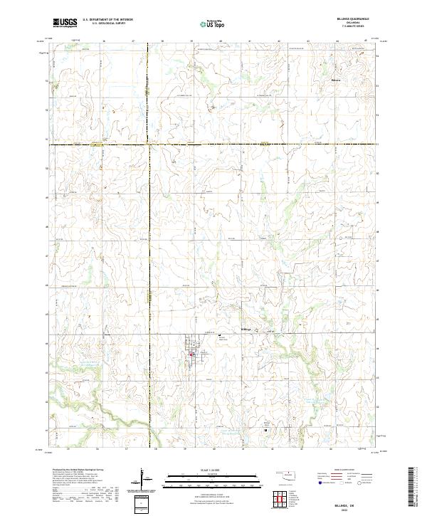 2022 Billings2022 Print · USGSThe north-central Oklahoma plains around the turn of the 2020s are captured here, centered on the historic town of Billings. Genealogists and local researchers can trace the rural landscape across four counties, identifying the site of Alcorn and the local road network.
 - 2022 Map of Renfrow, 2022 Print
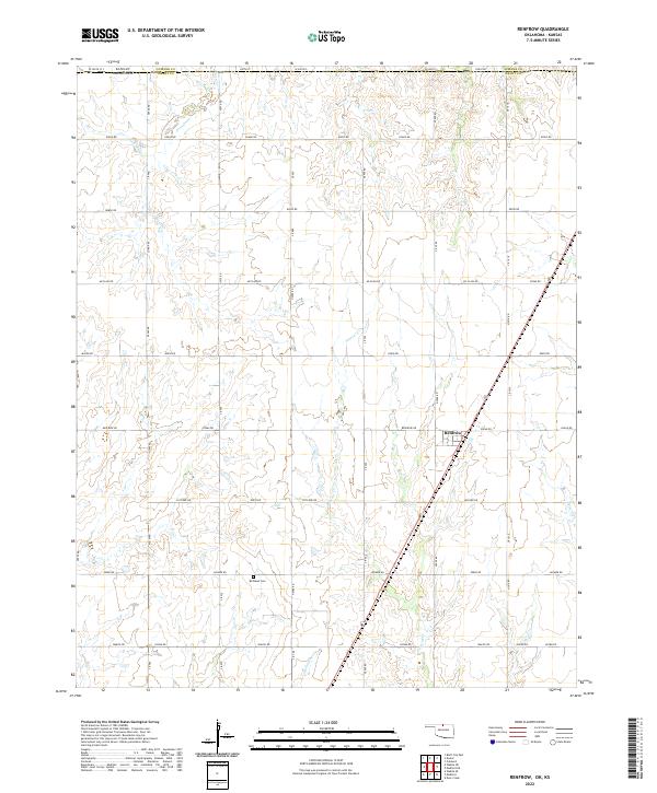 2022 Renfrow2022 Print · USGSThe northern edge of Oklahoma at the border of Kansas remains a landscape of deep-rooted agricultural grids and prairie drainage. Genealogists and local historians can locate the Richland Cem and trace the paths of Wolf Cr and Polecat Cr through the township.
 - 2022 Map of Wakita NE, 2022 Print
 2022 Wakita NE2022 Print · USGSThe northern edge of Grant County at the Kansas state line is captured here in recent years, showing a landscape defined by traditional section lines. Genealogists can locate Springdale Cem while tracing the waters of Pond Cr and Osage Cr.
 - 2022 Map of Pond Creek, 2022 Print
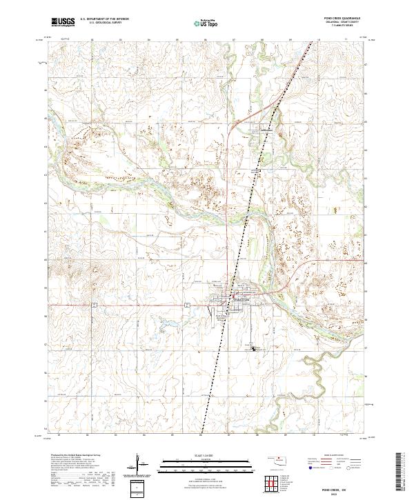 2022 Pond Creek2022 Print · USGSGrant County’s agricultural heartland is documented here in the early twenty-first century, centered on the historic settlements of Pond Creek and Jefferson. Researchers can locate several burial grounds including Saint Josephs Cem and trace the path of the Salt Fork Arkansas River.
 - 2022 Map of Kremlin, 2022 Print
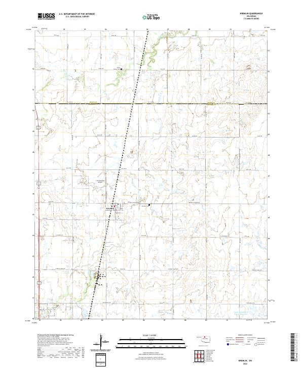 2022 Kremlin2022 Print · USGSKremlin and the border between Garfield and Grant counties are captured in this recent survey of Oklahoma's prairie farmland. Researchers can locate family sites near the Kremlin Cem, Valley Center Cem, and the F W Zaloudek Airport.
 - 2022 Map of Wakita SW, 2022 Print
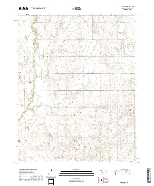 2022 Wakita SW2022 Print · USGSGrant County’s rural landscape is captured here in the early twenty-first century, showing the enduring grid of section-line roads and prairie drainages. Genealogists and local historians can locate Gilbert and the Wakita Cem or trace the winding courses of Duel Cr and Spring Cr.
 - 2022 Map of Deer Creek, 2022 Print
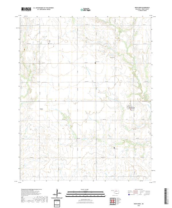 2022 Deer Creek2022 Print · USGSDeer Creek and its surrounding plains are documented in the early twenty-first century, showing the enduring grid of Oklahoma's wheat country. Genealogists can trace early area residents through rural burial grounds like Saint Marys Cem, Darland Cem, and Bayard Cem.
 - 2022 Map of Lamont, 2022 Print
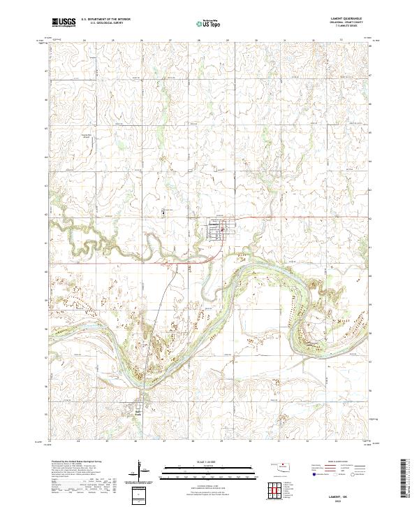 2022 Lamont2022 Print · USGSGrant County's agricultural heartland is documented here in the early twenty-first century as the local road network surrounds the Salt Fork Arkansas River. Genealogists and researchers can locate Lamont Cem and trace early family footprints near the town of Lamont.
 - 2022 Map of Sand Creek, 2022 Print
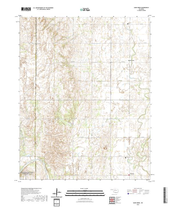 2022 Sand Creek2022 Print · USGSNorth-central Oklahoma's agricultural heartland is documented here, showing the rural communities of Sand Creek and Hawley as they appeared in 2022. Local researchers can locate family burial sites at Fairview Cem and trace the winding course of the Salt Fork Arkansas River.
 - 2022 Map of Nash, 2022 Print
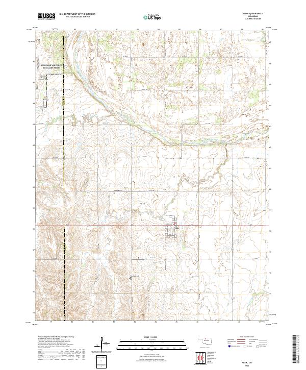 2022 Nash2022 Print · USGSThe northern Oklahoma plains around Nash are captured here in the early twenty-first century as a land of structured farms and military aviation. Trace family roots at Dunkard Cemetery and New Home Cemetery near the Salt Fork Arkansas River.
End of results
Showing maps 1-24 of 24
Top cities of Grant County
- Medford historical maps
- Pond Creek historical maps
- Lamont historical maps
- Wakita historical maps
- Nash historical maps
- Deer Creek historical maps
See more
Frequently asked questions
- What are the different types of historical maps available for Grant County?
- What is the oldest map of Grant County?
- Where can I purchase historical maps of Grant County for my home or office?
- Where can I download high-res historical maps of Grant County?
- Are there historical topographic maps available for Grant County?
- Is there historical aerial imagery available for Grant County?
- Where are historical maps of Grant County sourced from?