Old Maps of Grant County, Oklahoma for Hiking & Exploration
Hike through history with 151 historic maps of Grant County. Explore old trails, ghost towns, and forgotten backroads — perfect for outdoor adventurers and local explorers.
- Rediscover forgotten places: Map out old mining camps, roads, and footpaths that no longer exist on modern maps.
- Layer with modern tools: Combine with LiDAR or satellite views to plan hikes through historical terrain.
- Made for exploration: Popular among hikers, overlanders, and local history lovers.
Use these maps to find adventure and explore the hidden past of Grant County.
Grant County, OK maps
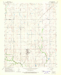
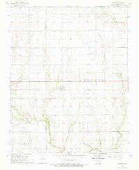
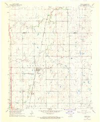
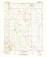
(151)- 1955 Map of Enid, 1966 Print
 1955 Enid1966 Print · USGSNorth-central Oklahoma's transition from open plains to the blackjack hills of the Osage Indian Reservation is captured in the mid-1950s. Researchers can trace the development of the Naval Reserve Oil Field, the grounds of Vance AFB, and the early footprints of Tulsa and Stillwater.4 unique versions available
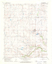
 - 1955 Map of Woodward, 1967 Print
 1955 Woodward1967 Print · USGSNorthwest Oklahoma and the bordering plains are captured during the mid-sixties, showing a landscape defined by river valleys and massive water projects. Researchers can trace family roots in towns like Woodward and Alva or locate landmarks such as the Western Oklahoma State Hospital and Kegelman AF.3 unique versions available
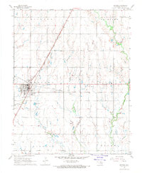
 - 1958 Map of Enid
 1958 Enid1958 Print · USGSNorthern Oklahoma is mapped here in the late fifties, showcasing a dense network of petroleum production and historic tribal lands. Researchers can trace the legacy of the Osage Indian Reservation, early energy hubs like the Cushing Oil Field, and the Chilocco Indian Agricultural School.2 unique versions available
 - 1958 Map of Woodward
 1958 Woodward1958 Print · USGSNorthwest Oklahoma and the neighboring panhandle borders are shown here during a period of steady mid-century growth. Researchers can trace the rail networks of the Atchison Topeka and Santa Fe and locate landmarks like the Western Oklahoma State Hospital and Port Supply Reservoir.2 unique versions available
 - 1968 Map of Hillsdale, 1969 Print
 1968 Hillsdale1969 Print · USGSNorth-central Oklahoma's agricultural heartland is documented here in the late sixties, just north of Enid. Researchers can trace the Atchison Topeka and Santa Fe line into Hillsdale, locate Hillsdale Cem, and see the early Oil Well sites among the Ninemile Canyons.2 unique versions available
 - 1968 Map of Lamont SE, 1969 Print
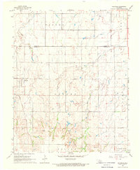
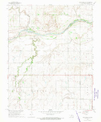
 1968 Lamont SE1969 Print · USGSOklahoma's northern plains are captured here in the late sixties, showing a landscape defined by the Salt Fork drainage and the St Louis - San Francisco railroad. Researchers can trace rural lineages at Mt Vernon Cem and Heitholt Cem or locate mid-century petroleum activity.
 - 1968 Map of Lamont NW, 1969 Print
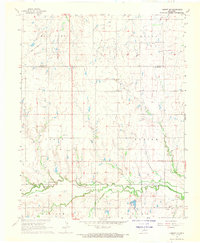
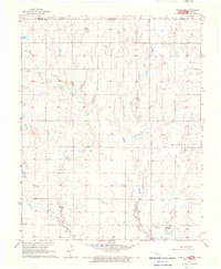
 1968 Lamont NW1969 Print · USGSGrant County’s agricultural and petroleum landscape is captured here in the late sixties as industry moved across the northern prairie. Trace family lands near Liberty Cem or follow the Salt Fork Arkansas River past Dolan Bridge.
 - 1968 Map of Deer Creek, 1969 Print
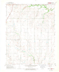
 1968 Deer Creek1969 Print · USGSGrant County in the late sixties shows a landscape where prairie farming meets the energy industry. Genealogists can locate St Marys Cem and Darland Cem while tracing the Atchison Topeka and Santa Fe rail line through Numa.2 unique versions available
 - 1968 Map of Billings, 1969 Print
 1968 Billings1969 Print · USGSThe town of Billings and the surrounding plains of Noble and Garfield Counties are captured here in the late sixties. Researchers can trace the diagonal route of the Chicago Rock Island and Pacific railroad and locate local landmarks like Sacred Heart Cem and Billings Union Cem.2 unique versions available
 - 1968 Map of Hunter, 1969 Print
 1968 Hunter1969 Print · USGSThe community of Hunter and the surrounding plains are captured here in the late sixties as the local economy balanced rail transport and oil production. Genealogists and historians can trace the St Louis - San Francisco rail line past White Cem and locate numerous active wells within the West Salt Fork Oil Field.
 - 1968 Map of Eddy, 1969 Print
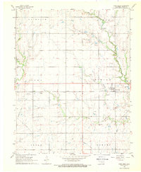
 1968 Eddy1969 Print · USGSNorth Central Oklahoma's river bottomlands are captured here in the late sixties at the junction of the Arkansas River and Salt Fork. Local historians can trace the St Louis-San Francisco rail line through Eddy or locate the New Home Cem.
 - 1968 Map of Blackwell NW, 1970 Print
 1968 Blackwell NW1970 Print · USGSThe Oklahoma-Kansas borderlands are captured here in the late sixties, where the Chikaskia River winds through the northern prairie. Researchers can trace rural genealogy and industry through sites like Triumph Cem, the Asbury Ch, and the extensive Webb North Oil Field.2 unique versions available
 - 1968 Map of Nardin, 1970 Print
 1968 Nardin1970 Print · USGSThe northern Oklahoma prairie comes into focus in the late sixties as a crossroads of the energy industry and heavy rail. Genealogists and historians can trace the Atchison Topeka and Santa Fe through Nardin or locate the Mt Oliver Cem.
 - 1968 Map of Wakita, 1970 Print
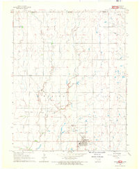 1968 Wakita1970 Print · USGSGrant County, Oklahoma, was a thriving center for the energy industry and rail transport during the late sixties. Researchers can trace the Atchison Topeka and Santa Fe rail line through Wakita or locate the Gibbon Cem and Gibbon settlement.
 - 1968 Map of Wakita SE, 1970 Print
 1968 Wakita SE1970 Print · USGSGrant County grain and rail networks were well established by the late sixties, centered on the small hub of Clyde. Genealogists can trace family history at Klondike Cem or Fairview Cem and follow the route of the Atchison Topeka and Santa Fe.
 - 1968 Map of Renfrow, 1970 Print
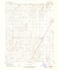 1968 Renfrow1970 Print · USGSNorthern Oklahoma prairie life in the late sixties centers on the rail corridor and expanding energy fields. Researchers can trace the Chicago Rock Island and Pacific line through Renfrow or locate the Richland Cem and early Gas Wells.
 - 1968 Map of Kremlin, 1970 Print
 1968 Kremlin1970 Print · USGSGarfield County in the late sixties shows a landscape where prairie agriculture meets industrial development along the rail lines. Genealogists and historians can trace the Kremlin townsite, locate the Valley Center Cem, and map the extent of the Chicago Rock Island and Pacific railroad.2 unique versions available
 - 1968 Map of Medford, 1970 Print
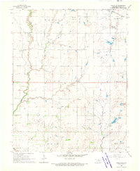
 1968 Medford1970 Print · USGSMedford and its surrounding townships are mapped here during the late sixties, showing a landscape shaped by two major railroads. Researchers can locate specific sites like the Czecho Slovak Cem, the Numa Field oil and gas district, and the Medford Municipal Airport.2 unique versions available
 - 1968 Map of Lamont, 1970 Print
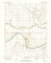
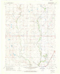
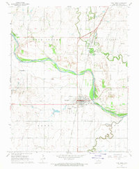
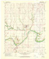 1968 Lamont1970 Print · USGSGrant County, Oklahoma, comes into focus in the late sixties as a landscape of river bends and oil derricks. Genealogists and historians can trace the foundations of Lamont and the Salt Fork community, including the local High Sch and the St Louis-San Francisco rail line.
 - 1968 Map of Medford NE, 1970 Print
 1968 Medford NE1970 Print · USGSThe Kansas-Oklahoma border comes to life in the late sixties as the Chicago and Rock Island Pacific railroad connects local industry and agriculture. Researchers can trace rural community roots at North Star Ch or locate mid-century landmarks like the Drive-in Theater and Spring Creek Cem.2 unique versions available
 - 1968 Map of Pond Creek, 1970 Print
 1968 Pond Creek1970 Print · USGSGrant County is captured here in the late sixties, showing the vital rail and river networks that sustained these northern Oklahoma plains. Researchers can locate family sites near Pond Creek, trace the Chicago Rock Island and Pacific tracks, or find local landmarks like St Josephs Cem and the County Fairground.
 - 1968 Map of Pond Creek NW, 1970 Print
 1968 Pond Creek NW1970 Print · USGSOklahoma's northern plains in the late sixties were defined by the wide curves of the Salt Fork Arkansas River and its rural community hubs. Researchers can trace land ties at Friends Cem, locate the Riverdale Community Hall, or find the Biby Landing Strip.2 unique versions available
 - 1968 Map of Wakita NE, 1970 Print
 1968 Wakita NE1970 Print · USGSThe Oklahoma-Kansas borderlands in the late sixties reveal a landscape of rural townships and active energy exploration. Genealogists and local historians can trace the Wakita Trend Gas Field and family sites near Springdale Cem or Pond Creek.
 - 1968 Map of Wakita SW, 1970 Print
 1968 Wakita SW1970 Print · USGSGrant County is captured in the late sixties as energy exploration reshapes its rural townships. Family history researchers can find Gilbert, Wakita Cem, and Gore Sch alongside the tracks of the Atchison Topeka and Santa Fe railroad.2 unique versions available
 - 1969 Map of Manchester, 1971 Print
 1969 Manchester1971 Print · USGSThe Oklahoma-Kansas state line meets at the town of Manchester in the late sixties, where the local economy follows the tracks of the Atchison Topeka and Santa Fe. Genealogists can locate family sites like the IOOF Cem or the SS Peter and Paul Cem and its nearby church.2 unique versions available
Showing maps 1-25 of 151
Top cities of Grant County
- Medford historical maps
- Pond Creek historical maps
- Lamont historical maps
- Wakita historical maps
- Nash historical maps
- Deer Creek historical maps
See more
Frequently asked questions
- What are the different types of historical maps available for Grant County?
- What is the oldest map of Grant County?
- Where can I purchase historical maps of Grant County for my home or office?
- Where can I download high-res historical maps of Grant County?
- Are there historical topographic maps available for Grant County?
- Is there historical aerial imagery available for Grant County?
- Where are historical maps of Grant County sourced from?