
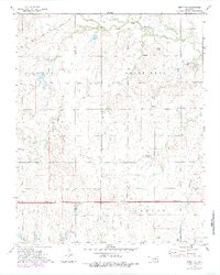
1968 Map of Lamont SE
USGS Topo · Published 1969About this map
The Southeast Salt Fork of the Salt Fork Arkansas River defines the northern drainage of this Oklahoma landscape, where the land transitions into the township boundaries of Alfalfa, Noble, and Blaine. Toward the south, Red Rock Creek meanders across the territory, flanked by a network of smaller tributaries including Wolf Creek, Hereford Creek, and Negro Creek. The mid-century petroleum and infrastructure of the region are evident through several scattered Oil Wells, a Drill Hole, and a Gravel Pit.
Find a feature on this map
19 named features on this map. Tap any name to fly to it.
Don’t see what you’re looking for? This feature index may not catch every label — zoom into the map to look around manually.
Map Details
Editions of this 1968 Lamont SE Map
This is the sole edition of this map. No revisions or reprints were ever made.
Other maps of this area

1955 · Enid
USGS Topo · 1:250,000

1956 · Garber
USGS Topo · 1:62,500

1958 · Enid
USGS Topo · 1:250,000

1968 · Lamont NW
USGS Topo · 1:24,000

1968 · Billings
USGS Topo · 1:24,000

1968 · Hunter
USGS Topo · 1:24,000

1968 · Eddy
USGS Topo · 1:24,000

1968 · Lamont
USGS Topo · 1:24,000

1972 · Perry NW
USGS Topo · 1:24,000
1979 · Perry NW
USGS Topo · 1:24,000