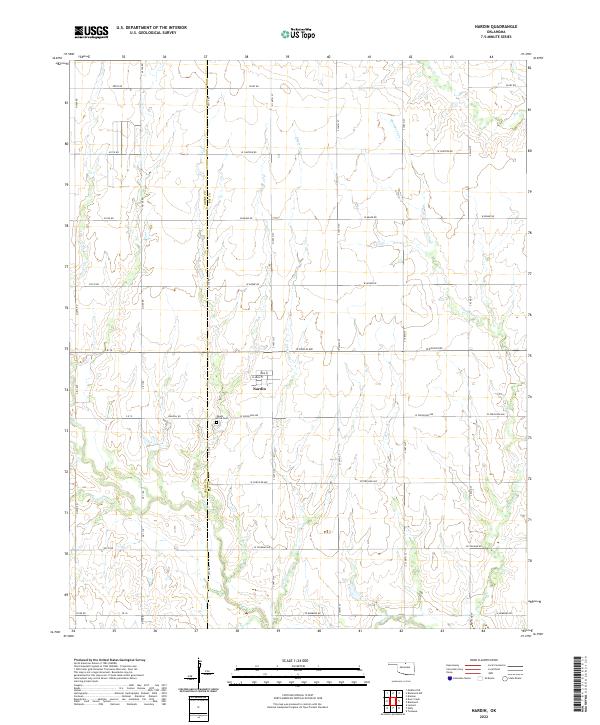
2022 Map of Nardin
USGS Topo · Published 2022About this map
The settlement of Nardin sits as the central focal point of this North Central Oklahoma landscape, positioned near the border of Grant and Kay Counties. The town's grid is clearly defined by local landmarks like Park Pl and W Main St, reflecting a rural community layout that has persisted through the decades. South of the town center lies the Mount Olive Cem, providing a significant location for genealogical research and local history studies in the region.
Find a feature on this map
45 named features on this map. Tap any name to fly to it.
Don’t see what you’re looking for? This feature index may not catch every label — zoom into the map to look around manually.
Map Details
Editions of this 2022 Nardin Map
This is the sole edition of this map. No revisions or reprints were ever made.
Other maps of this area

1955 · Enid
USGS Topo · 1:250,000

1958 · Enid
USGS Topo · 1:250,000

1967 · Braman
USGS Topo · 1:24,000

1968 · Deer Creek
USGS Topo · 1:24,000

1968 · Eddy
USGS Topo · 1:24,000

1968 · Blackwell NW
USGS Topo · 1:24,000

1968 · Nardin
USGS Topo · 1:24,000

1968 · Tonkawa
USGS Topo · 1:24,000

1968 · Lamont
USGS Topo · 1:24,000
1968 · Medford NE
USGS Topo · 1:24,000