1980s Maps of Greer County, Oklahoma
Explore 8 historic maps of Greer County from the 1980s. These maps offer a rare glimpse into what life looked like during the 1980s — showing old roads, neighborhoods, homes, and landmarks that have changed or disappeared over time.
Whether you're researching your family's past, planning a metal detecting trip, or studying how Greer County's landscape evolved across the 1980s, these high-resolution maps are a powerful tool for exploring the history of this region.
- Focus on a specific era: All maps on this page are from the 1980s, giving you a focused view of this time period.
- See what’s changed: Compare century-old streets, trails, and buildings to today's modern landscape using overlays and satellite layers.
- Research with precision: Use these maps for genealogy, historical research, land use analysis, or educational projects.
- View, download, or print: Maps are fully viewable online in high resolution, and can be downloaded or printed for your own records.
Start exploring Greer County's history through authentic maps from the 1980s. This is your window into the past.
Greer County, OK maps
(8)- 1985 Map of Elk City
 1985 Elk City1985 Print · USGSWestern Oklahoma in the 1980s is defined by its railroad junctions, emerging aviation hubs, and the winding North Fork Red River. Genealogists and local historians can trace the foundations of Sayre and Elk City, alongside landmarks like Clinton-Sherman Airport and Quartz Mountain State Park.2 unique versions available
 - 1985 Map of Altus
 1985 Altus1985 Print · USGSSouthwestern Oklahoma in the mid-eighties shows a vast agricultural and military landscape shaped by the Red River forks. Trace the intersections of the Atchison Topeka and Santa Fe railroad with rural points like Fairmount Cem and Duke.2 unique versions available
 - 1989 Map of Willow
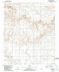
 1989 Willow1989 Print · USGSGreer County near the Beckham County line is shown here in the late eighties as an active energy corridor. Genealogists and local historians can trace family locations near Willow, Brinkman, and the Willow Cem, or locate the numerous wells across the Bloomington Oil and Gas Field.
 - 1989 Map of Plainview
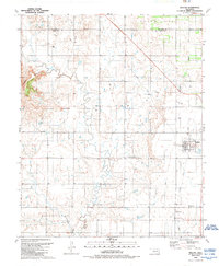
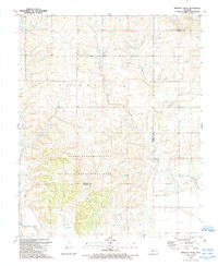
 1989 Plainview1989 Print · USGSGreer County, Oklahoma, is shown in the late 1980s at the intersection of local townships and deep-cut canyons. Genealogists can locate family landmarks near Plainview, the Jester Cem, and the rural Deer Creek Ch.
 - 1989 Map of Lake Creek
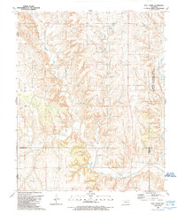
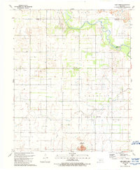 1989 Lake Creek1989 Print · USGSSouthwestern Oklahoma in the late eighties shows a landscape of ranching and energy production at the meeting of three counties. Trace family history at Pleasant Valley Cem and explore the winding North Fork Red River near Lake Creek.
 - 1989 Map of Retrop SE
 1989 Retrop SE1989 Print · USGSThe river bottomlands of Kiowa County meet the open plains of Greer and Washita counties during the late twentieth century. Genealogists and historians can trace local land use through features like the Altus-Lugert State Wildlife Management Area and scattered energy sites like the Oil Well near the North Fork Red River.
 - 1989 Map of Minnow Creek
 1989 Minnow Creek1989 Print · USGSThe Beckham and Greer county borderlands come into focus in the late eighties, showing a landscape defined by energy and conservation. Researchers can trace the extensive Gas Field operations or locate landmarks like Doc Hollis Lake and the Sandy Sanders State Wildlife Management Area.
 - 1989 Map of Bull Creek
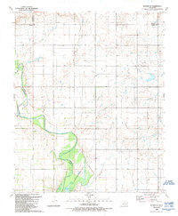
 1989 Bull Creek1989 Print · USGSWestern Oklahoma in the late eighties reveals a landscape defined by river forks and early settlement markers. Genealogists and researchers can locate the Vanherson Cem and trace the area's geography from the Salt Works to the Elm Fork Red River.
End of results
Showing maps 1-8 of 8
Top cities of Greer County
Frequently asked questions
- What are the different types of historical maps available for Greer County?
- What is the oldest map of Greer County?
- Where can I purchase historical maps of Greer County for my home or office?
- Where can I download high-res historical maps of Greer County?
- Are there historical topographic maps available for Greer County?
- Is there historical aerial imagery available for Greer County?
- Where are historical maps of Greer County sourced from?