1970s Maps of Greer County, Oklahoma
Explore 12 historic maps of Greer County from the 1970s. These maps offer a rare glimpse into what life looked like during the 1970s — showing old roads, neighborhoods, homes, and landmarks that have changed or disappeared over time.
Whether you're researching your family's past, planning a metal detecting trip, or studying how Greer County's landscape evolved across the 1970s, these high-resolution maps are a powerful tool for exploring the history of this region.
- Focus on a specific era: All maps on this page are from the 1970s, giving you a focused view of this time period.
- See what’s changed: Compare century-old streets, trails, and buildings to today's modern landscape using overlays and satellite layers.
- Research with precision: Use these maps for genealogy, historical research, land use analysis, or educational projects.
- View, download, or print: Maps are fully viewable online in high resolution, and can be downloaded or printed for your own records.
Start exploring Greer County's history through authentic maps from the 1970s. This is your window into the past.
Greer County, OK maps
(12)- 1971 Map of Russell, 1973 Print
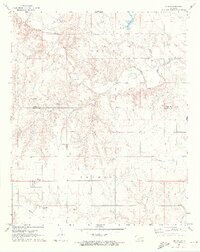
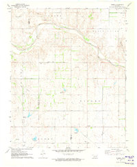 1971 Russell1973 Print · USGSHarmon and Greer counties appear at the start of the 1970s, showcasing a rural Oklahoma landscape shaped by the Salt Fork Red River. Genealogists can trace family roots through several local burial grounds including Wildcat and White Flat cemeteries, or locate the community Townhall near Russell.
 - 1971 Map of Blair, 1973 Print
 1971 Blair1973 Print · USGSThe agricultural plains of Southwest Oklahoma meet the granite peaks of the Wichita Mountains in the early seventies. Genealogists and historians can trace the irrigation networks of the West Canal and locate landmarks like Blair Cem and City View.2 unique versions available
 - 1971 Map of Mangum North, 1973 Print
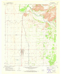
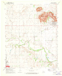
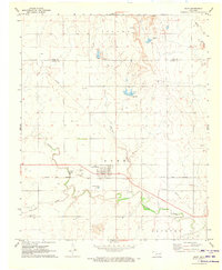
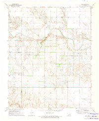
 1971 Mangum North1973 Print · USGSGreer County in the early seventies centers on the northern expansion of Mangum and the nearby settlement of Bloomington. Researchers can trace local landmarks like the C R I & P rail corridor, Marie Cem, and the Drive-in Theater.
 - 1971 Map of Madge, 1973 Print
 1971 Madge1973 Print · USGSHarmon County, Oklahoma, is documented in the early seventies as a landscape of isolated homesteads and winding creek beds. Researchers can locate the Independence Cem and the small settlements of Madge and Carl along the Texas border.
 - 1971 Map of Vinson, 1973 Print
 1971 Vinson1973 Print · USGSHarmon County in the early 1970s is characterized by its agricultural draws and the winding Elm Fork Red River. Genealogists and local historians can locate Hackberry Cem, Cave Creek Cem, and the small settlement of Vinson.2 unique versions available
 - 1971 Map of Granite, 1973 Print
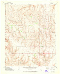
 1971 Granite1973 Print · USGSGreer County at the start of the seventies features a landscape where the granite peaks of Walsh Mountain meet the Elm Fork Red River. Researchers can trace the massive State Reformatory complex, find Rock Cem, or follow the old Rock Island rail line.
 - 1971 Map of Mangum South, 1973 Print
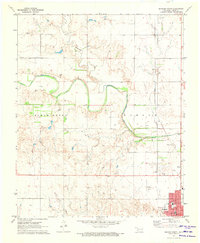
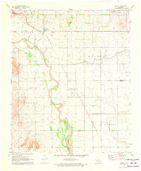
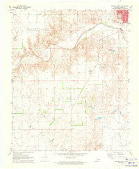 1971 Mangum South1973 Print · USGSGreer County settlement and the winding Salt Fork Red River are captured here in the early seventies. Researchers can trace the town grid of Mangum or locate rural landmarks like Ladessa Cem, the Gaging Station, and the local Quarry.
 - 1971 Map of Mc Queen, 1973 Print
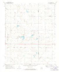 1971 Mc Queen1973 Print · USGSThe rural landscapes of Harmon and Greer counties are captured here in the early 1970s, focused on the small settlement of McQueen. Researchers can trace the path of the Hollis and Eastern railway and find several family-named land divisions like Looney and Tilley.
 - 1971 Map of Duke, 1973 Print
 1971 Duke1973 Print · USGSSouthwest Oklahoma at the start of the 1970s reveals a landscape of prairie commerce and family history along the Greer and Jackson County line. Trace the Hollis and Eastern rail line and locate Duke Cem, Rock Cem, and the Landing Field.
 - 1971 Map of Hester, 1973 Print
 1971 Hester1973 Print · USGSGreer and Jackson Counties are captured in the early seventies, a period defined by the sprawling irrigation systems of the West Canal. Researchers can trace the Missouri - Kansas - Texas rail line and locate the Hester Cem near the town of Hester.
 - 1971 Map of Lake Altus, 1973 Print
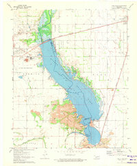 1971 Lake Altus1973 Print · USGSSouthwestern Oklahoma's landscape was defined by massive water projects and rugged granite peaks in the early 1970s. Trace the lakefront of Quartz Mountain Lake, the rails of the Atchison Topeka and Santa Fe, and the townsite of Lugert.
 - 1971 Map of Reed, 1973 Print
 1971 Reed1973 Print · USGSSouthwestern Oklahoma's river valley comes alive in the early 1970s, showcasing the winding Elm Fork Red River and its rural settlements. Researchers can locate the community of Reed, find landmarks like Jay Buckle Spring, and trace the grounds of Sulphur Ch.
End of results
Showing maps 1-12 of 12
Top cities of Greer County
Frequently asked questions
- What are the different types of historical maps available for Greer County?
- What is the oldest map of Greer County?
- Where can I purchase historical maps of Greer County for my home or office?
- Where can I download high-res historical maps of Greer County?
- Are there historical topographic maps available for Greer County?
- Is there historical aerial imagery available for Greer County?
- Where are historical maps of Greer County sourced from?