
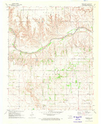
1971 Map of Russell
USGS Topo · Published 1973About this map
The Salt Fork Red River meanders across this West Oklahoma landscape, defining the border between Harmon and Greer counties in the early 1970s. This agricultural region is punctuated by scattered landmarks such as the Water Tank and a Townhall near the community of Russell. The map documents a rural infrastructure dependent on water management, evidenced by several engineered features like the Spillway and others along the drainage basins of Cave Creek and Turkey Creek.
Find a feature on this map
24 named features on this map. Tap any name to fly to it.
Don’t see what you’re looking for? This feature index may not catch every label — zoom into the map to look around manually.
Map Details
Editions of this 1971 Russell Map
This is the sole edition of this map. No revisions or reprints were ever made.
Other maps of this area

1955 · Lawton
USGS Topo · 1:250,000

1961 · Hollis
USGS Topo · 1:62,500

1971 · Mangum North
USGS Topo · 1:24,000

1971 · Vinson
USGS Topo · 1:24,000

1971 · Mangum South
USGS Topo · 1:24,000

1971 · Mc Queen
USGS Topo · 1:24,000

1971 · Duke
USGS Topo · 1:24,000

1971 · Reed
USGS Topo · 1:24,000
1971 · Shrewder
USGS Topo · 1:24,000

1975 · Hollis NE
USGS Topo · 1:24,000