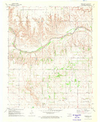
1971 Map of Shrewder
USGS Topo · Published 1973About this map
The Salt Fork Red River carves a winding path across this southwestern Oklahoma landscape, shaping the rugged breaks and drainage systems of Harmon County. In the early 1970s, this area remained largely rural, defined by small community hubs like Ron and the namesake Shrewder, both situated near the southern boundary. These settlements, along with Brownlow to the east, served a farming and ranching population supported by local institutions such as Fairview Ch and Dryden Ch. The presence of Tea Cross Cem and family-named landmarks indicates a deep-rooted genealogical history in the townships of Francis, Dryden, and Looney. While the river dominates the northern half of the sheet, the southern reaches are characterized by the meandering Turkey Creek and several Water Tanks, essential for agricultural life in this semi-arid region.
Find a feature on this map
16 named features on this map. Tap any name to fly to it.
Don’t see what you’re looking for? This feature index may not catch every label — zoom into the map to look around manually.
Map Details
Editions of this 1971 Shrewder Map
This is the sole edition of this map. No revisions or reprints were ever made.
Other maps of this area

1955 · Lawton
USGS Topo · 1:250,000

1961 · Hollis
USGS Topo · 1:62,500

1971 · Russell
USGS Topo · 1:24,000
1971 · Madge
USGS Topo · 1:24,000

1971 · Vinson
USGS Topo · 1:24,000
1971 · Mc Knight
USGS Topo · 1:24,000

1971 · Mc Queen
USGS Topo · 1:24,000

1971 · Reed
USGS Topo · 1:24,000

1975 · Hollis NE
USGS Topo · 1:24,000
1975 · Hollis NW
USGS Topo · 1:24,000