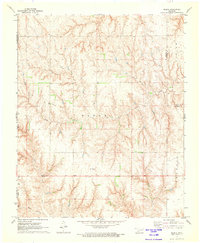
1971 Map of Madge
USGS Topo · Published 1973About this map
Madge and Carl define the rural landscape of southwestern Oklahoma in the early 1970s. This survey records a transition from the agricultural plateaus of Francis into the dissected drainages of Grape Creek and Horse Creek. Genealogy and local history researchers will find the Independence Cem and a Gaging Station along the Oklahoma and Texas state line, where the topography shifts toward Dixon Hollow. The map provides a detailed view of the regional boundary between Collingsworth and Harmon counties, illustrating how section lines and farm access roads follow the natural contours of the Bear Creek and Jester Creek watersheds.
Find a feature on this map
16 named features on this map. Tap any name to fly to it.
Don’t see what you’re looking for? This feature index may not catch every label — zoom into the map to look around manually.
Map Details
Editions of this 1971 Madge Map
This is the sole edition of this map. No revisions or reprints were ever made.
Other maps of this area

1954 · Amarillo
USGS Topo · 1:250,000

1954 · Plainview
USGS Topo · 1:250,000

1955 · Lawton
USGS Topo · 1:250,000

1955 · Clinton
USGS Topo · 1:250,000

1957 · Clinton
USGS Topo · 1:250,000

1958 · Amarillo
USGS Topo · 1:250,000

1958 · Plainview
USGS Topo · 1:250,000

1959 · Shinnery Creek
USGS Topo · 1:24,000

1961 · Erick
USGS Topo · 1:62,500

1963 · Little Wolf Creek
USGS Topo · 1:24,000