Old Maps of Jackson County, Oklahoma for Academic Research
Study the evolution of Jackson County with 176 high-resolution historic maps. Whether you're teaching, researching, or modeling changes in land use, these maps provide essential visual documentation of urban, environmental, and geographic change.
- Analyze long-term change: Track patterns in development, transportation, and natural features.
- Ideal for environmental or urban studies: Support academic projects with primary historical map data.
- Use in the classroom or lab: Educators and researchers rely on these maps to bring historical context to life.
These maps are a powerful tool for teaching, research, and visualizing how Jackson County has changed over the decades.
Jackson County, OK maps
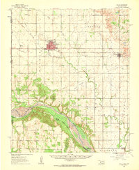
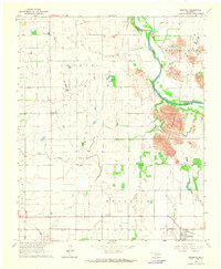
(176)- 1955 Map of Lawton, 1958 Print
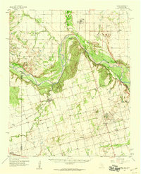
 1955 Lawton1958 Print · USGSSouthwestern Oklahoma and North Texas are shown here in the mid-fifties, dominated by the Wichita Mountains and the vital Red River watershed. Genealogists and historians can trace the foundations of Lawton alongside rural landmarks like Rainy Mountain Church and Pleasant Hill School.5 unique versions available
 - 1958 Map of Frederick, 1959 Print
 1958 Frederick1959 Print · USGSAcross the Tillman County plains in the late fifties, the landscape was defined by the transition from agriculture to oil. Researchers can trace the rail corridors of the Missouri Kansas Texas or locate local centers like Middick Store and Tesca Ch.
 - 1958 Map of Elmer, 1960 Print
 1958 Elmer1960 Print · USGSThe Oklahoma-Texas borderlands are captured here in the late fifties as oil production and ranching shaped the landscape. Researchers can locate vanished rural landmarks like Amerada Camp, the Fargo Oil Field, and the Southside School.2 unique versions available
 - 1960 Map of Goodlett, 1962 Print
 1960 Goodlett1962 Print · USGSHardeman County at the dawn of the 1960s was a landscape defined by the Red River and a busy network of converging rail lines. Researchers can trace the layouts of small communities like Goodlett and Punkin Center or locate rural burial grounds including Elba Cem and Johnson Cem.2 unique versions available
 - 1960 Map of Quanah, 1963 Print
 1960 Quanah1963 Print · USGSThe Red River frontier comes to life in the early sixties, showing the vital rail-and-river connection between Oklahoma and the Texas Panhandle. Researchers can trace family roots through Eldorado Cem, King Sch, and the rail lines serving Quanah and Chillicothe.3 unique versions available
 - 1961 Map of Hollis, 1963 Print
 1961 Hollis1963 Print · USGSHarmon County, Oklahoma, in the early sixties showcases a landscape defined by the Prairie Dog Town Fork Red River and the arrival of modern infrastructure. Researchers can locate family landmarks like Bitter Creek Cem, Antioch Ch, and the local Drive-in Theater in Hollis.
 - 1963 Map of Altus SE, 1965 Print
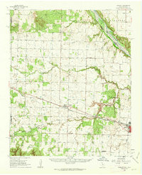
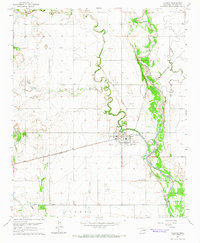
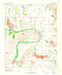
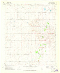
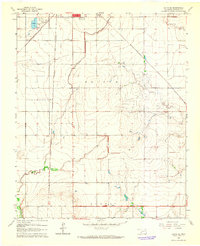 1963 Altus SE1965 Print · USGSJackson County agriculture meets burgeoning rail infrastructure in the early sixties south of Altus. Genealogists can locate Elmer Cem and Francis Cem near the Atchison Topeka and Santa Fe tracks.2 unique versions available
 - 1964 Map of Tipton SE, 1965 Print
 1964 Tipton SE1965 Print · USGSTillman County and the Red River forks are mapped here during the mid-sixties, capturing the rural community life of the Oklahoma plains. Genealogists and researchers can locate the Center View Cem, Mt Gillian Ch, and the Pleasant Valley Ch.2 unique versions available
 - 1964 Map of Martha, 1965 Print
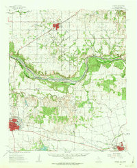
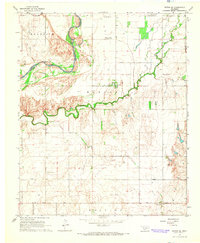
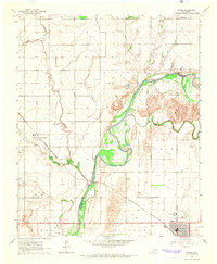
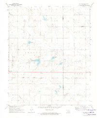
 1964 Martha1965 Print · USGSJackson County agricultural life in the mid-sixties is centered here on the Salt Fork Red River and the town of Martha. Genealogists can trace family connections at Mountain View Ch or find the sites of the Childrens Home and Victory Cem.2 unique versions available
 - 1964 Map of Altus, 1965 Print
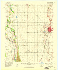
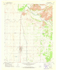
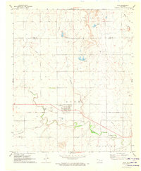
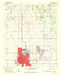 1964 Altus1965 Print · USGSJackson County in the mid-sixties serves as a vital military and railroad junction, anchored by the expansion of the regional seat. Genealogists and historians can locate legacy sites like Restlawn Memorial Park, the Jr College, and the sprawling Altus Air Force Base.2 unique versions available
 - 1964 Map of Tipton, 1965 Print
 1964 Tipton1965 Print · USGSOklahoma's southwestern plains come into focus in the mid-sixties, dominated by the winding course of the North Fork Red River. Genealogists and historians can trace the rail-side growth of Tipton, the Boucher Oil Field, and the site of a local Orphanage.2 unique versions available
 - 1964 Map of Warren, 1965 Print
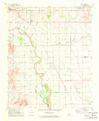
 1964 Warren1965 Print · USGSJackson and Kiowa counties meet along the winding river in the mid-1960s, a time of quiet rural life and heavy industry. Researchers can trace land boundaries in Warren or locate family sites near the Cem and Quartz Mountain State Park.2 unique versions available
 - 1964 Map of Olustee, 1965 Print
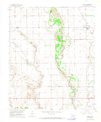
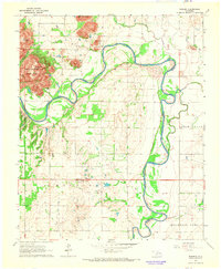
 1964 Olustee1965 Print · USGSJackson County's prairie landscape is captured in the mid-1960s, showing the intersection of the St Louis - San Francisco rail line and the Salt Fork Red River. Researchers can locate family sites at Olustee Cem and Aaron Cem or trace the early footprint of Olustee Airfield.2 unique versions available
 - 1964 Map of Headrick, 1965 Print
 1964 Headrick1965 Print · USGSSouthwestern Oklahoma in the mid-sixties reveals a land of river-bend settlements and mountain-shadowed farms. Genealogists and local historians can trace the legacy of Headrick and Friendship, locating the Navajo Cem and the route of the St Louis - San Francisco railroad.
 - 1964 Map of Long Mountain, 1965 Print
 1964 Long Mountain1965 Print · USGSSouthwestern Oklahoma's river valley and granite peaks are meticulously captured during the mid-1960s. Genealogists and historians can trace the paths of the St Louis - San Francisco railroad and locate rural landmarks like Headrick Cem and Centerville.2 unique versions available
 - 1971 Map of Blair, 1973 Print
 1971 Blair1973 Print · USGSThe agricultural plains of Southwest Oklahoma meet the granite peaks of the Wichita Mountains in the early seventies. Genealogists and historians can trace the irrigation networks of the West Canal and locate landmarks like Blair Cem and City View.2 unique versions available
 - 1971 Map of Mc Queen, 1973 Print
 1971 Mc Queen1973 Print · USGSThe rural landscapes of Harmon and Greer counties are captured here in the early 1970s, focused on the small settlement of McQueen. Researchers can trace the path of the Hollis and Eastern railway and find several family-named land divisions like Looney and Tilley.
 - 1971 Map of Duke SW, 1973 Print
 1971 Duke SW1973 Print · USGSThe Harmon and Jackson County border in the early 1970s reveals a landscape of working quarries and rural townships. Family history researchers can locate the Pleasant Hill Cem and trace the paths of Gypsum Creek and Cottonwood Creek.
 - 1971 Map of Duke, 1973 Print
 1971 Duke1973 Print · USGSSouthwest Oklahoma at the start of the 1970s reveals a landscape of prairie commerce and family history along the Greer and Jackson County line. Trace the Hollis and Eastern rail line and locate Duke Cem, Rock Cem, and the Landing Field.
 - 1971 Map of Prairie Hill, 1973 Print
 1971 Prairie Hill1973 Print · USGSJackson County in the early seventies reveals a landscape of rural communities and mineral extraction along the St Louis San Francisco railroad. Researchers can trace the layout of Creta, Marty, and Prairie Hill alongside local quarries.
 - 1971 Map of Hester, 1973 Print
 1971 Hester1973 Print · USGSGreer and Jackson Counties are captured in the early seventies, a period defined by the sprawling irrigation systems of the West Canal. Researchers can trace the Missouri - Kansas - Texas rail line and locate the Hester Cem near the town of Hester.
 - 1975 Map of Elmore City NE
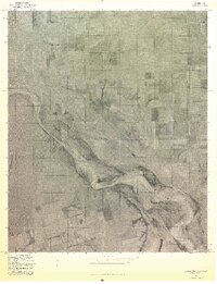 1975 Elmore City NE1975 Print · USGSThe Red River borderlands of Oklahoma and Texas are captured here in the mid-1970s through detailed aerial photography. Researchers can trace the agricultural layout surrounding Elmer and Hess and study the shifting sandbars of the Red River.
 - 1975 Map of Hollis SE
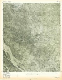 1975 Hollis SE1975 Print · USGSHarmon County at the Oklahoma-Texas border is seen from the air in the mid-seventies, showing the agricultural patterns of the southern plains. Researchers can trace the shifting sandbars of the Red River and the winding course of Sandy Louis Creek through this rural landscape.
 - 1975 Map of Quanah NE
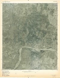 1975 Quanah NE1975 Print · USGSJackson County agriculture and the Texas border come into focus in the mid-seventies. Trace the shifting banks of the Red River and the path of Sandy Creek through a landscape of patterned fields.
 - 1975 Map of Frederick SW
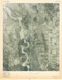 1975 Frederick SW1975 Print · USGSThe Oklahoma-Texas borderlands are captured in high-detail aerial imagery during the mid-1970s, showcasing the vast agricultural grid meeting the river's edge. Researchers can trace the winding, braided course of the North Fork Red River as it carves through the local landscape.
Showing maps 1-25 of 176
Top cities of Jackson County
- Altus historical maps
- Blair historical maps
- Olustee historical maps
- Eldorado historical maps
- East Duke historical maps
- Martha historical maps
See more
Frequently asked questions
- What are the different types of historical maps available for Jackson County?
- What is the oldest map of Jackson County?
- Where can I purchase historical maps of Jackson County for my home or office?
- Where can I download high-res historical maps of Jackson County?
- Are there historical topographic maps available for Jackson County?
- Is there historical aerial imagery available for Jackson County?
- Where are historical maps of Jackson County sourced from?