
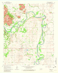
1964 Map of Warren
USGS Topo · Published 1965About this map
The North Fork Red River snakes through the heart of this southwestern Oklahoma landscape, defining the boundary between Jackson and Kiowa counties. The terrain is marked by the dramatic rise of the Quartz Mountains, where Quartz Mountain and Soldiers Peak tower over Devil Canyon. This 1964 survey captures the area during a period of established rural settlement, centered on the small community of Warren and its nearby Cem.
Find a feature on this map
20 named features on this map. Tap any name to fly to it.
Don’t see what you’re looking for? This feature index may not catch every label — zoom into the map to look around manually.
Map Details
Editions of this 1964 Warren Map
2 editions found
Other maps of this area

1955 · Lawton
USGS Topo · 1:250,000

1963 · Babbs
USGS Topo · 1:24,000

1964 · Altus
USGS Topo · 1:24,000

1964 · Lone Wolf
USGS Topo · 1:24,000

1964 · Headrick
USGS Topo · 1:24,000
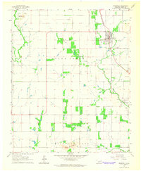
1964 · Roosevelt
USGS Topo · 1:24,000

1964 · Long Mountain
USGS Topo · 1:24,000

1971 · Blair
USGS Topo · 1:24,000

1971 · Lake Altus
USGS Topo · 1:24,000

1985 · Altus
USGS Topo · 1:100,000