1900s (20th Century) Maps of Latimer County, Oklahoma
Explore 60 historic maps of Latimer County from the 1900s (20th Century). These maps offer a rare glimpse into what life looked like during the 1900s — showing old roads, neighborhoods, homes, and landmarks that have changed or disappeared over time.
Whether you're researching your family's past, planning a metal detecting trip, or studying how Latimer County's landscape evolved across the 1900s, these high-resolution maps are a powerful tool for exploring the history of this region.
- Focus on a specific era: All maps on this page are from the 1900s, giving you a focused view of this time period.
- See what’s changed: Compare century-old streets, trails, and buildings to today's modern landscape using overlays and satellite layers.
- Research with precision: Use these maps for genealogy, historical research, land use analysis, or educational projects.
- View, download, or print: Maps are fully viewable online in high resolution, and can be downloaded or printed for your own records.
Start exploring Latimer County's history through authentic maps from the 1900s. This is your window into the past.
Latimer County, OK maps
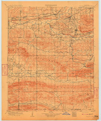
(60)- 1900 Map of Sansbois
 1900 Sansbois1900 Print · USGSIndian Territory in the late nineteenth century is documented here through its tribal boundaries and early river settlements. Genealogists can trace family roots near Stigler, Porum, and Whitefield, or locate the isolated station at Sandtown along the St L & S F R R.2 unique versions available
 - 1900 Map of Canadian
 1900 Canadian1900 Print · USGSIndian Territory at the turn of the century shows a landscape of tribal nations and developing rail towns along the CANADIAN RIVER. Genealogists and historians can trace early settlements like Fishertown and Indianola or the original Creek Nation Choctaw Nation Boundary Line.6 unique versions available
 - 1900 Map of Sallisaw
 1900 Sallisaw1900 Print · USGSThe Cherokee and Choctaw Nations are divided by the winding Arkansas River at the turn of the century. Genealogists can trace early tribal-era settlements like Bokoshe, Tamaha, and Oak Lodge along the routes of the Kansas City Southern R. R.2 unique versions available
 - 1900 Map of Winding Stair
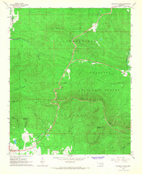
 1900 Winding Stair1900 Print · USGSThe Choctaw Nation at the turn of the century shows a frontier landscape shaped by the Ouachita Mountains and new rail lines. Genealogists can locate early settlements like Summerfield and Heavener or trace the Woods Trail across the Kiamichi Mountain range.2 unique versions available
 - 1901 Map of Tuskahoma
 1901 Tuskahoma1901 Print · USGSThe Choctaw Nation in the Indian Territory is captured here during its transition to statehood, showing a landscape of tribal centers and early railroad expansion. Genealogists and historians can locate the Council House and rural outposts like Bengal, Ola, and Damon.
 - 1908 Map of Tuskahoma, 1964 Print
 1908 Tuskahoma1964 Print · USGSOklahoma's Choctaw Nation territory at the start of the twentieth century shows a landscape shaped by ridge-top boundaries and the arrival of the steam engine. Researchers can locate early landmarks like the Choctaw Council House, Peachland Chapel, and mining era towns like Wilburton.
 - 1909 Map of Mc Alester
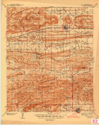
 1909 Mc Alester1909 Print · USGSSoutheast Oklahoma's coal mining belt and the rugged Choctaw Nation territory are captured here in the early years of statehood. Researchers can trace the rail-side growth of McAlester and Hartshorne or locate vanished sites like Barnett Sta Haywood PO and Perryville.3 unique versions available
 - 1909 Map of Tuskahoma
 1909 Tuskahoma1909 Print · USGSSoutheastern Oklahoma’s rugged mountain corridors and Choctaw Nation landmarks are documented here at the end of the territorial era. Genealogists and historians can trace rail-town development and find remote sites like the Choctaw Council House, Bunchtown, and Thessalonica Church.3 unique versions available
 - 1909 Map of Winding Stair
 1909 Winding Stair1909 Print · USGSSoutheastern Oklahoma’s early statehood era is defined here by the intersection of major rail corridors and high mountain ridges. Researchers can trace the development of transit hubs like Heavener and Wister, or locate remote valley settlements such as Whitesboro and Muse.4 unique versions available
 - 1909 Map of Sans Bois, 1954 Print
 1909 Sans Bois1954 Print · USGSHaskell and Muskogee counties are seen here in the decade following statehood, when rail lines and river crossings dictated the pulse of rural life. Genealogists can trace family roots through numerous local landmarks like Kanima P O, Belle Starr School, and the Sansbois Sta.
 - 1911 Map of Sallisaw
 1911 Sallisaw1911 Print · USGSEastern Oklahoma at the turn of the century was a land of expanding railroads and ancient river crossings along the Arkansas River. Genealogists and historians can trace the early settlement of the region through dozens of landmarks like Foreman Ferry, McCurtain, and the Badger Lee School.3 unique versions available
 - 1911 Map of Sansbois
 1911 Sansbois1911 Print · USGSEastern Oklahoma's river valleys and rugged hills come alive in this early twentieth-century survey of the Choctaw Nation's western reaches. Researchers can locate rural landmarks like Sansbois Station, the Belle Starr School, and early river crossings such as the Thornton Ferry.3 unique versions available
 - 1940 Map of Red Oak, 1971 Print
 1940 Red Oak1971 Print · USGSThe Ouachita Mountains of southeastern Oklahoma are captured here in the years just before the mid-century, showing a landscape of timbered ridges and railroad towns. Genealogists can trace family footprints at rural landmarks like Baldwin Cem, the Salonia Sch, and the State Sanitorium near Talihina.2 unique versions available
 - 1943 Map of Red Oak
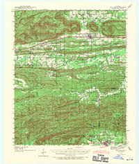
 1943 Red Oak1943 Print · USGSLatimer and Le Flore counties are captured here in the early 1940s as the railroad and timber economy shaped the Ouachita foothills. Genealogists and local historians can locate early landmarks like Baldwin Cem, Salonia Sch, and the State Sanatorium near Talihina.2 unique versions available
 - 1946 Map of Fort Smith
 1946 Fort Smith1946 Print · USGSThe Arkansas-Oklahoma borderlands appear here in the mid-forties, as new reservoirs began to transform the river valleys. Genealogists and historians can trace rail-served towns from Muskogee to Fort Smith and locate landmarks like Camp Chaffee.
 - 1950 Map of Mcalester
 1950 Mcalester1950 Print · USGSThe Ouachita Mountains and the coal country of Southeast Oklahoma are shown here in the late 1940s. Genealogists and historians can trace the rail-driven growth of McAlester, Wilburton, and Antlers alongside the rugged terrain of Kiamichi Mountain.2 unique versions available
 - 1962 Map of McAlester
 1962 McAlester1962 Print · USGSSoutheastern Oklahoma and western Arkansas are shown here during the early sixties, a time of transition for the region's mountain communities and timberlands. Researchers can trace the paths of the Kansas City Southern RR through Heavener or locate settlements like Talihina and Broken Bow near the Kiamichi Mountains.2 unique versions available
 - 1965 Map of Fort Smith
 1965 Fort Smith1965 Print · USGSEastern Oklahoma and Western Arkansas are captured here during a period of massive post-war change as new reservoirs reshaped the river valleys. Genealogists and historians can trace the rail networks of the Midland Valley RR and find established communities like Stilwell, Sallisaw, and Stigler.
 - 1965 Map of McAlester
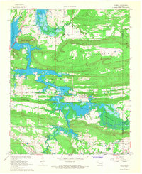
 1965 McAlester1965 Print · USGSSoutheastern Oklahoma and western Arkansas appear here in the mid-1960s, showing the intersection of the timber industry and the growing reservoir system. Genealogists can trace family roots through settlements like Antlers, Idabel, and Kiowa or follow the historic routes of the Kansas City Southern Ry.3 unique versions available
 - 1965 Map of Leflore, 1967 Print
 1965 Leflore1967 Print · USGSEastern Oklahoma's coal and timber country is captured here in the mid-1960s, showing the intersection of major rail lines and nascent reservoirs. Trace family sites near Leflore, Fanshawe, and the Hicks Chapel Cem or study the early footprint of Wister Lake.2 unique versions available
 - 1966 Map of Blackjack Ridge, 1967 Print
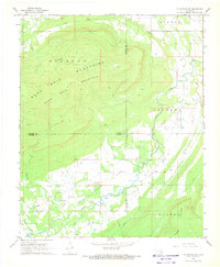
 1966 Blackjack Ridge1967 Print · USGSLe Flore County and the Ouachita National Forest are shown here in the mid-sixties during a period of active timber and resource management. Researchers can trace the path of Holson Valley Road and locate the Sycamore Lookout Tower or Bear Den Cave.3 unique versions available
 - 1967 Map of Fort Smith
 1967 Fort Smith1967 Print · USGSThe Arkansas River valley and the foothills of the Ozarks are captured here during a period of significant military and industrial activity. Researchers can trace the sprawling bounds of Camp Chaffee and Camp Gruber or locate vanished rail stops along the Midland Valley RR.
 - 1967 Map of Adamson, 1968 Print
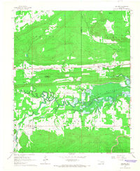
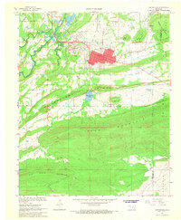
 1967 Adamson1968 Print · USGSNear the Pittsburg and Latimer county line in the late sixties, the rising waters of the Eufaula Reservoir reshaped this valley landscape. Researchers can trace the legacy of local education and faith at Jones Academy, St Paul Ch, and the Cole Chapel Cem.2 unique versions available
 - 1967 Map of Hartshorne, 1968 Print
 1967 Hartshorne1968 Print · USGSSoutheast Oklahoma’s coal and rail corridor comes into focus in the late 1960s, showing the neighboring hubs of Hartshorne and Haileyville. Genealogists and local historians can trace the Chicago Rock Island and Pacific Railroad alongside sites like Elmwood Cemetery and Lone Oak Sch.2 unique versions available
 - 1968 Map of Mc Curtain SW, 1969 Print
 1968 Mc Curtain SW1969 Print · USGSThe rugged highlands of the Sans Bois and Diamond Mountains meet the valley floor in the 1960s. Researchers can trace energy-sector development at the Red Oak Norris Gas Field and find family sites at Norris Cem or Rosedale Ch.2 unique versions available
Showing maps 1-25 of 60
Top cities of Latimer County
Frequently asked questions
- What are the different types of historical maps available for Latimer County?
- What is the oldest map of Latimer County?
- Where can I purchase historical maps of Latimer County for my home or office?
- Where can I download high-res historical maps of Latimer County?
- Are there historical topographic maps available for Latimer County?
- Is there historical aerial imagery available for Latimer County?
- Where are historical maps of Latimer County sourced from?