1940s Maps of Latimer County, Oklahoma
Explore 3 historic maps of Latimer County from the 1940s. These maps offer a rare glimpse into what life looked like during the 1940s — showing old roads, neighborhoods, homes, and landmarks that have changed or disappeared over time.
Whether you're researching your family's past, planning a metal detecting trip, or studying how Latimer County's landscape evolved across the 1940s, these high-resolution maps are a powerful tool for exploring the history of this region.
- Focus on a specific era: All maps on this page are from the 1940s, giving you a focused view of this time period.
- See what’s changed: Compare century-old streets, trails, and buildings to today's modern landscape using overlays and satellite layers.
- Research with precision: Use these maps for genealogy, historical research, land use analysis, or educational projects.
- View, download, or print: Maps are fully viewable online in high resolution, and can be downloaded or printed for your own records.
Start exploring Latimer County's history through authentic maps from the 1940s. This is your window into the past.
Latimer County, OK maps
(3)- 1940 Map of Red Oak, 1971 Print
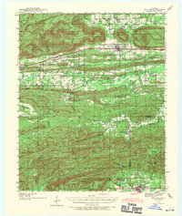 1940 Red Oak1971 Print · USGSThe Ouachita Mountains of southeastern Oklahoma are captured here in the years just before the mid-century, showing a landscape of timbered ridges and railroad towns. Genealogists can trace family footprints at rural landmarks like Baldwin Cem, the Salonia Sch, and the State Sanitorium near Talihina.2 unique versions available
 - 1943 Map of Red Oak
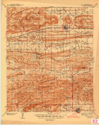 1943 Red Oak1943 Print · USGSLatimer and Le Flore counties are captured here in the early 1940s as the railroad and timber economy shaped the Ouachita foothills. Genealogists and local historians can locate early landmarks like Baldwin Cem, Salonia Sch, and the State Sanatorium near Talihina.2 unique versions available
 - 1946 Map of Fort Smith
 1946 Fort Smith1946 Print · USGSThe Arkansas-Oklahoma borderlands appear here in the mid-forties, as new reservoirs began to transform the river valleys. Genealogists and historians can trace rail-served towns from Muskogee to Fort Smith and locate landmarks like Camp Chaffee.
End of results
Showing maps 1-3 of 3
Top cities of Latimer County
Frequently asked questions
- What are the different types of historical maps available for Latimer County?
- What is the oldest map of Latimer County?
- Where can I purchase historical maps of Latimer County for my home or office?
- Where can I download high-res historical maps of Latimer County?
- Are there historical topographic maps available for Latimer County?
- Is there historical aerial imagery available for Latimer County?
- Where are historical maps of Latimer County sourced from?