1970s Maps of Latimer County, Oklahoma
Explore 29 historic maps of Latimer County from the 1970s. These maps offer a rare glimpse into what life looked like during the 1970s — showing old roads, neighborhoods, homes, and landmarks that have changed or disappeared over time.
Whether you're researching your family's past, planning a metal detecting trip, or studying how Latimer County's landscape evolved across the 1970s, these high-resolution maps are a powerful tool for exploring the history of this region.
- Focus on a specific era: All maps on this page are from the 1970s, giving you a focused view of this time period.
- See what’s changed: Compare century-old streets, trails, and buildings to today's modern landscape using overlays and satellite layers.
- Research with precision: Use these maps for genealogy, historical research, land use analysis, or educational projects.
- View, download, or print: Maps are fully viewable online in high resolution, and can be downloaded or printed for your own records.
Start exploring Latimer County's history through authentic maps from the 1970s. This is your window into the past.
Latimer County, OK maps
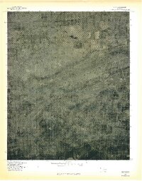
(29)- 1971 Map of Blocker, 1972 Print
 1971 Blocker1972 Print · USGSIn the early 1970s, the Pittsburg County landscape was defined by the expansion of the Eufaula Reservoir and active energy extraction. Researchers can trace the Old RR Grade near Blocker or locate the Blocker Ch.4 unique versions available
 - 1971 Map of Yanush, 1973 Print
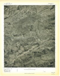
 1971 Yanush1973 Print · USGSSoutheastern Oklahoma’s Choctaw country is documented here in the early 1970s, focused on the rural community of Yanush and the surrounding creek valleys. Genealogists and historians can locate the Old Choctaw Indian Council House and several family-named burial sites like Hokit Cem and King Cem.2 unique versions available
 - 1971 Map of Kiamichi, 1973 Print
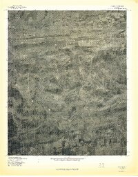
 1971 Kiamichi1973 Print · USGSThe Kiamichi River valley and Potato Hills are documented here in the early 1970s, showing a landscape shaped by rail and river. Researchers can locate family landmarks like Cole Spur Cem, Buffalo Valley Sch, and the St Louis-San Francisco railroad line.
 - 1971 Map of Gowen, 1973 Print
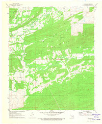
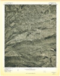
 1971 Gowen1973 Print · USGSEastern Oklahoma's coal and gas country is shown in the early seventies as the landscape evolved around the new shoreline of Eufaula Lake. Researchers can trace the rail-and-road connections between Gowen, Bowers, and Patterson near the local Strip Mines.2 unique versions available
 - 1971 Map of Sardis, 1973 Print
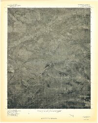
 1971 Sardis1973 Print · USGSThe rugged terrain of Pushmataha and Latimer counties comes into focus in the early seventies, showing a land of ridge-top summits and winding valleys. Trace family landmarks like Borden Cem and Mission Ch near the banks of Jackfork Creek.2 unique versions available
 - 1971 Map of Damon, 1973 Print
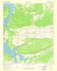
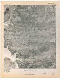
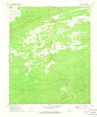 1971 Damon1973 Print · USGSLatimer County in the early seventies is a landscape of high ridges and winding creek valleys. Researchers can trace the layout of Damon, find the remote Veterans Colony, or locate genealogical sites like Gum Creek Ch and the Damon Cem.2 unique versions available
 - 1971 Map of Higgins, 1973 Print
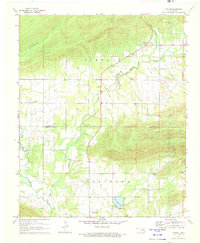
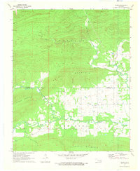
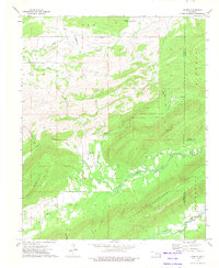
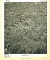
 1971 Higgins1973 Print · USGSLatimer County, Oklahoma, is shown in the early 1970s as a landscape of extraction and rugged ridgelines. Researchers can trace the legacy of local industry and transport through features like the Mountain Station Cem, the Old Railroad Grade, and numerous Gas Wells.
 - 1971 Map of Albion, 1973 Print
 1971 Albion1973 Print · USGSSoutheast Oklahoma in the early 1970s reveals a landscape of deep valleys and winding waterways where the railroad still shaped local life. Genealogists can trace family names through rural landmarks like Armstrong Cem, Myers Cem, and the Evangelistic Tabernacle.2 unique versions available
 - 1971 Map of Wilburton, 1973 Print
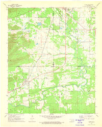
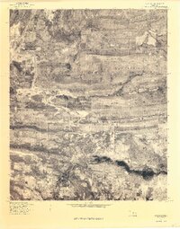
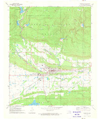 1971 Wilburton1973 Print · USGSWilburton and the surrounding coal and gas lands are captured in the early seventies as industrial mining and higher education shaped the landscape. Genealogists and historians can locate Wilburton Cemetery, the campus of Eastern Oklahoma State College, and the intricate network of Strip Mines and Gas Wells.
 - 1973 Map of Counts, 1975 Print
 1973 Counts1975 Print · USGSSoutheast Oklahoma at the start of the 1970s shows a landscape of tucked-away valleys and family-named cemeteries. Genealogists can trace local lineages through Burris Cem, Nace Cem, and the settlement at Counts.2 unique versions available
 - 1977 Map of Wilburton
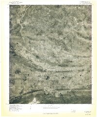 1977 Wilburton1977 Print · USGSWilburton and the surrounding Latimer County landscape are captured during the late seventies in this aerial-derived orthophoto. Researchers can trace the town's expansion and locate local landmarks such as Lake Wayne Wallace and the Sans Bois Mountains.
 - 1977 Map of Mc Curtain SW
 1977 Mc Curtain SW1977 Print · USGSLe Flore County land use and mountain terrain are captured in this 1970s aerial survey. Local researchers can trace old homesteads and timberlines near small communities like Brazil, Walls, and Cedar along the slopes of the Sans Bois Mountains.
 - 1977 Map of Quinton South
 1977 Quinton South1977 Print · USGSThe eastern Oklahoma landscape comes into focus in the late seventies as the timbered ridges meet the valley floor. Genealogists and historians can trace rural homesteads and roads near Quinton, Lewisville, and the prominent Tucker Knob.
 - 1977 Map of Blocker
 1977 Blocker1977 Print · USGSThe settlement of Blocker and the surrounding Pittsburg County terrain are captured in this mid-seventies aerial survey. Researchers can trace the shoreline of Eufaula Lake and the natural heights of Scaffold Mountain and Blue Mountain.
 - 1977 Map of Adamson
 1977 Adamson1977 Print · USGSThe Pittsburg County landscape in the late seventies is captured here through detailed aerial imagery centered on Adamson and Dow. Researchers can trace the sprawling base of Buffalo Mountain and the encroaching shoreline of Eufaula Lake near Gaines Creek.
 - 1977 Map of Featherston
 1977 Featherston1977 Print · USGSFeatherston and the surrounding Pittsburg County landscape are seen from the air in the late seventies. Family historians and land researchers can trace the roads near Featherston and the timbered slopes of the Sans Bois Mountains.
 - 1977 Map of Kinta
 1977 Kinta1977 Print · USGSHaskell County at the end of the seventies is shown here through detailed aerial imagery of the Sans Bois Mountains. Local researchers can trace the footprint of Kinta and the topographical landmarks of Hulsey Mountain and Sans Bois Creek.
 - 1977 Map of Higgins
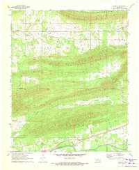
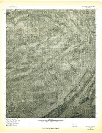
 1977 Higgins1977 Print · USGSLatimer County's rural landscape is captured in the late seventies through this detailed aerial survey. Researchers can trace the exact footprint of Higgins and the winding courses of Gaines Creek and Buffalo Creek across the valley.
 - 1977 Map of Lequire
 1977 Lequire1977 Print · USGSThe Haskell County hills appear in sharp detail during the late 1970s, showcasing a landscape shaped by the timbered ridges of the Sans Bois Mountains. Researchers can trace the rural roads connecting Lequire and Lodi while locating family-named landmarks like Ryan Peak.
 - 1977 Map of Hartshorne
 1977 Hartshorne1977 Print · USGSHartshorne and the surrounding Pittsburg County foothills are captured in this late-seventies aerial survey. Researchers can trace the street layouts of Hartshorne and Centerville or locate landmarks like Belle Starr Mountain and Hartshorne Lake.
 - 1977 Map of Gowen
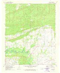
 1977 Gowen1977 Print · USGSLatimer County in the late seventies is shown through high-altitude aerial photography, revealing the rural character of the settlements below the Sans Bois Mountains. Researchers can trace the layout of small communities like Gowen, Chilli, and Patterson against the natural meanders of Gaines Creek.
 - 1977 Map of Damon
 1977 Damon1977 Print · USGSSoutheastern Oklahoma’s rural terrain is revealed in the late seventies through this aerial perspective of Latimer County. Researchers can trace the drainage of North Gaines Creek and locate the settlement at Damon between Blue Mountain and Eightmile Mountain.
 - 1978 Map of Eufaula, 1979 Print
 1978 Eufaula1979 Print · USGSEastern Oklahoma in the late seventies is defined by the sprawling waters of Eufaula Lake and the dense timber of the Sans Bois Mountains. Genealogists and historians can trace the development of towns like Checotah and Stigler or locate legacy sites like the Old R R Grade and Robbers Cave State Park.
 - 1978 Map of Fort Smith, 1979 Print
 1978 Fort Smith1979 Print · USGSThe Arkansas-Oklahoma borderlands in the late seventies show a landscape shaped by massive river reservoirs and sprawling military reservations. Trace the historic rail lines of the Missouri Pacific RR and locate regional landmarks like Fort Gibson, Tenkiller Ferry Lake, and Barling.2 unique versions available
 - 1978 Map of Fort Smith, 1979 Print
 1978 Fort Smith1979 Print · USGSThe Arkansas-Oklahoma borderlands in the late seventies show a region defined by river navigation, coal mining, and military expansion. You can trace industrial footprints like the Strip Mines and the vast Fort Chaffee Military Reservation.2 unique versions available
Showing maps 1-25 of 29
Top cities of Latimer County
Frequently asked questions
- What are the different types of historical maps available for Latimer County?
- What is the oldest map of Latimer County?
- Where can I purchase historical maps of Latimer County for my home or office?
- Where can I download high-res historical maps of Latimer County?
- Are there historical topographic maps available for Latimer County?
- Is there historical aerial imagery available for Latimer County?
- Where are historical maps of Latimer County sourced from?