
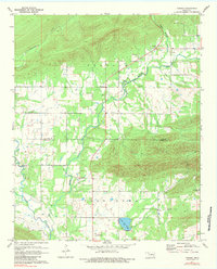
1971 Map of Yanush
USGS Topo · Published 1973About this map
The Old Choctaw Indian Council House stands as a primary historical landmark in this 1971 survey of the borderlands between Latimer and Pushmataha counties. This area in the Choctaw Nation is characterized by a mix of creek-bottom agriculture and upland terrain, with the settlement of Yanush situated at a central crossroads. The mapping detail reveals a deeply rooted community infrastructure, evidenced by the numerous burial grounds including Hokit Cem, King Cem, and Trowbridge Cem, as well as the Old Town-Tuskahoma Cem located near the council house.
Find a feature on this map
25 named features on this map. Tap any name to fly to it.
Don’t see what you’re looking for? This feature index may not catch every label — zoom into the map to look around manually.
Map Details
Editions of this 1971 Yanush Map
2 editions found
Other maps of this area

1901 · Tuskahoma
USGS Topo · 1:125,000

1908 · Tuskahoma
USGS Topo · 1:125,000

1909 · Tuskahoma
USGS Topo · 1:125,000

1940 · Red Oak
USGS Topo · 1:62,500

1943 · Red Oak
USGS Topo · 1:62,500

1950 · Mcalester
USGS Topo · 1:250,000

1962 · McAlester
USGS Topo · 1:250,000

1965 · McAlester
USGS Topo · 1:250,000

1971 · Kiamichi
USGS Topo · 1:24,000
1971 · Sardis
USGS Topo · 1:24,000