2020s Maps of Mayes County, Oklahoma
Explore 20 historic maps of Mayes County from the 2020s. These maps offer a rare glimpse into what life looked like during the 2020s — showing old roads, neighborhoods, homes, and landmarks that have changed or disappeared over time.
Whether you're researching your family's past, planning a metal detecting trip, or studying how Mayes County's landscape evolved across the 2020s, these high-resolution maps are a powerful tool for exploring the history of this region.
- Focus on a specific era: All maps on this page are from the 2020s, giving you a focused view of this time period.
- See what’s changed: Compare century-old streets, trails, and buildings to today's modern landscape using overlays and satellite layers.
- Research with precision: Use these maps for genealogy, historical research, land use analysis, or educational projects.
- View, download, or print: Maps are fully viewable online in high resolution, and can be downloaded or printed for your own records.
Start exploring Mayes County's history through authentic maps from the 2020s. This is your window into the past.
Mayes County, OK maps
(20)- 2022 Map of Ketchum, 2022 Print
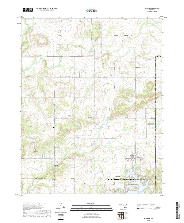 2022 Ketchum2022 Print · USGSNortheast Oklahoma’s lake country is captured here just as the settlements around Grand Lake O' The Cherokees continue to develop. Researchers can trace local lineage at the Ketchum Family Cem and Carselowey Cem or locate the rural corners of Okoee and Success.
 - 2022 Map of Cedar Crest, 2022 Print
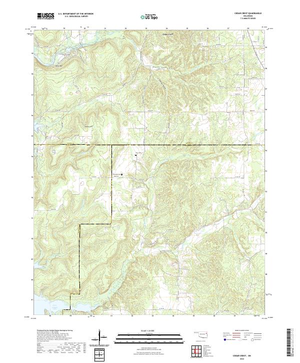 2022 Cedar Crest2022 Print · USGSNortheastern Oklahoma at the junction of Mayes, Wagoner, and Cherokee counties reveals a landscape of wooded ridges and creek bottoms in the 2020s. Genealogists and local historians can trace family burial sites at Gray Cem and Downing Cem or locate landmarks like Neely Mtn and Spring Creek.
 - 2022 Map of Chelsea, 2022 Print
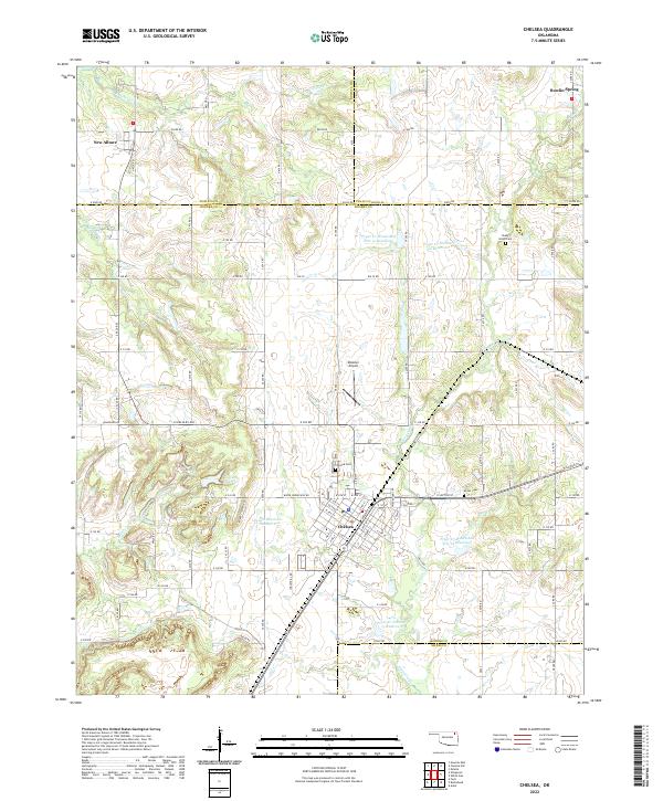 2022 Chelsea2022 Print · USGSNortheast Oklahoma in the early 2020s shows a landscape of established towns and managed water resources. Family historians and local researchers can trace the roads between Chelsea and New Alluwe, finding cemeteries like Shady Grove Cem and Snider Cem along the way.
 - 2022 Map of Osage Hills, 2022 Print
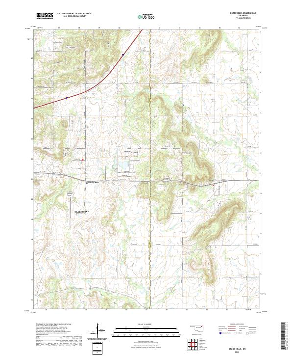 2022 Osage Hills2022 Print · USGSNorth of Claremore in the early 2020s, this area shows the meeting of Oklahoma ranchlands and the rising elevations of the Osage Hills. Trace family roots and local landmarks from Vann Cem to the early airfield at Claremore Regional Airport.
 - 2022 Map of Bushyhead, 2022 Print
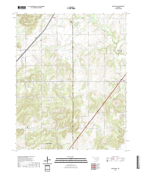 2022 Bushyhead2022 Print · USGSRogers and Mayes counties appear in the 2020s as a landscape of rural cemeteries and winding creek headwaters. Researchers can trace family history at Bethlehem Lutheran Cem, Washington Cem, and the small settlement of Hisle.
 - 2022 Map of Rose, 2022 Print
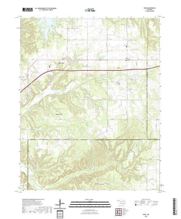 2022 Rose2022 Print · USGSThe rural landscapes of Mayes, Delaware, and Cherokee counties meet here in the twenty-first century. Genealogists and local historians can trace family locations near Rose Cem, Little Rock Cem, and the settlement at Snake Creek.
 - 2022 Map of Big Cabin, 2022 Print
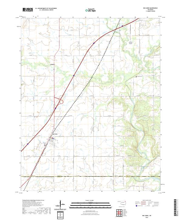 2022 Big Cabin2022 Print · USGSNortheastern Oklahoma's cattle country and transport corridors are shown here during the early twenty-first century. Researchers can trace family history at Big Cabin Cem or Landrum Cem and follow the paths of Big Cabin Creek and White Oak Cr.
 - 2022 Map of Salina SE, 2022 Print
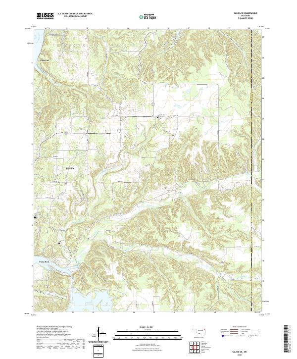 2022 Salina SE2022 Print · USGSThe Mayes and Delaware county borderlands are shown here in the 2020s, dominated by the waters of the Neosho River and Chimney Rock Lake. Local historians can trace family ties at Wickliffe Cem and explore the remote terrain of Tag Hollow and Chicken Hollow.
 - 2022 Map of Neodesha, 2022 Print
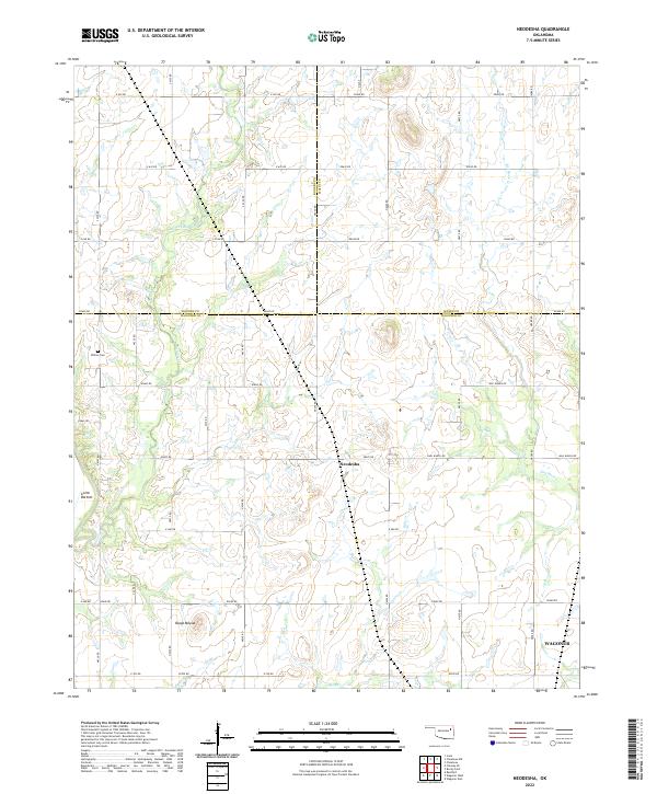 2022 Neodesha2022 Print · USGSNortheastern Oklahoma’s ranching country at the meeting of three counties is captured here in the early twenty-first century. Researchers can trace family-named sites like Willow Cem, Guinn Bottom, and the prominent local landmark of Osage Mound.
 - 2022 Map of Chouteau NW, 2022 Print
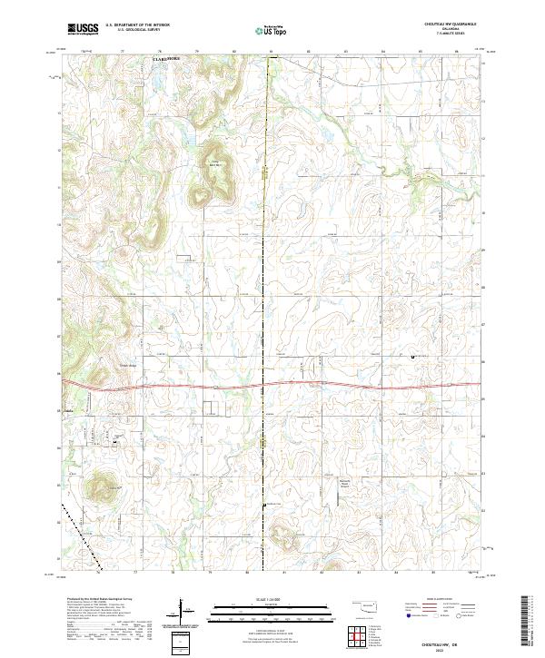 2022 Chouteau NW2022 Print · USGSEastern Oklahoma's rural transition is captured here between the growth of Claremore and Inola. Genealogists can trace family ties at Highland Cem, Amish Cem, and Brethren Cem, or locate landmarks like Buzzards Roost Airport.
 - 2022 Map of Salina, 2022 Print
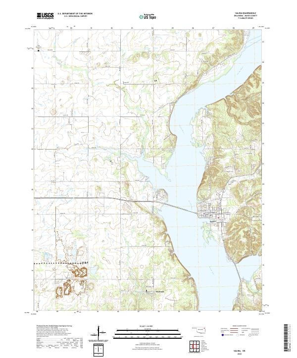 2022 Salina2022 Print · USGSThe riverfront town of Salina and the rural stretches of Mayes County are documented here in the early 2020s. Researchers can locate family landmarks like Bryan Chapel Cem, trace the waters of Wolf Cr, or explore the old settlement at Tip.
 - 2022 Map of White Oak, 2022 Print
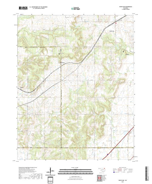 2022 White Oak2022 Print · USGSWhite Oak and its surrounding rural communities are documented in the early 2020s, revealing a landscape of prairie creeks and sectional roads. Researchers can trace family history at Shawnee Cem or explore the development around Sunsweet and Catale.
 - 2022 Map of Spavinaw, 2022 Print
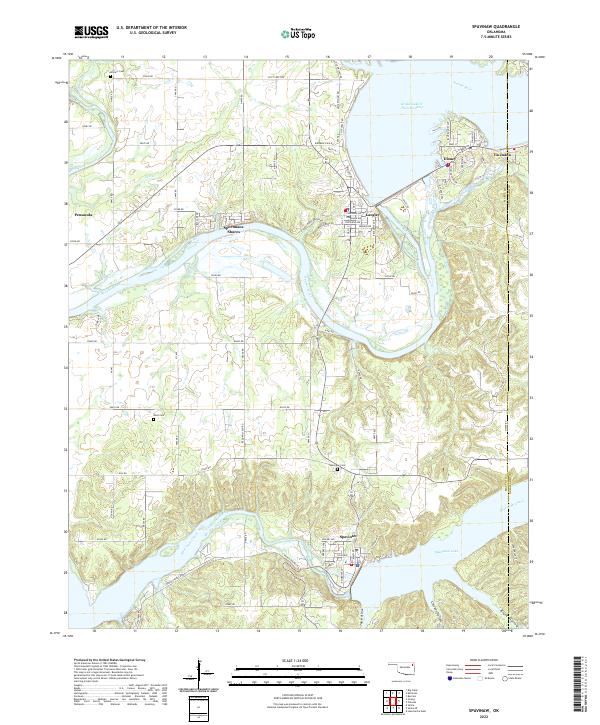 2022 Spavinaw2022 Print · USGSNortheast Oklahoma's lakeside landscape comes into focus at the turn of the millennium, showing the communities surrounding the Great Lake of the Cherokees. Researchers can trace local lineage at Military Cem or locate homesites in Sportmans Shores and Tia Juana.
 - 2022 Map of Peggs, 2022 Print
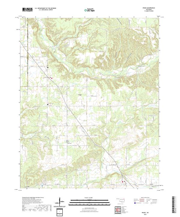 2022 Peggs2022 Print · USGSNortheastern Oklahoma’s creek-carved hills come into focus in the early 2020s, showing the rural community surrounding the settlement of Peggs. Local historians can trace family roots through several landmarks including Peggs Cemetery, New Home Cem, and the winding banks of Fourteenmile Cr.
 - 2022 Map of Chouteau, 2022 Print
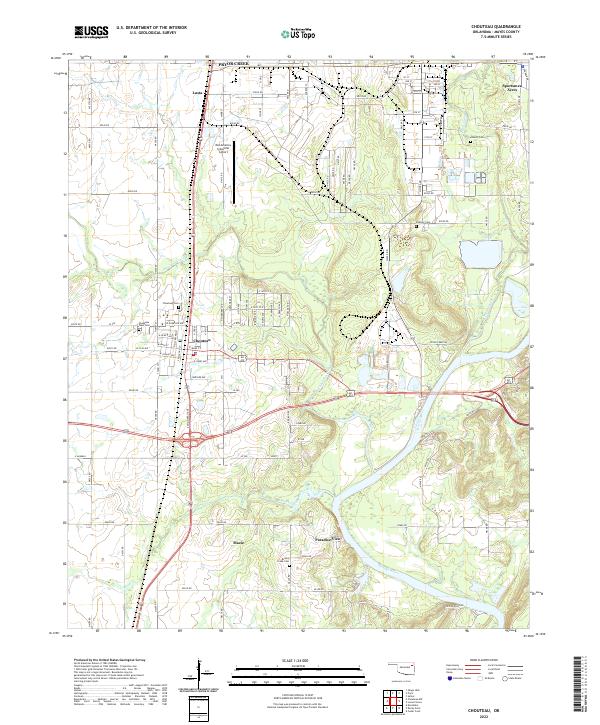 2022 Chouteau2022 Print · USGSChouteau and the surrounding Mayes County plains are shown here in the early twenty-first century as industrial and residential life centers on the Neosho River. Researchers can locate family landmarks like Sixkiller Cem and Brushy Creek Cem or trace the development of Sportsmen Acres and Mazie.
 - 2022 Map of Strang, 2022 Print
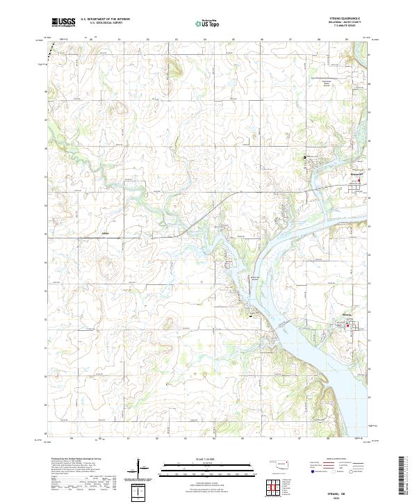 2022 Strang2022 Print · USGSMayes County, Oklahoma, is shown in this recent survey along the fertile Neosho River valley. Researchers can trace local lineage through Benge Cem or locate rural landmarks like Stearmans Roost Airport and the settlement of Strang.
 - 2022 Map of Rocky Point, 2022 Print
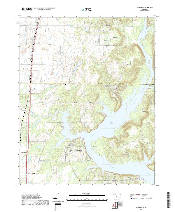 2022 Rocky Point2022 Print · USGSThe river valleys and reservoirs of eastern Oklahoma are shown here in modern detail, where the Neosho River meets Fort Gibson Lake. You can trace historical burial grounds like Union Mission Cem and follow the Union Pacific RR through Mazie and Leliaetta.
 - 2022 Map of Locust Grove, 2022 Print
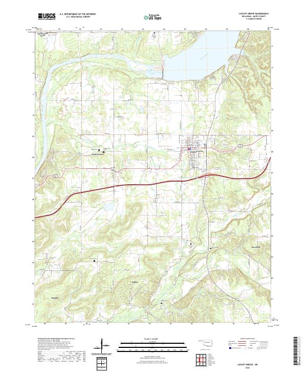 2022 Locust Grove2022 Print · USGSLocust Grove and the surrounding Mayes County countryside are captured here in the early 2020s. Genealogists can locate several family-named burial grounds like Bryan-Lindsey Cem and McLain Cem, while tracing rural settlements at Ballou and Iron Post.
 - 2023 Map of Adair, 2023 Print
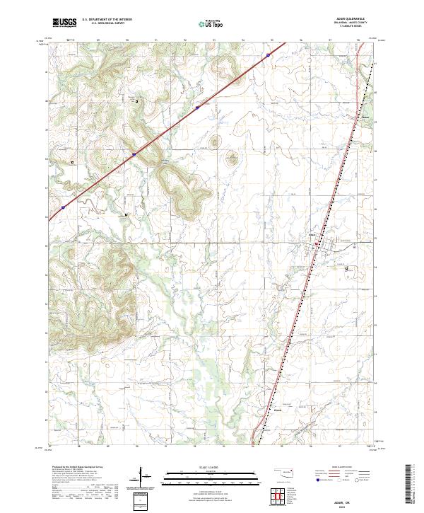 2023 Adair2023 Print · USGSAdair and the surrounding Mayes County countryside are captured in this modern survey of eastern Oklahoma. Genealogists can trace family roots through several local burial sites like Pleasant Hope Cem and landmarks such as Jesse James Hill and Whiskey Gap.
 - 2023 Map of Pryor, 2023 Print
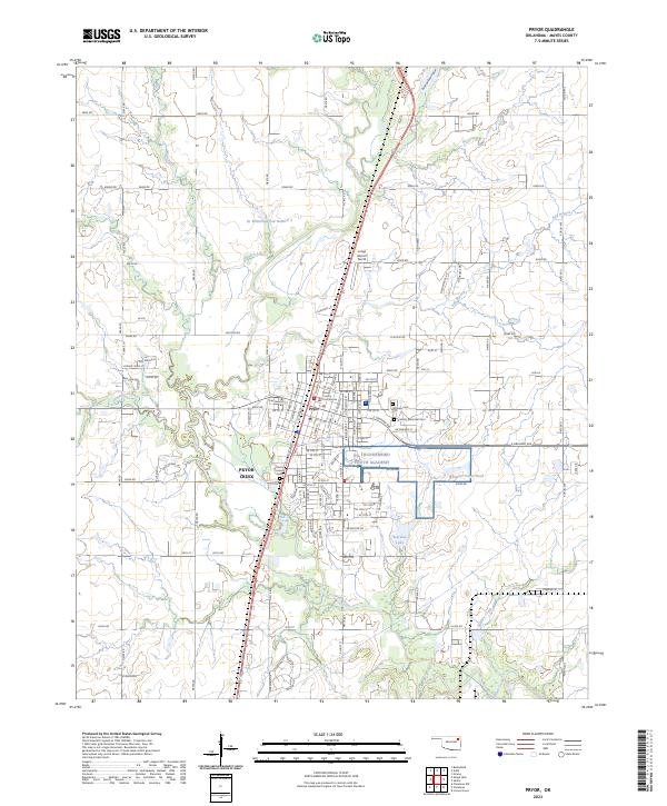 2023 Pryor2023 Print · USGSMayes County, Oklahoma, is shown in the early 2020s, centered on the growing city of Pryor. Local historians and genealogists can pinpoint the Mayes County Courthouse and trace family sites near Fairview Cem or County Home Cem.
End of results
Showing maps 1-20 of 20
Top cities of Mayes County
- Pryor Creek historical maps
- Chouteau historical maps
- Locust Grove historical maps
- Salina historical maps
- Adair historical maps
- Langley historical maps
See more
Frequently asked questions
- What are the different types of historical maps available for Mayes County?
- What is the oldest map of Mayes County?
- Where can I purchase historical maps of Mayes County for my home or office?
- Where can I download high-res historical maps of Mayes County?
- Are there historical topographic maps available for Mayes County?
- Is there historical aerial imagery available for Mayes County?
- Where are historical maps of Mayes County sourced from?