2020s Maps of McClain County, Oklahoma
Explore 23 historic maps of McClain County from the 2020s. These maps offer a rare glimpse into what life looked like during the 2020s — showing old roads, neighborhoods, homes, and landmarks that have changed or disappeared over time.
Whether you're researching your family's past, planning a metal detecting trip, or studying how McClain County's landscape evolved across the 2020s, these high-resolution maps are a powerful tool for exploring the history of this region.
- Focus on a specific era: All maps on this page are from the 2020s, giving you a focused view of this time period.
- See what’s changed: Compare century-old streets, trails, and buildings to today's modern landscape using overlays and satellite layers.
- Research with precision: Use these maps for genealogy, historical research, land use analysis, or educational projects.
- View, download, or print: Maps are fully viewable online in high resolution, and can be downloaded or printed for your own records.
Start exploring McClain County's history through authentic maps from the 2020s. This is your window into the past.
McClain County, OK maps
(23)- 2022 Map of Lindsay SW, 2022 Print
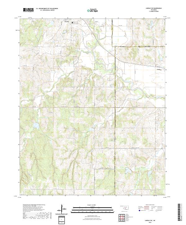 2022 Lindsay SW2022 Print · USGSThe Oklahoma heartland at the intersection of Grady, McClain, and Garvin Counties is shown here in the early twenty-first century. Genealogists and local historians can trace family roots near Bradley, locate the Bradley Cem, and follow the winding course of the Washita River.
 - 2022 Map of Wayne, 2022 Print
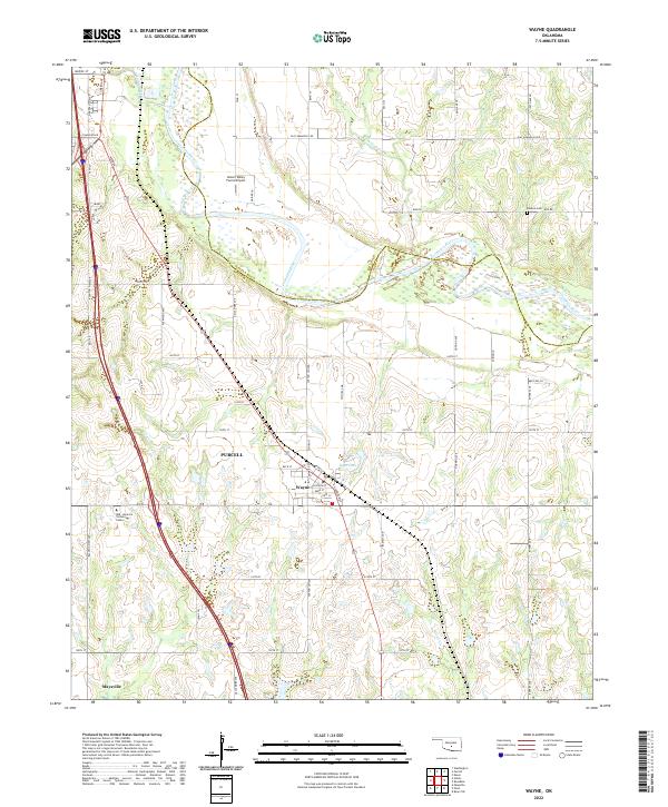 2022 Wayne2022 Print · USGSMcClain County’s river valley and prairie towns are captured here in the early twenty-first century as the landscape balances its rural roots with modern growth. Genealogists and historians can trace the town layouts of Wayne and Purcell, locating landmarks like Denton Cem and the banks of the Canadian River.
 - 2022 Map of Rosedale, 2022 Print
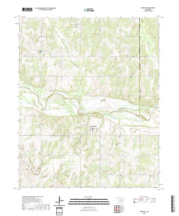 2022 Rosedale2022 Print · USGSRural McClain and Cleveland counties come into focus at this modern moment as the Canadian River winds through the heart of the territory. Researchers can locate family roots at Rosedale Cem and Corbett Cem or trace the drainage of Buckhead Cr.
 - 2022 Map of Bradley, 2022 Print
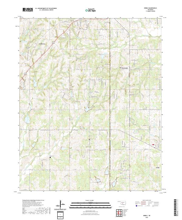
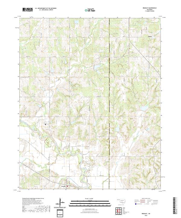 2022 Bradley2022 Print · USGSCentral Oklahoma's rural landscape at the Grady and McClain county line is documented here in the early twenty-first century. Genealogists and local historians can trace the course of the Washita River and locate Laflin Cem near the communities of Bradley and Dibble.
 - 2022 Map of Criner, 2022 Print
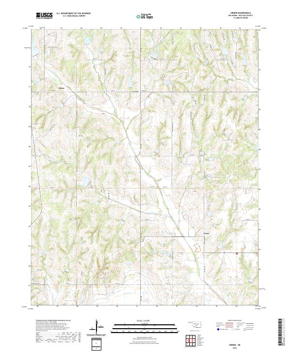 2022 Criner2022 Print · USGSMcClain County’s rolling prairie and creek bottoms are documented here in the early twenty-first century. Researchers can trace family lands and rural crossroads between the settlements of Dibble and Payne, following landmarks like Criner Creek and Finn Ridge Road.
 - 2022 Map of Lindsay, 2022 Print
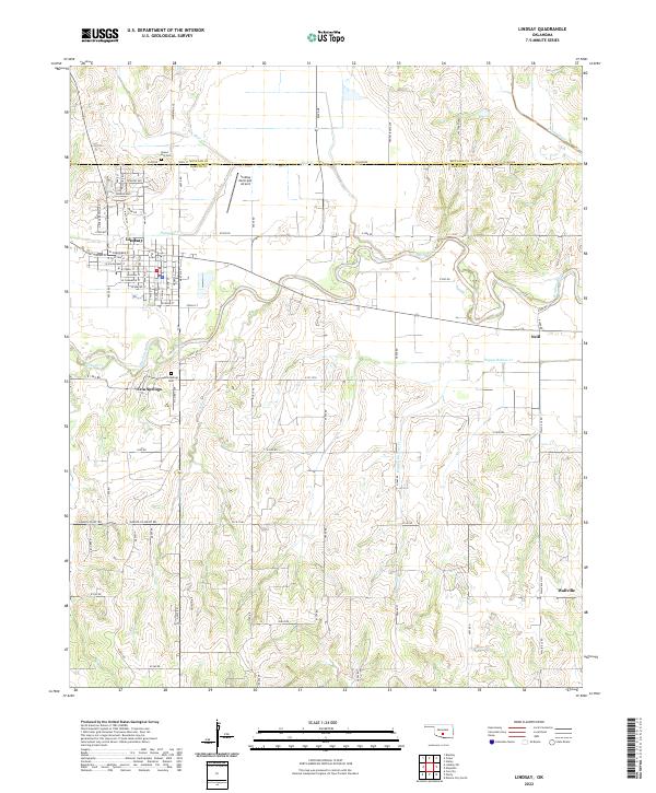 2022 Lindsay2022 Print · USGSLindsay and the surrounding Garvin County ranch lands are documented here in the early twenty-first century. Genealogists and local historians can trace family locations near the Washita River, Green Hill Cem, and the settlement of Wallville.
 - 2022 Map of Wanette, 2022 Print
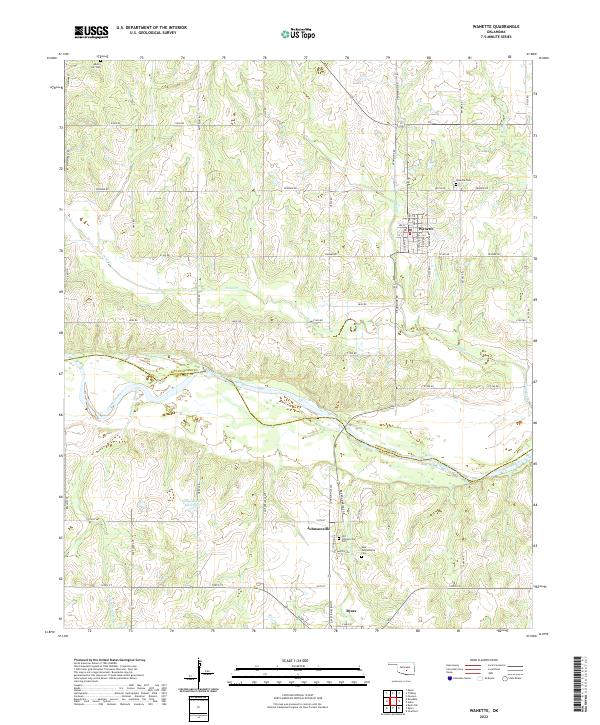 2022 Wanette2022 Print · USGSThe Oklahoma heartland around Wanette is shown here in the 2020s, highlighting the rural sections along the Canadian River and the McClain County line. Researchers can pinpoint historic burial grounds like Old Johnsonville Cem and the Martin Hill Cem.
 - 2022 Map of Paoli, 2022 Print
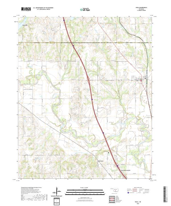 2022 Paoli2022 Print · USGSGarvin and McClain Counties are shown in the 2020s as the river-carved landscape around Paoli continues its long agricultural history. Genealogists and historians can trace family locations near Whitebead Cem, Florence Cem, and the oxbows of the Washita River.
 - 2022 Map of Stealy, 2022 Print
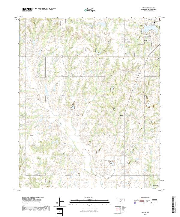 2022 Stealy2022 Print · USGSMcClain County at the turn of the 2020s shows a landscape of growing regional hubs and established section-line roads. Researchers can trace family history through Hillside Cem or locate rural landmarks like Sunburst Ranch and the small settlement of Stealy.
 - 2022 Map of Washington, 2022 Print
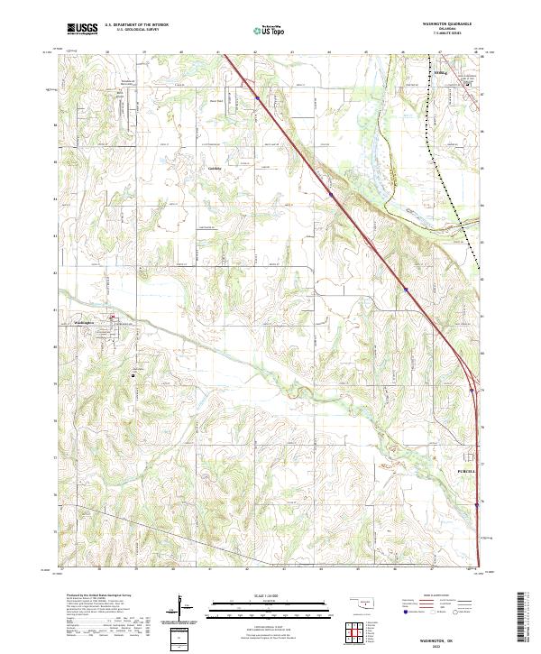 2022 Washington2022 Print · USGSMcClain County's agricultural heartland and the winding Canadian River valley are captured in this recent survey. Local historians can trace family plots at Washington Cem and Noble Independent Order of Odd Fellows Cem or locate private airfields like Dick's Airport.
 - 2022 Map of Purcell, 2022 Print
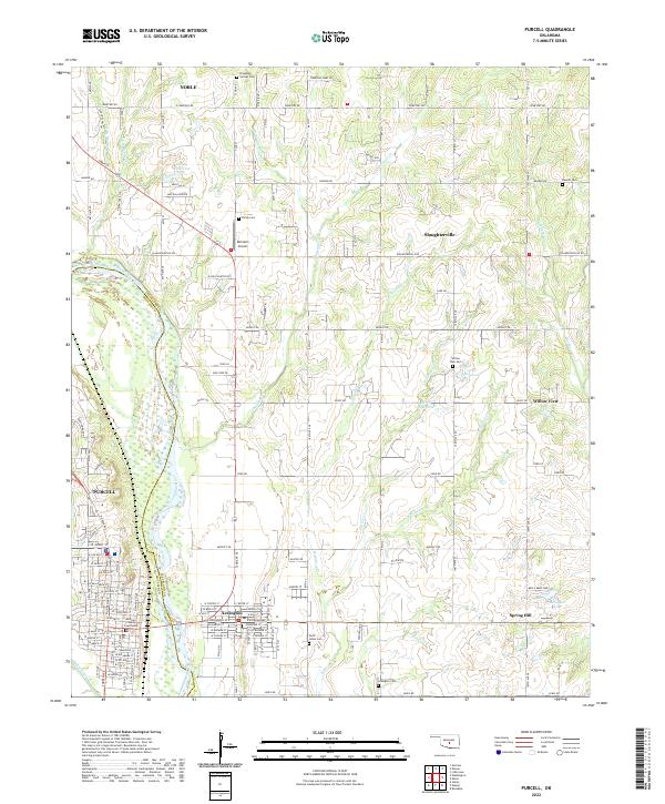 2022 Purcell2022 Print · USGSPurcell and Lexington sit on opposite banks of the Canadian River in this modern-era survey of central Oklahoma. Researchers can trace the civic heart of the area at the McClain County Courthouse or locate family plots at Shiloh Cemetery and Saint Johns Cemetery.
 - 2022 Map of Oklahoma City SW, 2022 Print
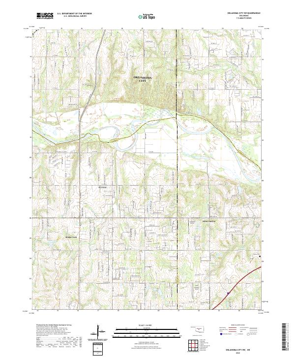 2022 Oklahoma City SW2022 Print · USGSOklahoma's central plains come into focus in the 2020s, where the expansion of Oklahoma City meets the Canadian River valley. Genealogists and local historians can pinpoint Clopton Cem, the Cole Landing Area, and landmarks like Bartons Butte.
 - 2022 Map of Dibble, 2022 Print
 2022 Dibble2022 Print · USGSBlanchard and Middleberg are shown here at the Grady and McClain county line during a period of steady rural growth. Genealogists can locate Hale Cem and Naples Cem or trace the many branches of Winter Cr.
 - 2022 Map of Norman, 2022 Print
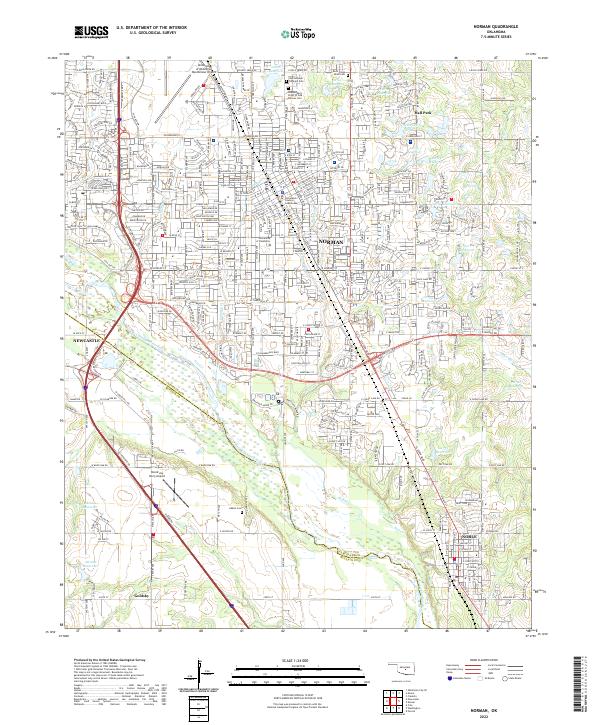 2022 Norman2022 Print · USGSNorman and the surrounding river valley are captured here during a period of modern expansion and civic maturity. Genealogists can locate family sites at the Saint Joseph Catholic Cem or Adkins Cem, while researchers can trace the footprint of the University of Oklahoma.
 - 2022 Map of Newcastle, 2022 Print
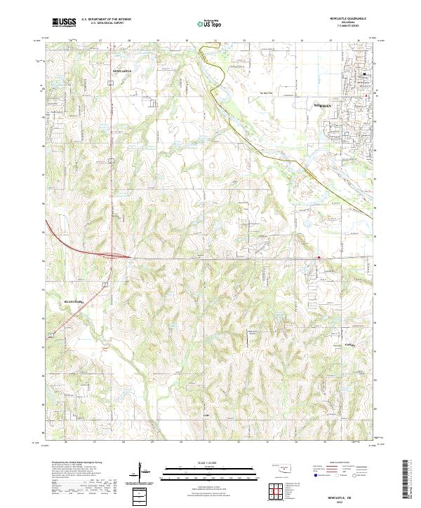 2022 Newcastle2022 Print · USGSThe Oklahoma City metro area expands across the Canadian River in the early 2020s, bridging McClain and Cleveland counties. Researchers can trace modern property lines and water features near Newcastle, Bison Hill Airport, and Mt Williams.
 - 2022 Map of Cole, 2022 Print
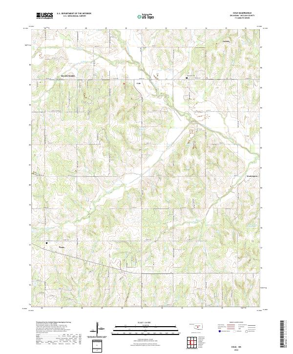 2022 Cole2022 Print · USGSMcClain County remains a landscape of quiet rural crossroads and winding creek valleys in this contemporary survey of central Oklahoma. Researchers can trace the local geography of Cole and Dibble, finding historic sites like Jerusalem Cem and Dibble Cem.
 - 2022 Map of Stratford, 2022 Print
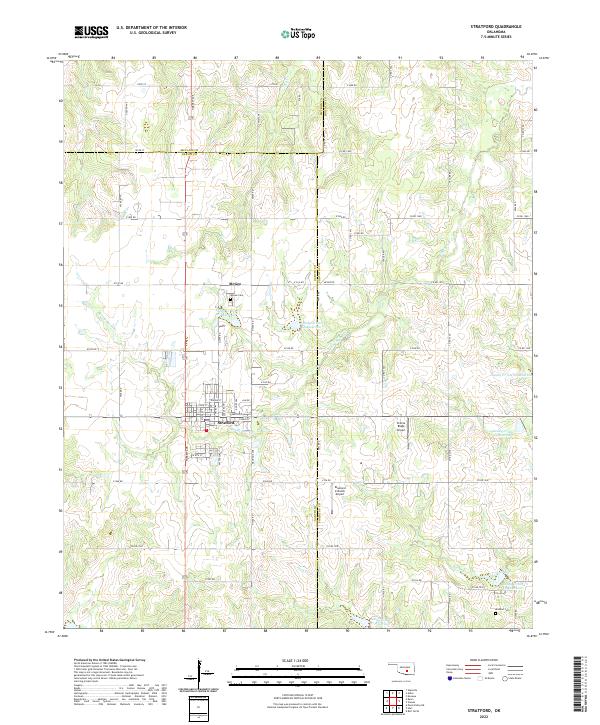 2022 Stratford2022 Print · USGSThe town of Stratford and the settlement of McGee are captured here in the early twenty-first century as part of a tri-county agricultural landscape. Researchers can trace family sites at McGee Cem and Midland Cem or explore the network of local reservoirs like Sandy Cr Site 28 Reservoir.
 - 2022 Map of Blanchard, 2022 Print
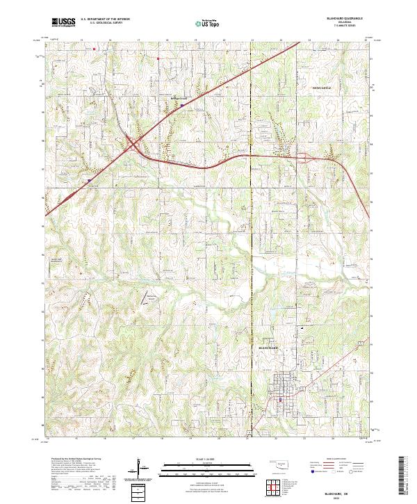 2022 Blanchard2022 Print · USGSBlanchard and Bridge Creek appear at the height of their modern expansion along the Grady and McClain county line. Researchers can trace family sites near the Blanchard Cem or locate local aviation landmarks like Warbonnet Airport and Nelson High Point Airport.
 - 2022 Map of Oklahoma City SE, 2022 Print
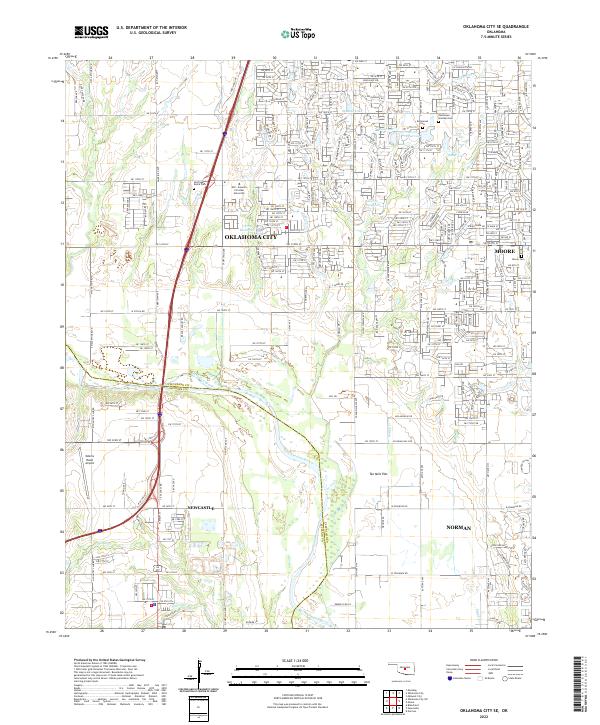 2022 Oklahoma City SE2022 Print · USGSOklahoma City and its southern suburbs appear here during a period of steady growth across the Cleveland and McClain county line. Researchers can locate family sites at Resthaven Gardens Cem or trace the geography of Ten Mile Flat and Marcy Creek.
 - 2022 Map of Byars, 2022 Print
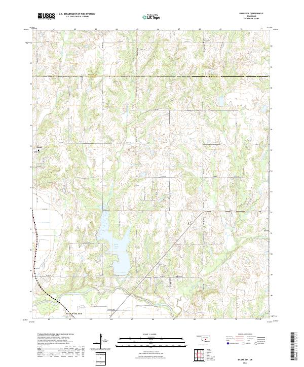
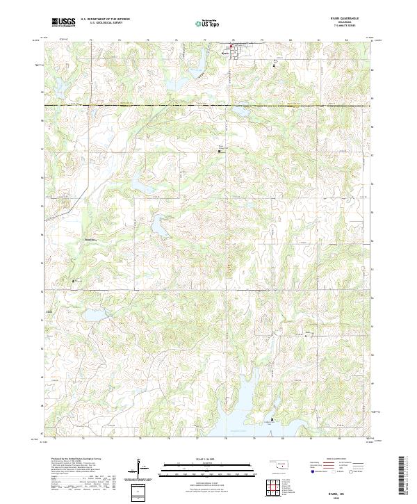 2022 Byars2022 Print · USGSCentral Oklahoma's rural landscapes and county borders are captured here in the early twenty-first century. Genealogists can locate several remote burial sites, including Clabber Flats Cem and Abney Cem, while tracing old homesteads near Boudinot and Civit.
 - 2022 Map of Byars SW, 2022 Print
 2022 Byars SW2022 Print · USGSThe Garvin County countryside north of the Washita River comes into focus in this recent survey of the prairie and creek valleys. Genealogists and local historians can trace the family lands near Paoli and Civit, or locate the Paoli Cem and Fort Family Cem.
 - 2022 Map of Maysville, 2022 Print
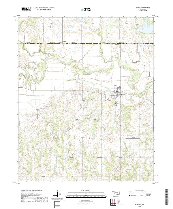 2022 Maysville2022 Print · USGSMaysville and its surrounding river valley are captured here in the early 2020s, showcasing a landscape defined by the Washita River and rural Oklahoma life. Researchers can trace family roots at Randolph Cem or explore the settlement at Story and the streets of Maysville.
 - 2022 Map of Asher, 2022 Print
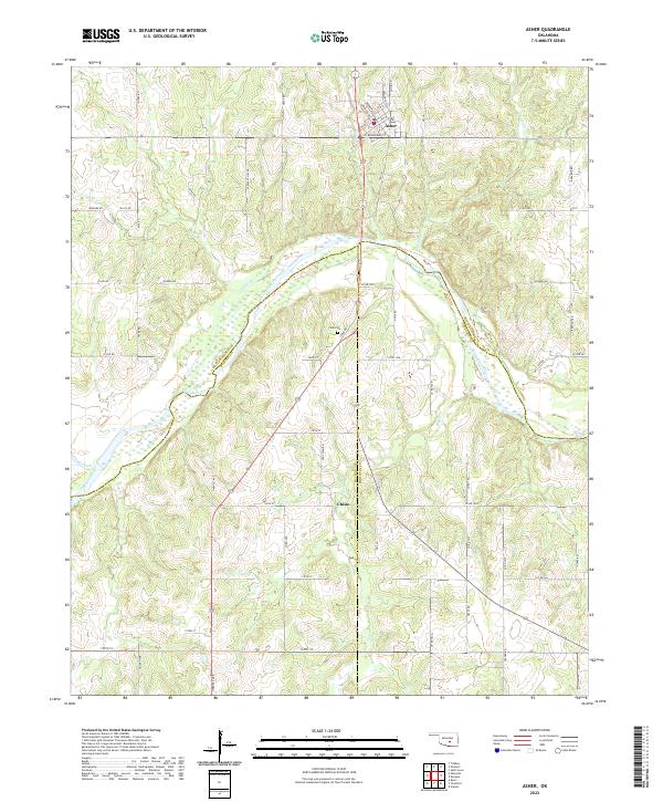 2022 Asher2022 Print · USGSThe rural crossing at Asher and the Canadian River valley are captured here in the early twenty-first century. Researchers can trace family sites near Chism or locate the Cook Cem tucked among the hills and seasonal creeks like Julian Cr.
End of results
Showing maps 1-23 of 23
Top cities of McClain County
- Newcastle historical maps
- Purcell historical maps
- Goldsby historical maps
- Wayne historical maps
- Washington historical maps
- Cole historical maps
See more
Frequently asked questions
- What are the different types of historical maps available for McClain County?
- What is the oldest map of McClain County?
- Where can I purchase historical maps of McClain County for my home or office?
- Where can I download high-res historical maps of McClain County?
- Are there historical topographic maps available for McClain County?
- Is there historical aerial imagery available for McClain County?
- Where are historical maps of McClain County sourced from?