1980s Maps of Broken Bow, Oklahoma
Explore 5 historic maps of Broken Bow from the 1980s. These maps offer a rare glimpse into what life looked like during the 1980s — showing old roads, neighborhoods, homes, and landmarks that have changed or disappeared over time.
Whether you're researching your family's past, planning a metal detecting trip, or studying how Broken Bow's landscape evolved across the 1980s, these high-resolution maps are a powerful tool for exploring the history of this region.
- Focus on a specific era: All maps on this page are from the 1980s, giving you a focused view of this time period.
- See what’s changed: Compare century-old streets, trails, and buildings to today's modern landscape using overlays and satellite layers.
- Research with precision: Use these maps for genealogy, historical research, land use analysis, or educational projects.
- View, download, or print: Maps are fully viewable online in high resolution, and can be downloaded or printed for your own records.
Start exploring Broken Bow's history through authentic maps from the 1980s. This is your window into the past.
Broken Bow, OK maps
(5)- 1981 Map of Broken Bow
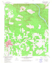 1981 Broken Bow1981 Print · USGSBroken Bow and the surrounding McCurtain County landscape are captured here in the early eighties as the timber and rail economy shaped the region. Genealogists and local historians can trace the locations of Crown Hill Cem, rural schools like North Highway Sch, and the Texas and Oklahoma Eastern rail line.
 - 1981 Map of Stephens Gap
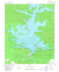 1981 Stephens Gap1981 Print · USGSSoutheast Oklahoma saw a massive transformation of its river valleys by the early eighties as new reservoirs redefined the mountain landscape. Researchers can trace the layout of Hochatown State Park and locate historic sites like the Hochatown Cem and Devils Backbone.
 - 1982 Map of Steel Junction, 1983 Print
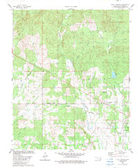 1982 Steel Junction1983 Print · USGSSoutheast Oklahoma in the early eighties shows a landscape of small rural settlements and timber-lined creek bottoms. Genealogists can trace family roots through numerous sites like Watsons Mem Cem, Lukfata Ch, and the school at Lukfata Sch.
 - 1986 Map of Idabel
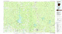
 1986 Idabel1986 Print · USGSThe tri-state borderlands of Oklahoma, Arkansas, and Texas come alive in the 1980s, centered on the Red River and the timberlands of the Ouachita National Forest. Genealogists and historians can trace the paths of the Missouri Pacific railroad through towns like Bokhoma and Ashdown.
 - 1986 Map of De Queen
 1986 De Queen1986 Print · USGSThe Arkansas-Oklahoma borderlands are shown here in the mid-1980s, highlighting the complex water systems and mountain ridges of the Ouachita region. Genealogists and historians can trace rail routes like the Kansas City Southern and find old community sites such as Ultima Thule or Oak Grove Ch.2 unique versions available
End of results
Showing maps 1-5 of 5
Top cities near Broken Bow
Frequently asked questions
- What are the different types of historical maps available for Broken Bow?
- What is the oldest map of Broken Bow?
- Where can I purchase historical maps of Broken Bow for my home or office?
- Where can I download high-res historical maps of Broken Bow?
- Are there historical topographic maps available for Broken Bow?
- Is there historical aerial imagery available for Broken Bow?
- Where are historical maps of Broken Bow sourced from?