1960s Maps of Noble County, Oklahoma
Explore 6 historic maps of Noble County from the 1960s. These maps offer a rare glimpse into what life looked like during the 1960s — showing old roads, neighborhoods, homes, and landmarks that have changed or disappeared over time.
Whether you're researching your family's past, planning a metal detecting trip, or studying how Noble County's landscape evolved across the 1960s, these high-resolution maps are a powerful tool for exploring the history of this region.
- Focus on a specific era: All maps on this page are from the 1960s, giving you a focused view of this time period.
- See what’s changed: Compare century-old streets, trails, and buildings to today's modern landscape using overlays and satellite layers.
- Research with precision: Use these maps for genealogy, historical research, land use analysis, or educational projects.
- View, download, or print: Maps are fully viewable online in high resolution, and can be downloaded or printed for your own records.
Start exploring Noble County's history through authentic maps from the 1960s. This is your window into the past.
Noble County, OK maps
(6)- 1966 Map of Lake Carl Blackwell, 1968 Print
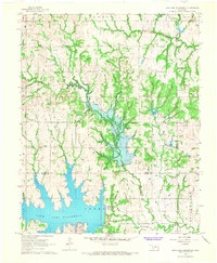 1966 Lake Carl Blackwell1968 Print · USGSNoble and Payne Counties undergo a major landscape shift in the mid-sixties as new reservoirs reshape the central Oklahoma terrain. Researchers can find family landmarks like Shelton-Bethel Cem and industrial sites such as the Rock Creek Oil Field.3 unique versions available
 - 1967 Map of Stillwater North, 1968 Print
 1967 Stillwater North1968 Print · USGSStillwater and its northern reaches are captured in the late sixties as the university and city began significant expansion. Researchers can trace the development of Oklahoma State University and the grounds of Boomer Lake Park or the settlement at Yost.3 unique versions available
 - 1968 Map of Billings, 1969 Print
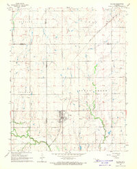 1968 Billings1969 Print · USGSThe town of Billings and the surrounding plains of Noble and Garfield Counties are captured here in the late sixties. Researchers can trace the diagonal route of the Chicago Rock Island and Pacific railroad and locate local landmarks like Sacred Heart Cem and Billings Union Cem.2 unique versions available
 - 1968 Map of Tonkawa SE, 1969 Print
 1968 Tonkawa SE1969 Print · USGSThe Oklahoma plains in the late sixties reveal an era of intensive energy extraction and expanding highways. Family historians can trace the Three Sands Oil Field and Glenrose while locating rural landmarks like Freedom Ch and Prairie View Cem.2 unique versions available
 - 1968 Map of Marland, 1969 Print
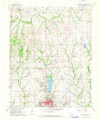
 1968 Marland1969 Print · USGSMarland and the Kay and Noble County line are captured here in the late sixties as the local economy balanced ranching with a maturing oil industry. Researchers can locate the site of Old Bliss, trace the Atchison Topeka and Santa Fe rail line, and find family markers at Cowboy Hill Cem.2 unique versions available
 - 1968 Map of Ponca City SE, 1969 Print
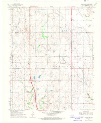
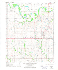
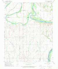 1968 Ponca City SE1969 Print · USGSThe confluence of the Salt Fork and Arkansas rivers defines this part of Noble County in the late sixties. Researchers can trace the Atchison Topeka and Santa Fe rail line and locate old community hubs like White Eagle and West Bressie.
End of results
Showing maps 1-6 of 6
Top cities of Noble County
- Perry historical maps
- Morrison historical maps
- Billings historical maps
- Red Rock historical maps
- Marland historical maps
Frequently asked questions
- What are the different types of historical maps available for Noble County?
- What is the oldest map of Noble County?
- Where can I purchase historical maps of Noble County for my home or office?
- Where can I download high-res historical maps of Noble County?
- Are there historical topographic maps available for Noble County?
- Is there historical aerial imagery available for Noble County?
- Where are historical maps of Noble County sourced from?