Old Maps of Noble County, Oklahoma for Academic Research
Study the evolution of Noble County with 128 high-resolution historic maps. Whether you're teaching, researching, or modeling changes in land use, these maps provide essential visual documentation of urban, environmental, and geographic change.
- Analyze long-term change: Track patterns in development, transportation, and natural features.
- Ideal for environmental or urban studies: Support academic projects with primary historical map data.
- Use in the classroom or lab: Educators and researchers rely on these maps to bring historical context to life.
These maps are a powerful tool for teaching, research, and visualizing how Noble County has changed over the decades.
Noble County, OK maps
(128)- 1893 Map of Mulhall
 1893 Mulhall1893 Print · USGSCentral Oklahoma land was newly opened for settlement when these surveyors documented the prairie around Mulhall and Orlando. Genealogists and local historians can trace the early township grids near Clarkson and along the winding Cimarron River.
 - 1893 Map of Stillwater
 1893 Stillwater1893 Print · USGSOklahoma Territory was still in its formative years when this survey of the Stillwater area was completed. Genealogists and historians can trace the early township grid and locate pioneer settlements like Marena, Brinton, and the springs at Elm Spring.
 - 1929 Map of Ripley, 1959 Print
 1929 Ripley1959 Print · USGSEastern Oklahoma townships in Payne and Pawnee Counties appear here as they were in the late 1920s, structured by early rail lines and river bends. You can trace the community life of the era through sites like Ingalls Signet P O, the Rosenwald Sch, and the Atchison Topeka and Santa Fe tracks.
 - 1930 Map of Pawnee, 1958 Print
 1930 Pawnee1958 Print · USGSNorth-central Oklahoma at the start of the 1930s shows a landscape shaped by river commerce, the oil industry, and early rail lines. Local historians can trace the Pawnee Indian School Reservation, the Old Town Trading Post, and numerous rural school sites like Highland Sch.
 - 1932 Map of Ripley
 1932 Ripley1932 Print · USGSRipley and Glencoe anchor this Depression-era portrait of the Oklahoma landscape as the oil industry began to mark the riverbanks. Researchers can locate dozens of vanished rural schools and early landmarks like Twin Mounds, the Payne County Farm, and the Signet PO.2 unique versions available
 - 1936 Map of Belford
 1936 Belford1936 Print · USGSOsage and Noble counties come into focus in the mid-1930s, showing a rural landscape defined by the winding Arkansas River. Genealogists and local historians can trace numerous country school sites like Braden Sch and Pleasant Valley Sch, alongside the Atchison Topeka and Santa Fe Ry through Apperson.3 unique versions available
 - 1936 Map of Pawnee
 1936 Pawnee1936 Print · USGSPawnee County and the surrounding cattle and oil country come alive in this mid-thirties survey of the Oklahoma plains. Researchers can locate dozens of country schools like Star A Star Sch and trace the Pawnee Indian School Reservation and the Old Town Trading Post.2 unique versions available
 - 1955 Map of Enid, 1966 Print
 1955 Enid1966 Print · USGSNorth-central Oklahoma's transition from open plains to the blackjack hills of the Osage Indian Reservation is captured in the mid-1950s. Researchers can trace the development of the Naval Reserve Oil Field, the grounds of Vance AFB, and the early footprints of Tulsa and Stillwater.4 unique versions available
 - 1958 Map of Enid
 1958 Enid1958 Print · USGSNorthern Oklahoma is mapped here in the late fifties, showcasing a dense network of petroleum production and historic tribal lands. Researchers can trace the legacy of the Osage Indian Reservation, early energy hubs like the Cushing Oil Field, and the Chilocco Indian Agricultural School.2 unique versions available
 - 1966 Map of Lake Carl Blackwell, 1968 Print
 1966 Lake Carl Blackwell1968 Print · USGSNoble and Payne Counties undergo a major landscape shift in the mid-sixties as new reservoirs reshape the central Oklahoma terrain. Researchers can find family landmarks like Shelton-Bethel Cem and industrial sites such as the Rock Creek Oil Field.3 unique versions available
 - 1967 Map of Stillwater North, 1968 Print
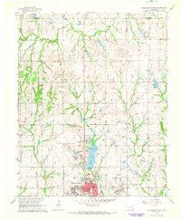 1967 Stillwater North1968 Print · USGSStillwater and its northern reaches are captured in the late sixties as the university and city began significant expansion. Researchers can trace the development of Oklahoma State University and the grounds of Boomer Lake Park or the settlement at Yost.3 unique versions available
 - 1968 Map of Billings, 1969 Print
 1968 Billings1969 Print · USGSThe town of Billings and the surrounding plains of Noble and Garfield Counties are captured here in the late sixties. Researchers can trace the diagonal route of the Chicago Rock Island and Pacific railroad and locate local landmarks like Sacred Heart Cem and Billings Union Cem.2 unique versions available
 - 1968 Map of Tonkawa SE, 1969 Print
 1968 Tonkawa SE1969 Print · USGSThe Oklahoma plains in the late sixties reveal an era of intensive energy extraction and expanding highways. Family historians can trace the Three Sands Oil Field and Glenrose while locating rural landmarks like Freedom Ch and Prairie View Cem.2 unique versions available
 - 1968 Map of Marland, 1969 Print
 1968 Marland1969 Print · USGSMarland and the Kay and Noble County line are captured here in the late sixties as the local economy balanced ranching with a maturing oil industry. Researchers can locate the site of Old Bliss, trace the Atchison Topeka and Santa Fe rail line, and find family markers at Cowboy Hill Cem.2 unique versions available
 - 1968 Map of Ponca City SE, 1969 Print
 1968 Ponca City SE1969 Print · USGSThe confluence of the Salt Fork and Arkansas rivers defines this part of Noble County in the late sixties. Researchers can trace the Atchison Topeka and Santa Fe rail line and locate old community hubs like White Eagle and West Bressie.
 - 1972 Map of Perry NW, 1974 Print
 1972 Perry NW1974 Print · USGSNoble County oil and gas country is captured here in the early seventies during a period of significant highway expansion. Researchers can trace the Chicago Rock Island and Pacific rail line or locate the Palo Cem and White Rock Oil Field.3 unique versions available
 - 1972 Map of Morrison NE, 1974 Print
 1972 Morrison NE1974 Print · USGSThe Otoe-Missouria tribal lands of Noble County are captured in the early 1970s just as the modern turnpike was being built. Trace local heritage at the Otoe-Missouria Indian Agency, the Otoe-Missouria Cem, and landmarks like Big Hill.3 unique versions available
 - 1972 Map of Morrison, 1974 Print
 1972 Morrison1974 Print · USGSNoble County in the early seventies shows a landscape in transition as the St Louis - San Francisco railroad operates alongside a Turnpike Under Construction. Genealogists and local historians can locate Pleasant Valley Cem and trace family ties near Petes Corner or the town of Sumner.3 unique versions available
 - 1972 Map of Red Rock, 1974 Print
 1972 Red Rock1974 Print · USGSRed Rock and the surrounding Otoe tribal lands are captured here during the early seventies as new infrastructure arrived. Genealogists and historians can locate Red Rock, trace the Atchison Topeka and Santa Fe rail line, and see the Cimarron Turnpike while still under construction.2 unique versions available
 - 1972 Map of Ceres, 1974 Print
 1972 Ceres1974 Print · USGSNoble County's agricultural and industrial landscape comes into focus during the early seventies as the local infrastructure modernized. Genealogists and historians can trace family locations near Ceres or examine cultural landmarks like Bohemian Hall and the Mt Carmel Cem.2 unique versions available
 - 1972 Map of Perry, 1974 Print
 1972 Perry1974 Print · USGSPerry and the surrounding Noble County plains are shown in the early seventies as a thriving rail hub and agricultural center. Researchers can trace the junction of the St Louis - San Francisco railroad, find Grace Hill Cemetery, or locate the Cherokee Strip Museum.2 unique versions available
 - 1972 Map of Lucien, 1974 Print
 1972 Lucien1974 Print · USGSThe Noble County oil fields and the community of Lucien are captured here during the early seventies. Genealogists and researchers can trace local family landmarks such as Sample Cem, McGuire Cem, and the rail stops of the St Louis - San Francisco.
 - 1972 Map of Black Bear, 1974 Print
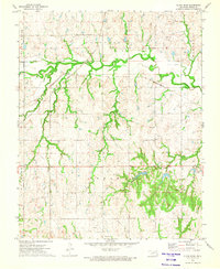 1972 Black Bear1974 Print · USGSThe rural landscape of Noble County in the early seventies shows a community built on the intersection of major rail lines and local industry. Researchers can trace family history through Zion Cem and Richburg Cem, or locate mid-century infrastructure like oil wells and the Water Tank.2 unique versions available
 - 1974 Map of Orlando East, 1977 Print
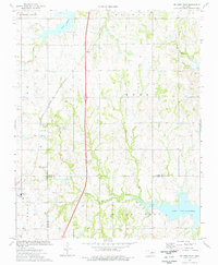 1974 Orlando East1977 Print · USGSNear the intersection of Noble, Logan, and Payne counties in the mid-1970s, this area reflects a landscape shaped by oil production and rail transport. Genealogists and historians can trace Orlando and Fairview Cem alongside the Atchison Topeka and Santa Fe tracks.
 - 1974 Map of Orlando West, 1977 Print
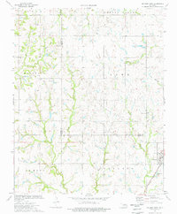 1974 Orlando West1977 Print · USGSThe Noble and Logan county line in the mid-1970s shows a landscape of petroleum extraction and rural crossroads. Researchers can trace local genealogy and industry through the Atchison Topeka and Santa Fe rail line, German Cem, and Orlando.
Showing maps 1-25 of 128
Top cities of Noble County
- Perry historical maps
- Morrison historical maps
- Billings historical maps
- Red Rock historical maps
- Marland historical maps
Frequently asked questions
- What are the different types of historical maps available for Noble County?
- What is the oldest map of Noble County?
- Where can I purchase historical maps of Noble County for my home or office?
- Where can I download high-res historical maps of Noble County?
- Are there historical topographic maps available for Noble County?
- Is there historical aerial imagery available for Noble County?
- Where are historical maps of Noble County sourced from?